


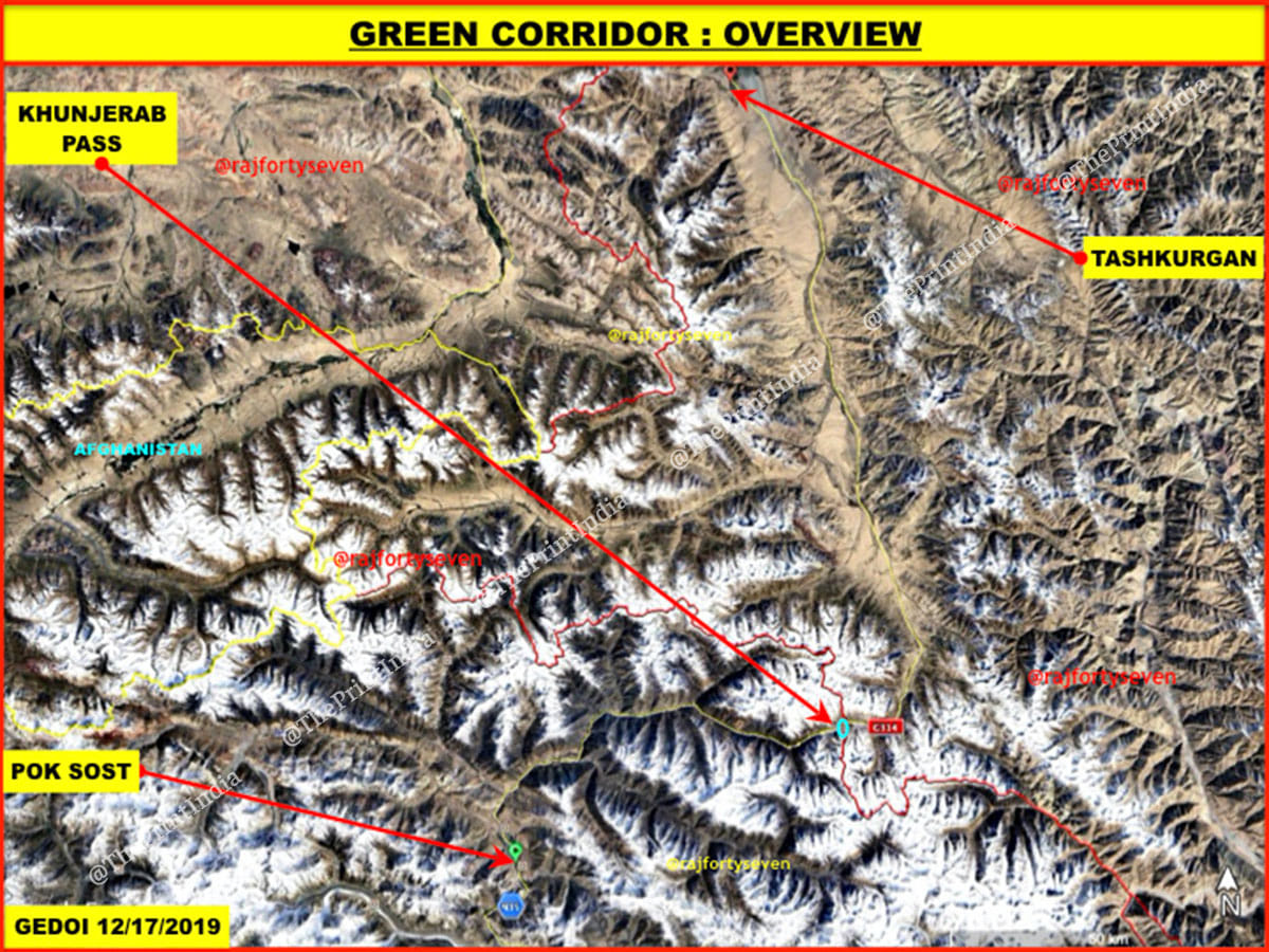
New Delhi: China and Pakistan have agreed in principle to implement a ‘Green Corridor’ on the economic corridor between the two countries (CPEC).
The ‘Green Corridor’ will allow quick clearance of perishable agricultural items via the Khunjerab Pass in the Gilgit-Baltistan region of Pakistan-occupied Kashmir.
The agreement, likely to be signed next year, will permit Pakistani traders to export 313 items duty free through the Sost Dry Port to Tashkurgan in China’s Xinjiang Autonomous Region. Additional customs staff will be especially deployed at the ‘Green Corridor’ to ensure minimum intrusive examination and automated processing.
ThePrint uses more satellite images to take an in-depth look at this ‘Green Corridor’ on the CPEC, a project India has consistently opposed.
Also read: Infrastructure in Tibet gets a big boost as China stepped up focus after Doklam face-off
Sost Dry Port
The Sost Dry Port, with a perimeter length of 1,400m, is built on 21 acres of land, and isn’t very different from the one at Moqpondass, which ThePrint had reported on in August 2019.
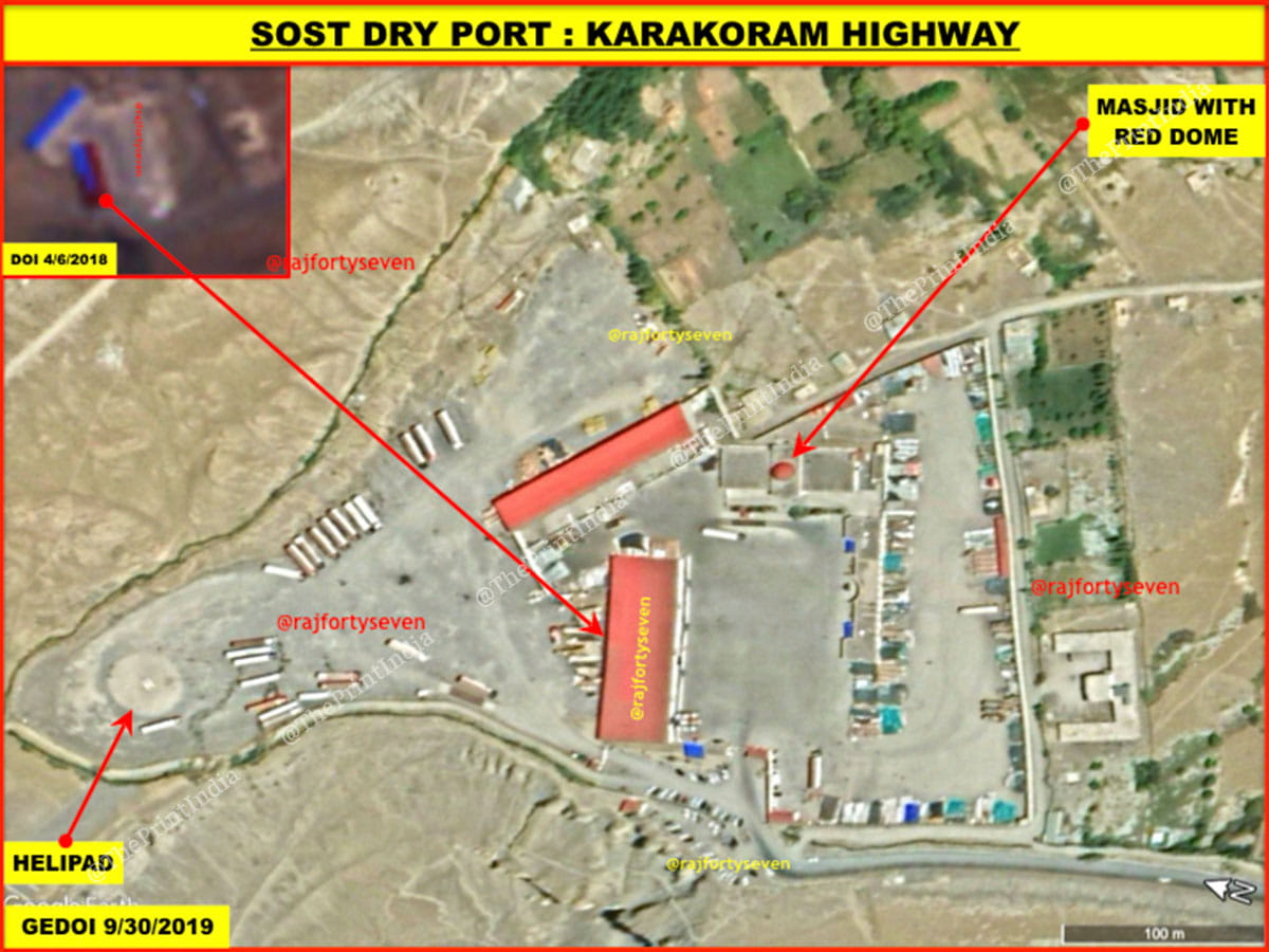
Satellite images indicate that the administration of the Sost port has probably been taken over by the Chinese. The earlier blue roofs of the two main barracks holding stores have been painted red since April 2018, quite unlike the white domes observed in the rest of Pakistan.
Pictures of the port indicate that it has now been renamed “Silk Route Dry Port”, and show a Chinese flag along with a Pakistani flag at the main gate.
Khunjerab Pass
The Khunjerab Pass lies on the Karakoram Highway on the northern-most side of Pakistan-occupied Kashmir.
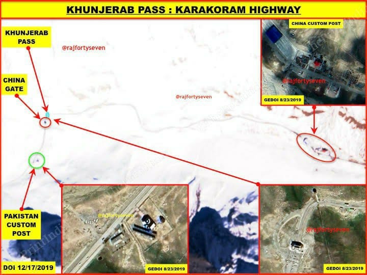
Satellite images from 17 December indicate that the road is completely under snow, with the levels being much higher in PoK than in Xinjiang. The road remains closed from 15 October to 1 May every year.
The highway also passes through a narrow corridor at the Attabad Lake on the Hunza river in Gojal Valley, where the road may not be able to take sustained traffic, as reported earlier.
Tashkurgan town
Satellite images clearly show that there is no dry port or even a special area that could serve as a parking space in the entire Tashkurgan region in Xinjiang.
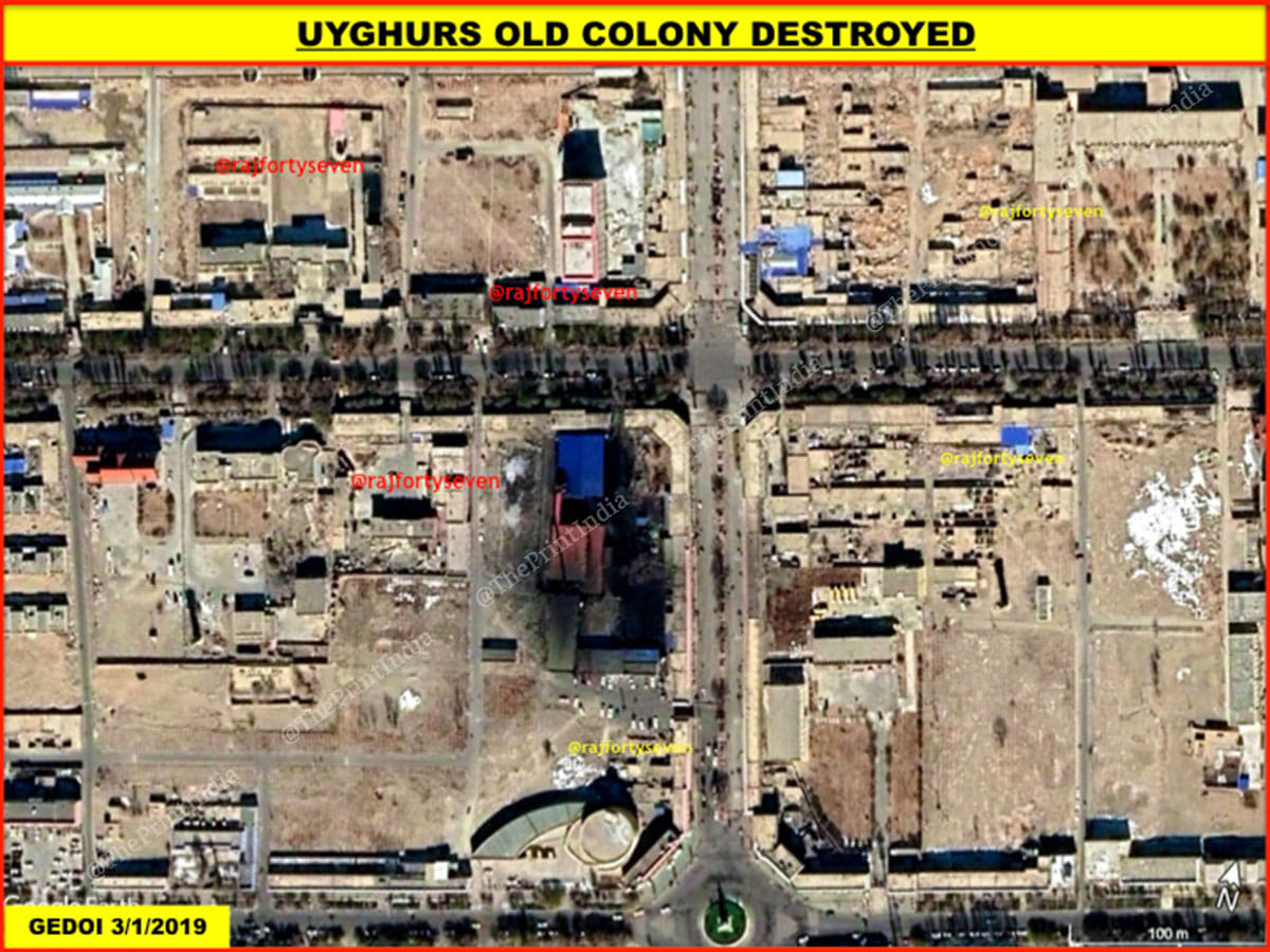
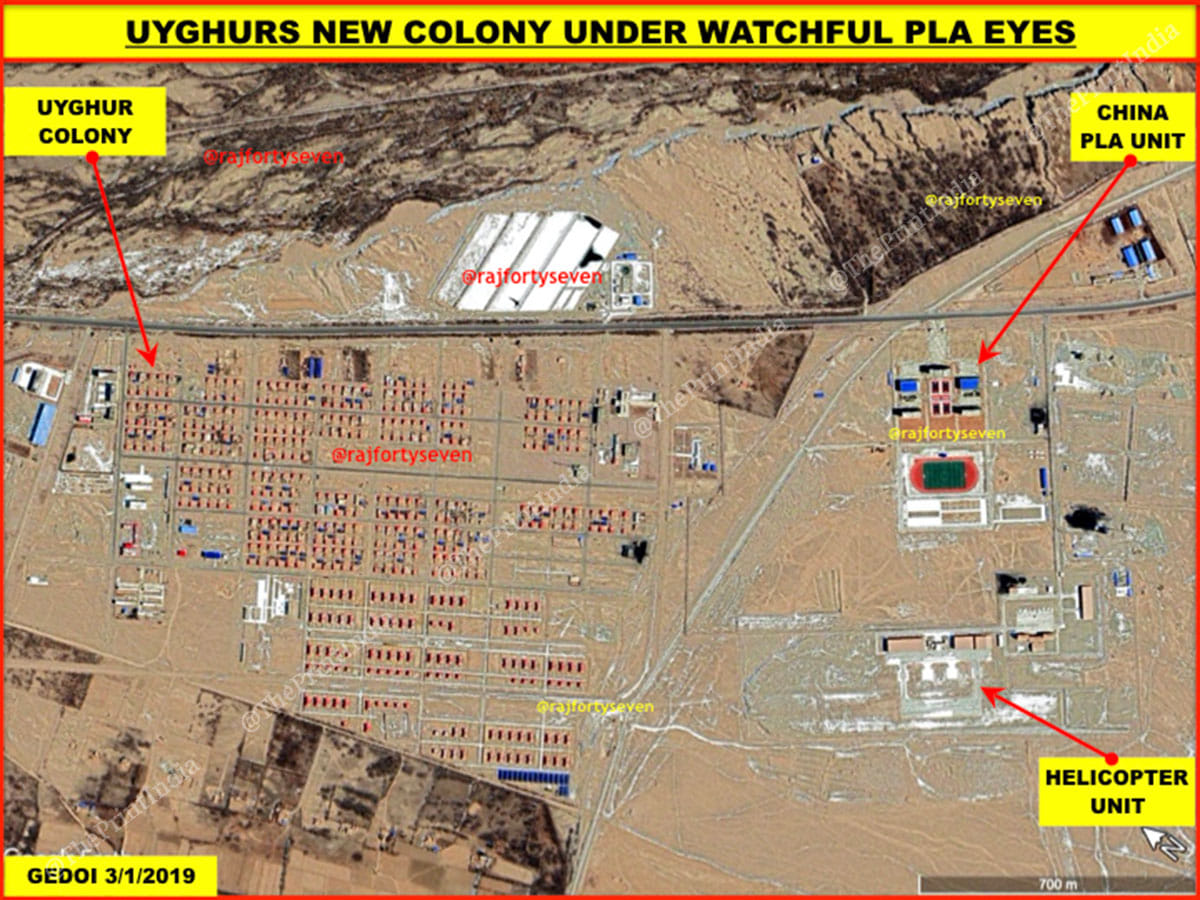
However, there is evidence of Uyghur settlements being destroyed and a new colony being set up under the watchful eyes of the People’s Liberation Army.
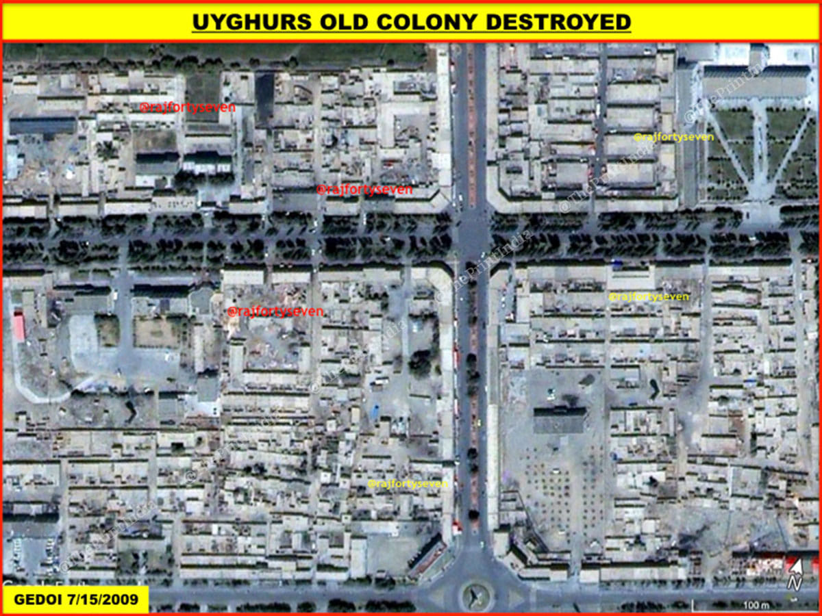
The new colony hosts a recently-inducted PLA formation, along with a helicopter unit.
Tashkurgan features mostly government-owned factories and buildings.
Also read: After Uyghurs, another Muslim minority is under fire in China