



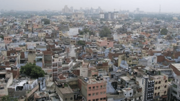
In October this year, the Delhi government issued a notification marking a historic turning point: removing the “rural” tag from its villages. Under Section 507a of the Delhi Municipal Corporation Act, 1957, the Lieutenant Governor Taranjit Singh Sandhu declared Delhi’s remaining 48 rural villages to be urban areas. With this, all 357 villages in the government’s administrative count formally acquired urban status.
The notification covers settlements from Palla and Mungeshpur in north Delhi to Rawta, Dhansa, Jhatikara and Ghumanhera in the southwest. The change applies not merely to their built-up settlements, or old abadis, but to their entire revenue estates. But the notification did not make their agricultural fields disappear, repair inadequate drainage systems or restore neglected village ponds.
Delhi now has no “rural” villages. But it still has farmers, agricultural land, village commons and communities whose relationships with these landscapes predate the modern metropolis.
What, then, does urbanisation promise, and what remains unresolved?
The government’s vision: integrating villages into Delhi’s future
The government’s rationale is straightforward. Delhi faces mounting pressure from population growth, housing shortages, traffic congestion and uneven infrastructure. Many villages already function as densely populated urban neighbourhoods, yet continue to struggle with inadequate sewerage, roads, water supply and public facilities.
Chief Minister Rekha Gupta has presented the decision as an opportunity to integrate these settlements into wider development while preserving their identity. The proposal was approved by the Delhi Development Authority (DDA) in February 2026 and subsequently by the Municipal Corporation of Delhi (MCD) in September, before the October announcement.
Its timing, though, is equally significant.
Just two months earlier, the Centre had notified the Master Plan for Delhi 2047 (MPD-2047), a framework for housing, transport, land use, environmental management and urban regeneration under the broader vision of Viksit Bharat 2047. The plan envisages approximately 40 lakh additional housing units alongside improved connectivity, redevelopment and more intensive use of selected urban corridors. Planning instruments such as land pooling, transit-oriented development and improvement plans are intended to help manage future growth.
Urbanisation, in this context, is meant to bring Delhi’s villages into a more coordinated planning framework. There are good reasons for residents to welcome this prospect. But a change in administrative status is not the same as the delivery of urban infrastructure.
Which agency will prepare detailed improvement plans for the newly urbanised villages? Will existing deficiencies be mapped before development begins? How will residents participate in identifying priorities? And how will the government measure whether the promised improvements have actually reached them? These questions will determine whether urbanisation becomes a meaningful reform or remains primarily an administrative achievement.
Also Read: Satya Niketan was not an accident. Delhi has a student housing problem
Infrastructure for the metropolis or for the village?
Urban Extension Road-II (UER-II) offers a useful illustration of Delhi’s changing priorities.
Designed to improve connectivity across the capital’s outer districts and neighbouring NCR areas, the road links important peripheral settlements and is part of a wider effort to reduce pressure on the city’s existing transport corridors.
In August 2025, Prime Minister Narendra Modi inaugurated the Alipur–Dichaon Kalan stretch and associated links toward Sonipat and Bahadurgarh. MPD-2047 envisages more intensive development along qualifying stretches of UER-II, making the city’s periphery increasingly important to its future residential and commercial geography.
Such infrastructure can improve mobility and access to opportunities. But its benefits are not experienced equally at every scale. Residents near the Mundka–Bakkarwala toll plaza protested in 2025, arguing that the road had complicated everyday journeys between their homes and agricultural fields. The National Highways Authority of India maintained that alternative routes remained available.
The dispute illustrates an important planning challenge. A road may improve connectivity across Delhi while simultaneously changing how a community moves within its own surroundings. Effective planning must consider both realities.
There is a similar distinction between constructing major infrastructure and providing essential neighbourhood services. A village connected to an expressway may still lack functioning drains, accessible footpaths, reliable drinking water or safe public spaces.
For residents, development is experienced not only through metropolitan projects but through everyday journeys: a child reaching school, an elderly person accessing healthcare, or a household navigating a waterlogged street during the monsoon.
The success of MPD-2047 will depend partly on whether its large ambitions translate into these ordinary improvements.
Agriculture has not disappeared from Delhi
The formal end of rural classification also raises a less visible policy question: what happens to agriculture in an entirely urban Delhi?
Government agricultural statistics recorded approximately 29,000 hectares of net sown area in 2022–23, demonstrating that cultivation continued across substantial parts of the capital despite decades of urban expansion. Villages such as Jaunti, associated with early high-yielding wheat cultivation during India’s Green Revolution, remain reminders of Delhi’s agricultural history. In Rawta, cultivation continues alongside serious concerns over water-logging and the changing drainage landscape around the Najafgarh Drain.
Urbanisation does not automatically prohibit farming. But it changes the administrative framework within which cultivation takes place. In September 2024, the Delhi High Court took suo motu cognisance of difficulties faced by residents of Jaunti and other urbanised villages where land mutations had remained suspended without an adequate alternative mechanism. The government subsequently permitted inheritance-based mutations, but broader questions surrounding land administration and cultivation documentation persisted.
Then in December 2025, the Delhi government announced plans for a digital farmer registry, geo-mapping of agricultural land and digital crop surveys. These initiatives could improve the recognition of agricultural activity.
Their effectiveness, however, depends on whether they accommodate the circumstances of farmers in urbanised villages, including those whose traditional cultivation records are unavailable or outdated. The government must clarify how agricultural services, crop documentation and environmental support will operate in areas that remain agricultural in practice.
So if Delhi still has farmers, its policies must retain a place for farming, regardless of how their villages or communities are classified.
Also Read: Delhi villages and the rush to document their vanishing stories
Who speaks for a village after urbanisation?
For Supreme Court advocate Dhruv Yadav, the larger concern is the gradual weakening of the village as a collective institution. Under the Delhi Panchayat Raj Act and Delhi Land Reforms Act of 1954, village communities had Gaon Sabhas and elected Gram Panchayats with responsibilities relating to local administration and community resources.
Delhi’s last Gaon Panchayat elections were held in 1983. On 25 January 1990, the Lieutenant Governor superseded the Panchayats, transferring their functions to Deputy Commissioners. Elections were not subsequently held to restore these bodies. Urbanisation brought further changes to the legal status of Gaon Sabhas and the administration of their common assets. Yadav argues that while the villages themselves survived, their institutional capacity to make collective decisions about their surroundings diminished.
There is an important legal distinction, however. In Jogender Singh v. Government of NCT of Delhi (2010), the Delhi High Court rejected a claim for separate Panchayat elections where residents were already represented through elected municipal councillors.
Municipal representation is, therefore, an established part of Delhi’s governance system, not an absence of democratic representation.
The city has also constituted Village Development Committees under the Delhi Village Development Board framework. These provide a potential channel for identifying local needs. But questions remain about their effectiveness, responsibilities and influence over planning decisions.
A municipal ward may contain several settlements with different priorities. A village pond, historical pathway or shared community space may hold significance that is not immediately apparent in broader ward-level planning.
The question now is not simply whether villagers have elected representatives. But whether existing institutions give communities sufficient influence over decisions that reshape their everyday surroundings.
Could village improvement plans include structured consultations with residents, including women, young people, agricultural workers and newer inhabitants? Could Village Development Committees publish priorities and progress reports? And could planning agencies systematically incorporate local historical and ecological knowledge? These are practical opportunities for making urban governance more participatory.
The ecological infrastructure that cities overlook
Delhi’s village commons have historically supported far more than agriculture. Johads or a check dam, grazing grounds, pathways, wells and other shared spaces served ecological, social and cultural purposes. A pond could recharge groundwater, support livestock and provide a gathering place. An open space might be used seasonally even when it appeared vacant for much of the year.
As the city’s villages urbanised, responsibility for such spaces increasingly became distributed among multiple departments and development agencies. This fragmentation can make protection and restoration difficult.
Delhi’s Wetland Authority identified 1,367 waterbody sites using revenue records and satellite imagery. Earlier ground-verification exercises identified only 674 as visible, although differences in records and verification methods require care when interpreting these figures. In Goyla Khurd, the National Green Tribunal examined highway construction affecting a listed village pond along UER-II, revealing the deficiencies in these measures.
In April 2026, the NGT found several environmental violations and directed further examination and restorative measures. The case demonstrates that the protection of existing ecological features must be built into infrastructure planning from the beginning.
This is not an argument against roads, housing or urban improvement.
Instead, a long-due conversation about what Delhi recognises as infrastructure.
A road is infrastructure. So is a functioning drainage system. But a village pond that absorbs rainwater, supports biodiversity and helps recharge groundwater also performs an essential public function.
At a time of recurring urban flooding, water stress and extreme heat, overlooking these landscapes can undermine the very development Delhi hopes to achieve.
MPD-2047 provides an opportunity to integrate environmental planning with village regeneration. Doing so will require coordination among agencies and meaningful engagement with communities familiar with these spaces.
Also Read:Lal Dora villages are a parallel city in Delhi. No one wants to fix this dirty secret
Development without erasure
It would be misleading to portray Delhi’s villages as uniformly opposed to urbanisation. Over generations, residents have adapted to changing economies, pursued education and professional careers, developed businesses and welcomed newcomers. Many have actively sought the services and opportunities associated with urban life.
Nor should every traditional practice be treated as inherently sustainable or equitable. Preserving village identity does not mean preventing communities from changing. But change must take place with an understanding of the histories, relationships and needs involved.
The 2047 development goal recognises the need for improvement plans in urban villages and acknowledges the heritage significance of some settlements. That recognition offers a starting point, but heritage cannot be limited to monuments or picturesque streets.
Delhi’s villages also contain living histories of language, migration, livelihoods, rituals and ecological relationships. Their development should begin with careful documentation of what exists, what residents value and what needs to improve.
Otherwise, the familiar contradiction will persist: settlements that existed long before modern planning frameworks will continue to be described primarily through the language of inadequate planning. The village existed before the plan. Its history cannot be reduced to the difficulties it presents to the plan.
Delhi’s October notification completes a major administrative transition. Whether it delivers a corresponding improvement in people’s lives remains an open question.
The government’s 2047 vision is ambitious. Better housing, connectivity, public services and coordinated development are all legitimate and necessary aspirations. But it is plausible.
The next stage requires village-specific infrastructure plans, reliable agricultural administration, protection of ecological commons and institutions through which residents can meaningfully participate in decisions about their surroundings.
Delhi has completed the urbanisation of its villages on paper. The task now is to make that transition work for the people who live there.
The question is whether they will help shape Delhi’s next chapter or continue to live within plans designed largely without them.
Puneet Singh Singhal is the Co-founder of Billion Strong and the founder of Green Disability and Dilli Dehat Project. He tweets at @puneetsinghal22. Views are personal.
(Edited by Insha Jalil Waziri)