Fears of China potentially ‘weaponising’ its rivers call for a scientific-security analysis, something sorely lacking in Indian policy circles.
A lack of interdisciplinary coordination of expertise is now referred as ‘siloisation’. This is visible in the manner in which we approach the possibility of future ‘water wars’ between India and China.
The fear of China ‘weaponising’ its rivers is studied in silos that are no longer tenable. Analysts approach it through the prism of securitisation, while ecologists and hydrologists apply a scientific lens. The crucial intersections between these approaches are underexplored in Indian policy circles.
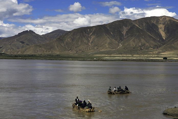
One river, in particular, dominated the conversation at a workshop organised by the International Union for the Conservation of Nature (IUCN): the Brahmaputra, which emerges from the Himalayas in China’s Tibetan Autonomous Region (TAR) as the Yarlung Tsangpo, flows through India and Bangladesh, finally falling into the Bay of Bengal.
Foreign policy analysts started the conversation with the potential for conflict, whereas hydrologists urged that the issue be considered from a scientific perspective within the dynamics of cooperation. They pointed to popular misperceptions to demonstrate the importance of examining these issues in the right context, and consider what can lead to an inter-state conflict and what amounts to misreading — especially if, by causing panic, these misperceptions have the potential to aggravate existing domestic ethnic conflicts in India’s Northeast.
A case-in-point is the wholesale fear of Chinese projects on the Yarlung Tsangpo, significantly reducing the flow of water into India. The Yarlung Tsangpo, however, surfaces in a rain-shadow area: there is little rain, and melting glaciers contribute to the lean volume of water in China. Only as it enters India does the Brahmaputra become a heaving behemoth, its volume fed by rainfall and tributaries.
A cross-disciplinary approach to studying the contentious issue of sharing water between India and China is critical for three reasons.
First, on the geopolitical front, India has existing land border disputes with China that are unlikely to be resolved in the near future, as was indicated by the long military standoff on the Doklam plateau earlier this year.
Second, both countries also face the challenges of rapid population growth and urbanisation, with which access to fresh water – a scarce resource in Asia – is fundamentally interlinked. Several rivers that water southern Asia – the Brahmaputra and the Indus, for example – emerge from China. China’s water shortages could potentially lead to it leveraging its upper riparian status, with negative consequences for downstream states. The fallout here too must be studied in the context of China’s own assessment of the economic, political, and technological feasibility of diverting water from the Yarlung Tsangpo to its dry northern areas within the South-North Water Transfer Project.
Finally, it is important to assess what role rivers play in the Belt and Road Initiative (BRI). Although China posits BRI as a development cooperation initiative through cross-border connectivity of mutual benefit to those involved, it is of far greater geostrategic import than this so-called rationale allows.
India opted to not send a representative to the BRI Summit in May, its primary objection to the initiative being that the China-Pakistan Economic Corridor (CPEC) traverses disputed territory between India and Pakistan. Much of the intense discussion on BRI has focussed on the ambitious network of roads, rails, and maritime connectivity that China hopes to establish in fulfilment of its objectives.
There is still little talk, however, of the transboundary rivers that crisscross BRI’s proposed routes, both in the context of China’s water-sharing arrangements with other countries, and how its global quest for resources fits into its strategic narrative.
For example, Pakistan sought Chinese monetary assistance as part of CPEC to help construct the Diamer-Bhasha dam on the Indus river. The Indus passes through Gilgit-Baltistan, which both India and Pakistan lay claim to. India naturally opposed the project, and while it has since reportedly been withdrawn from the CPEC due to strict conditions imposed by China – including, apparently, ownership of the dam – individual project hold-ups are unlikely to change BRI’s eventual course.
Bilateral hydropolitics, a lack of transparency, and skewed perceptions often stoke fears of China potentially ‘weaponising’ the river, which derive from and compound several other fault lines that already exist in the relationship. What is the impact of both Chinese hydropower and water diversion projects in downstream countries such as India and Bangladesh? What role do transboundary rivers play in the BRI agenda? These questions must be viewed in a framework that anchors China’s geostrategic ambitions in scientific-security analysis.
More voices may foster more disagreement, perhaps sometimes even further complicate and shift the direction of talks, especially on as politicised an issue as the India-China relationship. However, if cutting-edge policy analysis is the desired result, cross-disciplinary approaches must be employed to study priority concerns such as transboundary river waters.
A version of this article originally appeared at South Asian Voices, an online platform for strategic analysis and debate hosted by the Stimson Center.
Ruhee Neog is director, Institute of Peace and Conflict Studies (IPCS), New Delhi, and Visiting Fellow, Stimson Center, Washington D.C.

COMMENTS