

HySIS will be India’s first hyperspectral imaging satellite, which can take photographs of Earth’s surface across three bands of one wavelength.
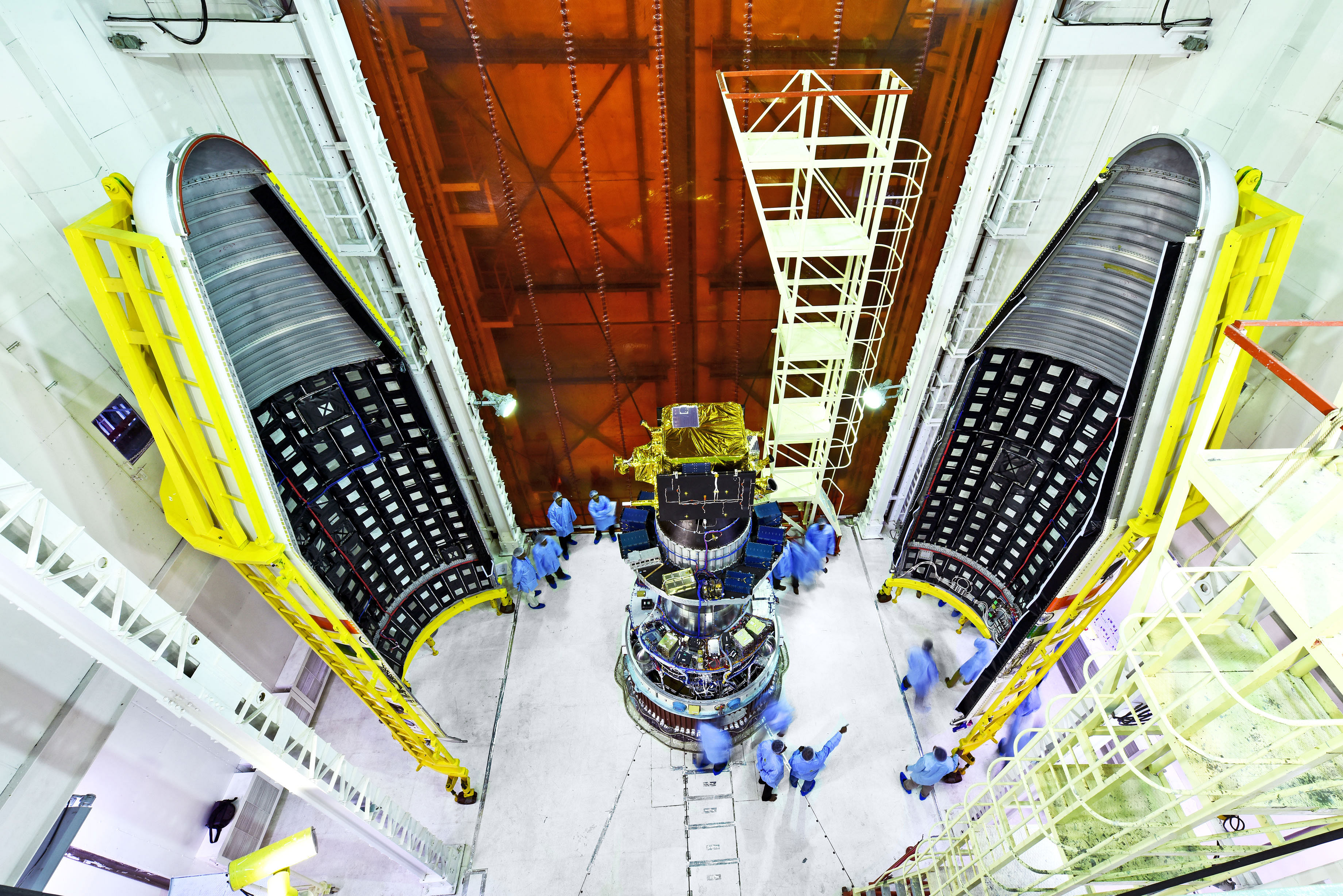
Bengaluru: The Indian Space Research Organisation (ISRO) is all set to launch India’s first Hyperspectral Imaging Satellite (HySIS) along with 30 other satellites from 8 different countries at 9.58 am Thursday from Sriharikota.
The satellites will fly aboard the PSLV on its 45th flight for the mission called the PSLVC43/HySIS.
Images from HySIS are expected to greatly help the country in the agriculture and defence sectors. It is also expected to be able to track targets on the ground.
Also read: ISRO’s biggest rocket takes off with cutting-edge communication satellite
The satellite
Hyperspectral imaging is the process of collecting and processing images across the electromagnetic spectrum. Since the same object or area will be observed through multiple cameras operating on multiple bands of one wavelength, the resultant image is of increased clarity and provides additional attributes than a regular imaging camera.
“The primary goal of HysIS is to study the earth’s surface in visible, near infrared and shortwave infrared regions of the electromagnetic spectrum,” said ISRO in a statement.
The satellite images can detect variation in soil, water, and vegetation on the ground. Data from the satellite will be used in the fields of agriculture, forestry, soil survey, geology, coastal zone studies, inland water studies, environmental monitoring, pollution detection, and military observations.
The satellite weighs 380kg and is 2.2m x 1.4m x 1.1m in dimensions. It is expected to function for at least five years.
Also read: India’s first private satellite – a small piece of history on SpaceX’s Falcon 9 rocket
The mission
The satellites will be placed in two different orbits. HySIS will be placed in a polar sun synchronous orbit at an altitude of 636 km and inclination of 97.957 degrees.
A sun synchronous orbit is one where the satellite passes over the same spot on earth everyday at the same time. HySIS will pass over India, going around the Earth and over the North and South Poles.
After HySIS separates, the other 30 satellites will be placed one after the other in quick succession in a 504 km orbit at an inclination of 97.46 degrees.
The co-passengers are one micro satellite (weighing 55 kg) and 29 nano satellites (each under 10 kg). The single micro satellite and 22 of the 29 nano satellites are from the US, of which 16 are Earth observation satellites and the others, vehicle identification.
Other satellites are from Australia, Canada, Columbia, Finland, Malaysia, Netherlands, and Spain.
This is the thirteenth flight of the PSLV in its Core Alone variant. It is also ISRO’s sixth launch this year. The entire mission and the full separation of all satellites is expected to take 1 hour, 52 minutes, and 47 seconds, making this the PSLV’s third longest mission.