






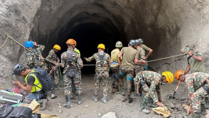

Chinese commentary on the latest flash floods along the China-Nepal border largely presents them as a shared Himalayan risk, driven by climate change, extreme terrain and the difficulty of monitoring hazards across borders. Much of the discussion centres on what may have triggered the disaster and why early warnings failed. Far less attention is paid to the growing exposure of people and infrastructure to such hazards, including the role of expanding connectivity and infrastructure in a fragile Himalayan environment.
Global Times reported that this was a chain reaction that began with instability in high-altitude glaciers and was amplified by ice and rock collapses, mountain erosion and debris flows. Zhang Qianggong, head of climate and environmental risk at the International Centre for Integrated Mountain Development, identifies three factors behind the speed and scale of the floods: The steep vertical drop gave collapsed material enormous potential energy; narrow valleys left little room for debris to disperse; and glacial valleys and river channels contained large amounts of loose material that debris flows picked up as they moved, increasing their volume and force.
These conditions also make early warning difficult. Jin Canrong, professor and vice dean at Renmin University, notes that China can closely monitor risks within its territory, but monitoring Nepal’s upper mountain areas is far harder. Landslide lakes are especially unpredictable: once a barrier bursts, downstream communities may have less than an hour to evacuate.
The early-warning gap
Chinese commentary attributes the delayed warning to gaps in the cross-border system, particularly the lack of a fully integrated, real-time network linking Chinese and Nepalese monitors. Although China has advanced satellite, hydrological and remote-sensing capabilities and the two countries cooperate on disaster prevention, information still passes through multiple agencies and communication networks before reaching communities.
Chinese accounts consequently emphasise Nepal’s institutional and emergency-response limitations, arguing that delays in this chain can make even timely information ineffective. Tang Chuan, professor at Chengdu University of Technology and an expert at the State Key Laboratory of Geological Hazard Prevention and Geological Environment Protection, said there is already considerable cooperation between research institutions and experts from China and Nepal. But if monitoring equipment needs to be deployed directly within Nepal, he noted, an intergovernmental cooperation agreement would be required. All of this, according to Chinese perspectives, helps explain why early warning was delayed from the Chinese side.
Also read: What Nepal floods tell us—warming Himalayas, weak warning systems, no cross-border plans
Infrastructure and risk
The response emerging from Chinese commentary is greater China-Nepal cooperation in disaster management and resilience. Jin Canrong proposes joint monitoring stations to track glacial lakes and mountain movements in real time, as well as redesigning Gyirong Port to move key facilities away from high-risk river areas. He also calls for heightened alerts and temporary closures during the flood season.
Zhang Xingnan, professor at Hohai University, similarly suggests using remote-sensing satellites and other technologies to monitor key mountain areas during periods of concentrated glacier melt. Once a barrier lake is detected, he argues, the two sides should maintain high vigilance, share information promptly and investigate potential hazards before they become disasters.
Chinese commentary calls for better monitoring, faster warnings and stronger infrastructure, but not less connectivity. Jin argues that Himalayan trade routes must remain open despite rising geological risks. China has expanded infrastructure in this fragile region. That does not prove its projects caused the disaster, but it raises a question largely absent from the discussion: has connectivity also increased exposure to the risks China now seeks to manage? The truth is resilience building cannot replace accountability.
Blaming Indian accounts
There is also a clear geopolitical dimension to the Chinese discussion. Some Chinese online commentary has characterised criticism of China’s handling of the disaster as an information war, particularly from Indian accounts.
A Baijiahao commentator lamented that a natural disaster had been turned into an anti-China political narrative before the facts were established, alleging that some Indian media and online actors were exploiting the information vacuum to blame China and reinforce anti-China sentiment.
A Weibo post similarly accused Indian and other foreign accounts of using the disaster to wage a propaganda campaign against China, spreading false or misleading claims amid limited information in the early stages. It cited allegations that a Tibetan dam had collapsed, that China had deliberately released floodwaters affecting Indian pilgrims, and that Chinese dams were poorly constructed, alongside the use of old flood photographs and AI-generated maps. It also rejected claims that China delayed an early warning to Nepal by 45 minutes, arguing that such narratives were intended to portray China as irresponsible and drive a wedge between China and Nepal.
Another issue was a report suggesting that Nepal’s refusal to allow foreign rescue teams may have been influenced by China’s sensitivity over border issues. Chinese commentators strongly rejected this assertion, arguing that Nepal had imposed a blanket restriction on foreign rescue teams because allowing dozens of countries to deploy personnel in the remote Himalayan disaster zone could create difficulties in access, coordination and resource allocation.
South Korea had a particularly strong reason to seek access, as employees of South Korean companies were potentially trapped in the affected area. But Chinese commentary argued that allowing one country’s rescue team in could make it difficult for Nepal to reject similar requests from India, the US, China, the UK, Malaysia, Australia and others.
A Weibo post also portrayed India’s push to deploy its National Disaster Response Force or military aircraft as partly driven by geopolitical competition with China. Rasuwa’s location near the China-Nepal border, it argued, made the deployment of foreign military personnel and aircraft particularly sensitive.
The dominant vocabulary on the Chinese internet is one of resilience, climate change, ecological challenges and cooperation. China presents itself as having the technology and capacity to help manage the risks. But it cannot be both a major driver of Himalayan connectivity and stand outside the risks that connectivity creates. The case for better early warning is strong. So is the case for more resilient infrastructure. What is missing is greater scrutiny of the development choices that may be increasing exposure in the first place.
Before asking how to make these projects more resilient, there must also be an honest assessment of whether development in Tibet and along the China-Nepal border has increased the risks in the first place.
Sana Hashmi, PhD, is a fellow at the Taiwan-Asia Exchange Foundation. She tweets @sanahashm1. Views are personal.
(Edited by Prashant Dixit)