In the Library of the Royal Academy of Arts in London is a simple, hand-drawn sketch map made in 1786 for the artist Ozias Humphry. Annotated in Persian, it shows the area between Benares and Delhi (Shahjahanpur) following the course of the Rivers Ganges and Jumna. The map is a small panorama—only 4 ½ inches tall but 18 inches long—and made from one, or possibly two, pieces of paper pasted together. It has been folded, not rolled, so it would have sat in a small bag, or more likely the pocket of an eighteenth-century traveller. Part pictographic, the map depicts the ancient city of Allahabad as a square and named Qila (Fort) Illahabad. The fort, which still stands today on the riverbank, was built by the Mughal Emperor Akbar in 1583 and was already a venerable landmark when Humphry passed by. Compass points are helpfully indicated on his map: teraf shimal (north direction), teraf janub (south direction), teraf marush (east direction) and teraf magrib (west direction).
This is a map prepared by someone familiar with the route between Benares and Delhi. There is a certain authority in the placing of the rivers, the fort and the various towns en route. The cartographer is likely to have been an agent who dealt with ferrying passengers and goods across the region. The existing map shows only a small section of the journey undertaken by Humphry. Other sections, now missing, might have been pasted on at each end to show the complete route from Calcutta, the Presidency capital of the East India Company, to Delhi, the Mughal capital.
Unlike the survey maps discussed later in this chapter, Humphry’s map is an unique piece of ephemera. Dozens of such maps must have been carried by travellers unfamiliar with their intended route, which they then discarded like used train tickets at the end of a journey. Luckily for us, the artist was a methodical man, keeping a diary during his visit to Lucknow (although not while travelling). The map was probably tucked inside the pages of his diary at some point as a souvenir of the journey. There are no helpful arrows on the map to indicate in which direction Humphry was travelling, whether to Lucknow—where he arrived on 20 February—or back to Calcutta, setting out on a borrowed elephant in early August. A Lucknow acquaintance, the former surveyor Colonel Claude Martin, had generously loaned him the elephant, and because a letter from Martin is part of this small collection at the Royal Academy, there is a good chance the map was drawn in Lucknow for the journey back. Humphry himself was unable to read the map’s Persian annotations; it had been made for the literate man who accompanied him and who made the travelling arrangements on land and water.
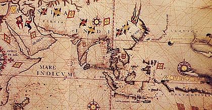
Indian cartography before the arrival of the Europeans seems particularly elusive, even non-existent. The outline of the subcontinent appears on medieval maps of the world in more or less correct form, but its interior, the distance between its towns and the course of its great rivers, remained almost uncharted— although not unknown—until the middle of the eighteenth century. The ‘Mughal’ maps carefully documented by Susan Gole are in fact maps that the Frenchman Jean-Baptiste-Joseph Gentil commissioned while he was agent for the French government at Awadh, one of the breakaway provinces from the Mughal Empire. We can speculate why pre-colonial maps of India have not been found: they were not needed while the majority of the population kept to a limited circuit of markets and places of worship; land revenue records were based on the names of landholders, not visual records of their holdings; lack of printing technology before the 1670s meant that hand-drawn maps could not be reproduced or widely circulated. But the contrast between medieval mapping in Britain, where credible maps were being produced by the thirteenth century, and India’s cartographical silence is striking. And the implications of agreeing or even actively encouraging foreigners to survey and map your own country provides an important clue to the successful colonisation of that country.
Also read: Both Gandhi and Patel believed Hindus would flee than fight to protect themselves upon attack
If there are no known land maps until Europeans began surveying the subcontinent, this doesn’t mean that ‘personal’ maps like Humphry’s didn’t exist, or maps for pilgrimage routes. It may simply mean that they haven’t survived. The work of the Austrian Jesuit, Father Joseph Tieffenthaler, who arrived in India in 1740 provides the link between hand-drawn maps for travellers (desi maps) and the surveys begun under James Rennell for the East India Company. Although often linked together in accounts of early European cartography in India, the two men were very different in their approaches. Tieffenthaler, who spoke Hindustani and Persian, consulted with and used the work of Indian mapmakers. Rennell employed European surveyors who worked with Indian assistants using Western equipment and methods.
One of Tieffenthaler’s most important contributions is his map entitled ‘A General Chart of the Course of the Ganges and the Gagra’, published in Paris in 1784, a year before his death at Lucknow. Measuring 29 inches by 23, the ‘General Chart’ is made up of six separate maps, four of which are by unnamed Indian cartographers. Running through the map is Tieffenthaler’s own partial survey of the two great rivers, the Ganges and the Gogra (Ghaghara), from their source in the Himalayas. Tieffenthaler had begun his survey 20 years earlier in the mid-1760s, when Calcutta was recovering from the damage caused by Siraj-ud-daula’s attack, and it is correctly recorded in Tieffenthaler’s map as one place[1]name among many others along the busy banks of the Ganges. A number of sacred sites in India were and still are the focus of regular pilgrimages by Hindus, Jains and Buddhists. The ‘General Chart’ has at its centre the lake of Mansarovar in the Himalayas, believed to be the abode of Lord Shiva. Tieffenthaler does not record visiting the lake and the adjoining Mount Kailash, so it follows that his map of the area would have come from an Indian source, from people familiar with the route who recorded it for other pilgrims, and this makes it a rare indigenous survival, preserved by a European.
It is Tieffenthaler’s town maps that provide the clearest indication that he was using Indian sources and Indian draughtsmen too. Look at his panoramic maps of Laknao (Lucknow) and Maxvdabad (Murshidabad), both situated on rivers. There is a sense of movement in the depictions of survey boats travelling upriver, but most striking is the way some drawn elevations of the buildings lining the banks are flung flat on their backs. The west bank of the Murshidabad map, the area called Mahinagar, presents a pleasant view of trees and buildings in conventional form. But you have to turn the map upside down to see the east bank in similar fashion, and here the great Katra Masjid appears in its own enclosure as a separate elevation which can be viewed by turning the map 90 degrees. The Lucknow map is similarly idiosyncratic, viewed from the north bank with the Macchi Bhawan fort gates and the Aurangzeb Mosque elevations aligned flat to the right while adjoining buildings remain horizontal. Neither map has compass points, although the directional flow of both rivers is correctly shown, and it would be reasonably easy to navigate one’s way through these attractive towns with their distinctive buildings. This is the nearest we are going to get to the lost desi maps of pre-colonial India unless a hidden cache turns up.
Also read: Ali Shariati—the Paris-educated scholar who taught Iranian women how to be modern & Islamic
Part of Humphry’s map covers the Sarak-e-Azam, the Great Road, also known as Badshahi Sarak (Royal Road) and Uttarapatha (Northern Road). It lost its Indian names early in the nineteenth century to become the Grand Trunk Road, and today it is simply called GT Road. First established during the third century BCE, it runs for approximately 1,500 miles across the subcontinent from Bangladesh to Kabul and was the trade route that linked India to Central Asia. A sparse network of other roads zigzagged across the subcontinent during the Mughal era, providing trade and pilgrimage routes. An important road ran from Agra, via Jaipur, and Ajmer, leading south through Ahmadabad to the western port of Surat. But, as Jean Deloche reminds us in his definitive study of Transport and Communications in India Prior to Steam Locomotion, roads do not have an independent existence separate from human settlement, and they could fall in and out of favour depending on political and economic circumstances. While the road between Delhi and Agra allowed the Mughal capital to shift comfortably between the two cities, the road to Surat dwindled in significance as power shifted to the developing port of Bombay. An extreme example of this is the old, pre-Mughal capital of Gaur in Bengal: once one of the most populated cities in the subcontinent, it was deserted when the Ganges changed course and is now only approachable by a single track.
Along a number of Mughal roads, particularly in northern India, the route was marked by a series of structures called kos minar. The kos is an ancient measure of distance, equivalent in Bengal to just under 2 miles, and minar is a pillar or tower (as in minaret), so this is a marker like the English milestone. Of the thousand or so kos minars constructed from the reign of Akbar onwards, just over a hundred remain today. They were built of stone, where it was available, or more frequently of brick covered with stucco, and they stand like giant pepper pots with rounded tops along the old roads. A curiosity of the kos was that it differed in length through the subcontinent, stretching to almost 4 miles in the south of the country and contracting to about 1 mile as it approached Afghanistan. Along the routes were serais, or lodging places for travellers and their animals. (The term ‘caravanserai’ indicates that people preferred to travel in convoy for security.) The remains of Badli-ki-Serai a few miles north of old Delhi give a good indication of the size of a major serai, though unfortunately only its two giant gateways remain today. Inside its vanished walls were individual cells where travellers could rest, get stabling and fodder for their animals, and find a canteen for their own meals. All this had to be paid for, of course, but the safety of a well-organised serai was greatly preferable to pitching tents off the main road. Caravanserais are mainly associated today with the Islamic world, where many fine examples remain.
 This excerpt from Empire Building by Rosie Llewellyn-Jones has been published with permission from Penguin Random House India.


