





“Now parts of the dry land are sea, and now it is dry where ships were sailing just before”. Writing about the formidable tides around Barygaza, present-day Bharuch in Gujarat, the anonymous first-century author of The Periplus of the Erythraean Sea was describing a daily hazard. Yet his observations point to a broader truth. We instinctively treat the coastline on a map as absolute and a fixed certainty.
But the Earth is a restless geographer constantly reshaping the contours of the land and the sea. Rivers change their course, harbours collect silt, storms cut into settlements, and the sea advances or retreats. Just as seasonal winds reshape desert dunes, coastlines are continually redrawn, though far more slowly. Over centuries, these shifts can strand a once-bustling harbour or submerge the busy streets of a coastal city.
The Periplus is a Greek merchant’s account of Roman-era maritime trade, intended as a practical guide for merchants and mariners. Alongside Ptolemy’s Geography, it records the names of numerous Indian ports and glimpses of the commercial life: ships waiting for the monsoon, cargo coming ashore, and merchants from distant coasts bargaining over wares. Few of those ports are now lost, few others are now settlements far from the sea. This maritime past came into sharper focus last week, as the third phase of underwater exploration at Poompuhar coast concluded. Conducted jointly by the Tamil Nadu State Department of Archaeology and the Indian Maritime University, the preliminary findings were reported on 22 September, with a detailed report expected in February 2027.
A submerged past
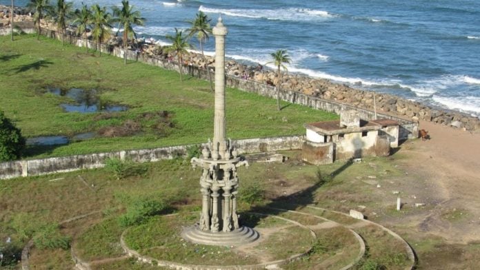
At its peak, Poompuhar, known then as Kaveripoompattinam, was both an early Chola capital and a major port at the mouth of the Kaveri river. The latest survey recorded more than 250 ceramic fragments, including one provisionally identified as part of a West Asian torpedo jar, as well as four terracotta ring wells on the seabed. Sonar images also revealed structural features beyond the present shoreline, while researchers state that the wells may mark a former land surface or palaeochannel.
Interestingly, Tamil Sangam literature preserves both memories of the port at its height as well as its loss. Pattinappālai, generally dated to the first or second century CE, pictures a prosperous, multilingual city where “swift horses with lifted heads arrive on ships from abroad” and merchants traded goods brought from distant shores. The later Buddhist epic Manimekalai, dated to the sixth century, carries a somber memory: “The divine city Pukār was swallowed by the ocean.” These poems preserve the living memory of a port that once flourished and parts of which were eventually lost; the recent underwater archaeological evidence corroborates this fact.
The coastal excavation off Poompuhar coast is not an isolated endeavour. Disclosures in the Rajya Sabha during the recent Monsoon Session regarding the Archaeological Survey of India’s expanded underwater mandate through 2030 heralds a vital institutional shift. The drive to systematically survey submerged sites, stretching from Dwarka and Bet Dwarka in Gujarat to Mahabalipuram and Karaikal on the Coromandel Coast, has gained fresh momentum. Off Elephanta Island in the Arabian Sea, archaeologists have documented imported amphora fragments, West Asian glazed pottery, a massive freshwater storage cistern, and submerged stone masonry that point to a former landing quay. Far from being merely a serene sanctuary of rock-cut caves, Elephanta emerges as a bustling ancient trade hub. Across both the Arabian Sea and the Bay of Bengal, these surveys are gradually piecing together a continuous, working littoral infrastructure.
Also read: India was once home to free-flying, meat-eating goddesses. Yoginis were feared and respected
An ancient superhighway
The geopolitical implications of this rigorous marine archaeology extend directly into modern statecraft. As New Delhi navigates the strategic contours of the Indo-Pacific, ASEAN, and the wider Indian Ocean, ancient commerce offers profound historical depth to contemporary diplomacy. Joint seabed expeditions, shared archives, and collaborative research with ocean-state partners can buttress the notion of historic ties, with verifiable material evidence and connections.
In popular imagination, the Silk Road looms large as the definitive ancient highway, largely owing to a century of deliberate mapping and excavation transforming a dispersed network into a monumental global concept. The trade volume carried across these overland tracks was dwarfed by what moved by sea. India sat at the centre of the ancient world’s trade network for at least 4,000 years, its maritime past deserves comparable attention. From Mesopotamian archives recording Indian trade communities to the maritime networks of the Indus-Saraswati and the Coromandel, the Indian Ocean was the true superhighway of the ancient world.
For too long, this maritime history remained peripheral to accounts centred on inland capitals and territorial frontiers. Exploring and authoritatively documenting these submerged landscapes, from Poompuhar and Dwarka to the broader littoral rim, is a civilisational imperative. By leading this scholarship, India does not just reclaim a missing past for global history, it establishes the authoritative standing needed to project durable soft power and shape the maritime discourse of the 21st century.
Maitridevi Sisodia is an author, columnist, and civil servant. She is currently serving as a Deputy Collector in Ahmedabad. Views are personal.
(Edited by Aamaan Alam Khan)