



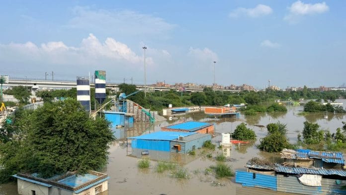

New Delhi: To resolve the issue of demarcating the boundaries of Yamuna floodplains, the National Green Tribunal asked the Delhi Environment Secretary to call for a meeting of the Delhi Development Authority and the Irrigation and Flood Control Department within one week.
According to the 16 July hearing at NGT, the demarcation process being conducted by DDA was stalled midway because the I&FC department sent a different map of the Yamuna floodplains. To clear the confusion and enable DDA to restart the process, NGT directed a joint meeting to be held between the departments.
“Since the entire work of demarcation of the floodplain is held up because of the said communication, we require the Principal Secretary, Environment, GNCTD, to hold a joint meeting of the officials,” read the NGT order dated 16 July.
An official demarcation of the Yamuna floodplains would ensure that no illegal constructions, encroachments, or ecologically unsafe activities are carried out on them. In 2015, NGT had directed the Delhi government to officially identify and mark the floodplains on the 22-km-long stretch of the Yamuna river that flows from the Wazirabad to the Okhla barrage.
10 years on, Yamuna floodplains await demarcation
The issue of Yamuna floodplains demarcation was brought up by the Delhi government in 1978, after the historic floods in the river that inundated the capital city. That year, Yamuna recorded its highest water level at 207.49 m.
According to an I&FC department document dated December 23, 2025, the Delhi High Court had appointed a Yamuna Removal of Illegal Encroachment Monitoring Committee in 2006 to decide the distance of embankments and construction allowed near the Yamuna’s banks.
In 2016, the Union government passed the River Ganga (Rejuvenation, Protection and Management) Authorities Order, 2016, which provided a template that can be followed for the Yamuna in Delhi. On 16 July, however, the NGT said that even after ten years since the initial order, the Yamuna floodplains in Delhi have still not been officially demarcated.
According to the order, a copy of which is with The Print, DDA received a map of the Delhi floodplains in March this year. It was prepared by Geo Spatial Delhi Limited (GSDL) and contained detailed elevation measurements and pointed to the area that is likely to be inundated during floods, with a 1% annual probability. DDA then began working on the physical demarcation of the plains using bollards, or thick metal posts. DDA had then set a deadline of 31 July for the completion of the process.
The Irrigation and Flood Control department, however, sent a revised map of the floodplains to DDA in June.
“…The DDA has informed that … out of 277 bollards, 206 bollards were fixed, but because of the receipt of the communication from the Irrigation and Flood Control Department of GNCTD, the DDA has not proceeded,” read the NGT document.
Since DDA had completed half the work based on the initial map, they told NGT that they stopped the demarcation work and awaited further instructions on whether they should act on the revised map. DDA is now awaiting communication from the I&FC department.
After ordering the Delhi Environment Secretary to clear the confusion and hold a joint meeting of the two departments within a week, NGT scheduled the next hearing on the case for September 18. It asked for progress reports from both departments a week before the next hearing.
(Edited by Aakriti Handa)