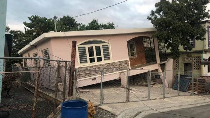
Bengaluru: Puerto Rico was rocked by a devastating 6.4-magnitude earthquake Tuesday, which killed at least one person. The earthquake’s physical effects on the land can now be seen from space, says NASA. According to a statement released Friday, satellite imagery can identify where the ground has been displaced.
All earthquakes cause permanent changes to the surface of the earth. Imagery can be compared from different points in time to note the visible physical changes. Radar is even better for this purpose as it can measure displacement to a deeper extent and can provide more details.
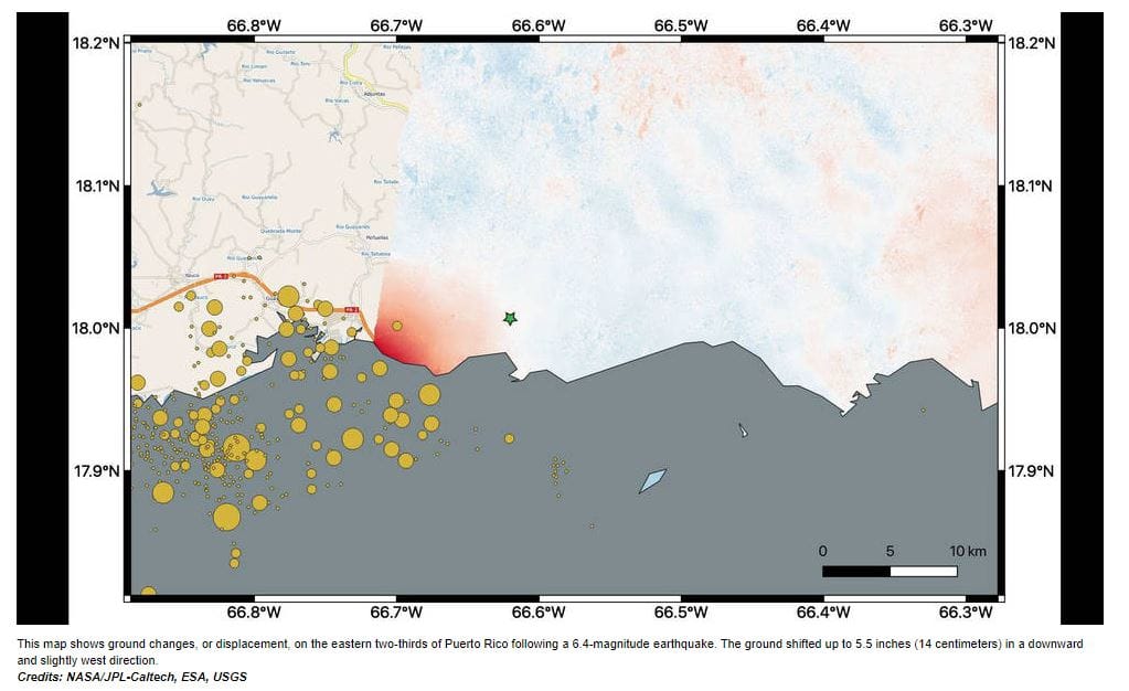
For this earthquake, scientists mapped the surface changes and their direction using data obtained by European Space Union’s (ESA) Copernicus Sentinel-1A satellite using the interferometric synthetic aperture radar (InSAR) on board.
Data acquired on 9 January was compared with data from 28 December 2019 to infer the changes.
Ground shifted downwards and to the west

The developed map shows changes on the eastern two-thirds of the Puerto Rican island and points out areas where the ground has been displaced. The area to the west of the city of Ponce (identified by a green star on the map) shows the maximum displacement, ranging up to 5.5 inches of ground change.
The scientists also note that the ground has appeared to have shifted downward and slightly to the west.
The orange circles on the map indicate the quake’s epicentre and aftershocks, identified by the United States Geological Survey (USGS). Scientists are now using this satellite data to help federal and local authorities identify areas that are expected to be damaged.
Scientists will also analyse data from the upcoming 14 January passage of the satellite overhead.
Puerto Rico prone to earthquakes
Puerto Rico was hit by yet another earthquake on Friday which was a 5.2 magnitude aftershock. The island is prone to earthquakes, and less than two weeks into the new year, has already experienced over 950 quakes. Many were too weak to be felt, but more than 500 were of magnitude 2 on the Richter scale.
The island sits in the middle of the Caribbean tectonic plate and the North American plate—the two tend to collide. According to USGS, the North American plate is being squeezed down under the Caribbean plate to the north of Puerto Rico, while to the south of the island, the top of the Caribbean plate is pushing itself down beneath the island. This combination causes frequent earthquakes throughout the island.
Also read: Scientists discover earthquake-like phenomenon called stormquakes that can pound sea floor


