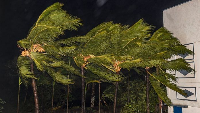
New Delhi: Cyclone Amphan, which has been steadily intensifying over the Bay of Bengal, is likely to make landfall over West Bengal on 20 May.
It had formed over south-east Bay of Bengal on the evening of May 16, as had been forecast by the IMD.
As of Monday afternoon, it lies about 770 km nearly south of Paradip (Odisha), 920 km south-southwest of Digha (West Bengal) and 1,040 km south-southwest of Khepupara (Bangladesh).
The cyclone has been classified as extremely severe.
The IMD, which has been tracking the progress of the cyclone, has advised fishermen not to venture into south Bay of Bengal over next 24 hours; to central Bay of Bengal from 17 May to 18 May and into North Bay of Bengal from 18 May to 20 May.
Low-lying areas of South and North 24 Parganas and low-lying areas of East Medinipur district of West Bengal are likely to be flooded due to a storm surge — a rise in sea level as a result of storms.
The IMD warns of extensive damage to all types of kutcha houses, and some damage to ‘pucca’ structures as a result of the cyclone.
It has also warned of extensive uprooting of communication and power poles, disruption of rail or road link at several places and damage to standing crops, plantations and orchards.
According to the weather office, when the cyclone hits Bengal the wind speeds will range between 165-175 kmph with gusts of up to 185 kmph.
By comparison, last year Cyclone Fani — which was the strongest tropical cyclone to hit Odisha since 1991 — had wind speeds of up to 200 kmph.
Also read:India has made strides in clean energy since 2015 but Covid could negate it: WEF report
How are cyclones formed?
Tropical cyclones typically form over warm ocean waters near the equator.
Warm, moist air rises from over the ocean, creating an area of lower air pressure below. This causes cool air from surrounding areas to rush in.
However, this air too becomes warm and rises, causing more cool air to gush in. This process continues causing a cyclonic storm.
The warm air — containing water vapour — rises and cools, forming clouds. This whole system of clouds and wind spins and grows, continuously fed by the ocean’s heat and water evaporating from the ocean surface.
As the storm system rotates faster and faster, an eye forms in the centre. Conditions are very calm and clear in the eye. When the wind speeds reach 119 kmph, the storm is officially a “tropical cyclone”.
Tropical cyclones usually weaken when they hit land, as they are no longer being “fed” by the warm ocean waters. However, they dump many centimetres of rain and often cause heavy wind damage before they die out completely.
The strong winds also bring water into the shore, which can lead to flooding. The phenomenon, known as storm surge, can be dangerous for coastal areas.
Cyclones are classified into five categories depending on the strength of the winds produced and the damage it is expected to cause.
Also read: Scientists reveal why North Magnetic Pole has shifted from Canada towards Siberia


