





More than a century ago, when the Harappan cities still lay buried beneath the earth, when the history of the subcontinent was thought to begin only in the 6th century BCE, and when there was no known evidence of an Indian Bronze Age, an Italian Indologist, traveller and explorer traversed the undulating sand dunes and flat alluvial plains of the erstwhile Bikaner state on camelback.
Between 1916 and 1919, Luigi Pio Tessitori, who was entrusted by John Marshall, surveyed this rich landscape marked by ancient mounds along the dry channel of the Ghaggar. During his survey, he recorded bardic lore, documented monuments, inscriptions and ancient theris, also known as archaeological mounds. It was the time when archaeology in undivided India was transforming under the keen eyes of Lord Curzon, who appointed young Marshall to head the Archaeological Survey of India over a decade ago.
In the winter season of 1915-16, Harold Hargreaves, superintending archaeologist, was supposed to take a trial trench at Harappa. He had surveyed the site along with YR Gupte, assistant surveyor, who had found two to three seals from the mound of Harappa. While Hargreaves was unimpressed by the site, Gupte was intrigued by the curious characters and animals carved on the piece of steatite. He decided to write about these in an article to be reviewed by Marshall. By 1916, neither was the site excavated by Hargreaves, nor did Gupte publish these seals, and Harappa was pushed into the background until 1922.
However, in 1917, Tessitori stumbled upon a large site near Suratgarh, located close to the dry channel of the Ghaggar. His fascination with the site led him to take up excavation at this site, similar to what Hargreaves was supposed to do at Harappa. This limited excavation by Tessitori brought to light a few brick structures, pottery, some antiquities and three seals, similar to what Gupte found at Harappa a few years prior.
When Tessitori submitted the excavation report to Marshall, he omitted the mention of these seals. If these seals were revealed to Marshall and other archaeologists familiar with material from Harappa, this site and this geographical region would have changed the initial understanding of the ancient past. But for six decades, this site remained buried until it was excavated in independent India.
This is the story of a lesser-known, less appreciated but highly rich site on the fringes of the Thar, at the confluence of Ghaggar and Chautang– Kalibangan, the Harappan frontier in the Thar, a settlement of merchants, farmers and traders.
Also Read: Dholavira and Khetri show that empires die but networks survive. Wealth flows from geography
Kalibangan: Harappan Frontier in the Thar
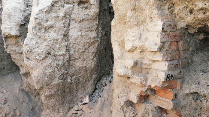
Kalibangan, the name literally translates to black bangles, is an archaeological site located at the confluence of rivers Ghaggar and Chautang, in present-day Hanumangarh district of Rajasthan. After its initial investigation by Tessitori, the site remained buried both literally and symbolically despite its mention in the survey records of Aurel Stein in the 1940s. Since Stein was unable to identify the site’s cultural affinity, the onus of its recognition fell on Amalananda Ghosh and his team, who surveyed the Bikaner state in the 1950s.
Ghosh identified the site as a Harappan settlement and recorded its antiquities. The research questions during this survey did not align with the excavation of Kalibangan, which had to wait till 1961, when it was finally subjected to excavation by the Archaeological Survey of India. Stalwarts of Indian archaeology, including BB Lal, BK Thapar, JP Joshi and others, excavated the site between 1961-1969.
Spread over an area of 25 hectares, the site comprises three mounds—KLB 1, KLB 2 and KLB 3. The excavation yielded an Early Harappan deposit at the site for the first time in independent India.
According to BK Thapar, Kalibangan was the fourth pre-urban or Early Harappan site to be excavated following the excavation at Amri, Kot Diji and Harappa, which were part of newly formed Pakistan. The Early Harappan level, which is dated to the fifth millennium BCE, yielded a parallelogram fortified settlement measuring 250m x 180m. The fortification wall was made of mud-bricks (30x20x10cm) in the ratio of 3:2:1 and had two structural phases.
Within the walled area, houses with two to three rooms and a courtyard, made with mud bricks and a sophisticated drainage system made of baked brick or terracotta pipes, were found. A lane measuring 1.5 metres in width between two houses was excavated during the early and pre-urban levels. Moreover, a hearth resembling a modern-day tandoor with mud-plastered walls was found, along with cylindrical pits lined with lime plaster, possibly for storing water.
Agriculture practises indicated by the infamous furrow marks at the sites and archaeobotanical evidence indicated at cultivation of winter (rabi) crops. And for the antiquities, chert blades, terracotta toy-cart wheel, carnelian and agate beads, and a copper celt were found.
During the Mature Harappan (urban phase), the settlement was divided into a citadel found at KLB 1, which was found overlaying the Early Harappan horizon, and a lower city found at KLB 2. Excavators noted that the city layout and the settlement pattern changed during this period. The citadel was a fortified parallelogram measuring 240 x 120m. The fortification was 3 to 7 meters in width and was made of mud-bricks in the ratio of 4:2:1.
The lower city was about 40 m away from the citadel and was also fortified. The fortification was 3 to 9 meters wide and within the fortification the city had a gridiron plan of streets running north to south and in the east to west direction. The streets were two to five meters wide. Evidence of houses with multiple rooms, sometimes decorated with stylised terracotta tiles, courtyards, and lanes was found. The drainage system was even more sophisticated, with specialised terracotta pipes, some even bearing Harappan letters were found. The water management system also included wells made with trapezoid-shaped bricks. Evidence of wheat and barley was found, along with the domestication of cattle, which was a continuation from the early phase.
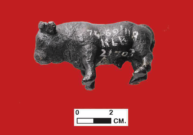
The material culture was as vibrant as any other major Harappan city, which had to be accommodated in multiple volumes of the excavation report. An array of terracotta human figurines was found from the site, which is significant as it is a rarity in the eastern domain of the civilisation. Some were decorated and some were also anthropomorphic. An interesting terracotta anthropomorphic figure, resembling a Celt, was found. Apart from human figurines, animal figurines, particularly that of a zebu bull, are a favourite of the people of Kalibangan. Interestingly, bulls are integral to the locality even today, as one can find many grazing on the site or resting under a tree. A copper bull statue is especially significant for its iconography and making.
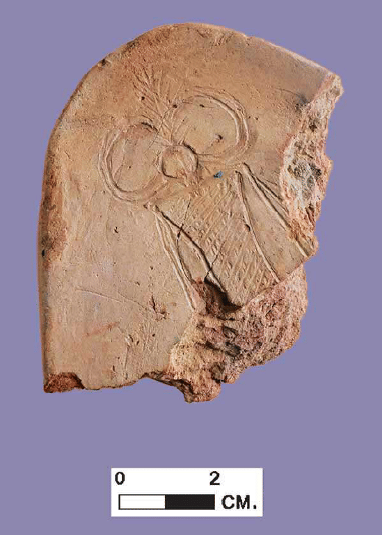
Moreover, a terracotta cake, which is one of the Harappan markers, largely underrated, was found. It had an engraved human figure with horned headgear on one side, and a human figure carrying probably an animal on the other side is interesting and rare. This, as per the excavators, suggest to some belief system among the people, evidence of which was found at KLB 3 on the northeastern edge of the site. It was here that multiple hearths labelled by excavators as fire-altars were found. The absence of any domestic activity in this area and the presence of an isolated mud-brick structure appealed to the excavators as evidence of rituals.
Why Kalibangan?
While a thesis can be written on the plethora of significant and unique evidence found at the site, it is important to highlight its importance, as the buck often stops at Rakhigarhi these days. Unlike Rakhigarhi, this site was excavated for nine field seasons, which yielded evidence that is unique to the region where it is located. Ancient cities, particularly Harappan cities, were strategically located. Similarly, Kalibangan, literally translated as black bangles, is located near the confluence of Ghaggar and Chautang. According to Gregory Possehl, this city may have played a significant role as a way station and monitor of overland communications of the Harappan people.
With over a hundred Harappan sites in the lower Ghaggar basin, the area, which is present-day Sri Ganganagar and Hanumangarh districts of Rajasthan, Kalibangan appears to be a big settlement, located in the middle of the lower Ghaggar River basin. It is approximately 277 km west of Rakhigarhi and 300-320 km east of Ganweriwala, another major Harappan site located in Cholistan but within the Ghaggar-Hakra river Basin.
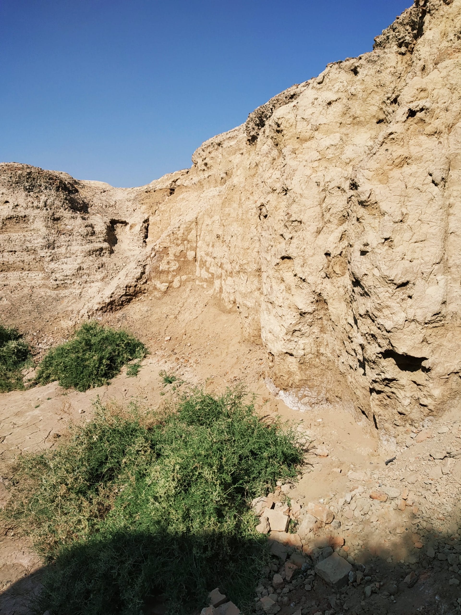
As it was at the confluence of the major river channel and its tributaries, interconnected by smaller but significant Harappan sites, it is possible that Kalibangan was not only a way-station as Possehl suggested but a major centre of trade and authority. The array of material from other Harappan sites is an indicator of the interconnected matrix which is a hallmark of Harappan Civilisation.
Protected and preserved
The site remained underrepresented in the public domain despite being the only Harappan site in this region to have a decent site museum. Government initiatives to re-excavate the site and build an open-air museum have yielded no results, but as we keep pushing these demands, we have to understand if an open-air site museum would be advisable.
Just as dramatic as its discovery and how it was pushed into the background, the site should not be ignored. Kalibangan is not just another site, but represents a fortress of resilience and power in the arid region on the fringes of Thar.
Disha Ahluwalia is an archaeologist and junior research fellow at the Indian Council Of Historical Research. She tweets @ahluwaliadisha. Views are personal.
(Edited by Ratan Priya)