






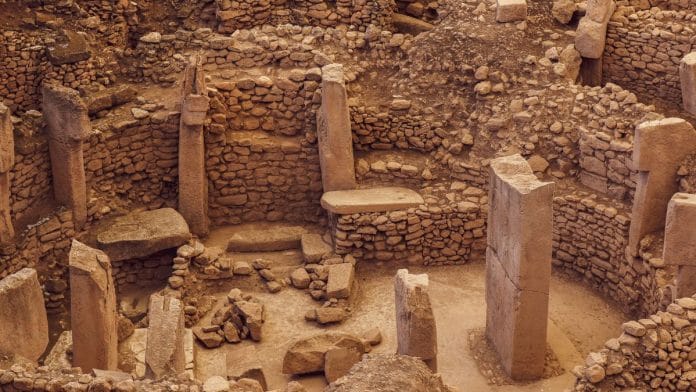

Even before the written records there is evidence of trade, said William Bernstein in ‘A Splendid Exchange: How Trade Shaped the World’. Trade, often left out of conversations about our history, is not the linear process it is sometimes assumed to be.
Trade is broadly understood as exchange of goods, resources or services between individuals and groups, often arising from demand, and difference in availability. It is a process that includes the transformation of raw material into finished products that are then sold at the marketplace But it is not linear — it involves a network of people and communities across geographical and social boundaries.
While demand is the driving force for any business, the most neglected aspect in understanding the history of trade is geography and landscape. It is the landscape that creates possibilities. As people adapt to their ecology, possibilities transform into ways of life, cultural traits, and practices that generate patterns of movement and exchange.
This dynamic relationship between space and cultures was defined by Carl Sauer “cultural geography” in the 1920s. For Sauer, culture was the agent, nature was the medium, and the cultural landscape was the result.
Carl Sauer described this dynamic relationship between space and cultures as “cultural geography” in the 1920s. For Sauer, culture was the agent, nature was the medium, and the cultural landscape was the result.
Landscape shapes cultures, culture produces trade, and trade gives rise to wealth. It is this wealth that has given rise to the cities, states and empires. It is this relationship between geography, culture, movement, networks and wealth that lies at the heart of Akshay Chavan’s The Wealth Network.
Rather than looking at India’s economic history in a traditional manner, Chavan follows the routes and nodes through which people, goods, and ideas moved, asking how geography shaped the movement of wealth and how these networks, in turn, shaped the cultures.
In doing so, the book reflects on how some networks have stood the test of time, and survived changes in political power. Some of these routes were established thousands of years ago and continue to function. Dynasties may come and go, but people, practices and connections survive.
Geography creates culture, culture creates trade
In archaeology, a site is never understood in isolation. Whether it is a village, town, city, port or a trade centre, its location plays an important role in understanding the resources, routes and settlement around it. The topography, hydrology, climate, vegetation and availability of raw materials can reveal why people chose to settle in a particular place and how they interacted with places around them. When these individual sites are viewed together, a pattern begins to emerge. This pattern reveals the interconnectedness of movement and exchange.
Let’s take a look at the four major Harappan cities – Harappa in the north, Dholavira in south, Mohenjodaro in the west and Rakhigarhi in the east. Between these cities lay an array of settlements that connected them, both directly and indirectly. Maintaining a degree of uniformity across the ecologically diverse landscape was not an easy feat.
Networks of movement and exchange would have played an important role in sustaining these connections. When people of Dholavira interacted with people of Mohenjodaro for instance, they were also connecting two very different ecologies and cultural regions. Moreover, Harappa’s geographical position would have facilitated the movement of raw material, while Rakhigarhi, located in a region devoid of any significant raw material, would have played a significant role in managing the eastern limits of the realm.
These cities, along with the settlements between them, can therefore be understood as nodes within a much larger matrix of trade, exchange and interactions.
In The Wealth Network, Chavan too connects geographies in a similar way. According to him, the Aravallis, the Thar desert and the Gujarat coast, are the alchemy of arid geography. In the mountainous region covered by scrub forests, there is no dearth of resources. Copper and zinc and many other minerals have been extracted from these regions since the third millennium BCE at least, if not earlier.
The Khetri mines known for the rich copper deposits, were exploited and mined by people who traded this raw material with contemporary settlements including the Harappans, who were around 300 km northwest of Khetri. Around Khetri archaeologists have found a chalcolithic cultural complex, known as the Ganeshwar-Jodhpura Cultural complex. Further south are the people of Ahar-Banas culture, in the region of present-day Udaipur. They too mined resources for a possible exchange.
These two examples are over 5000 years old, but this route continued to exist long after these civilisations. Towns like Bikaner, Jodhpur, Udaipur, Barmer, which were also central to dynastic rule, grew from a historic network. The roots of this economic landscape, says Chavan, has been experimented with trade, metallurgy and urban planning thousands of years earlier.
Also read: 3 things that are wrong with BJP’s Vande Mataram politics
What survives is not the empire, but the network
Although, this was just one example of the extensive trade routes of the past, the book takes you through the entire subcontinent, from the great cotton route covering the Deccan Plateau, Western Ghats, Paithan, Aihole, Daulatabad to Pune, to the metal route, which extends from Bhubaneshwar all the way to Jamshedpur — a region still known for metal resources and steel manufacturing units.
In the book Chavan identifies 108 wealth routes, each offering a way of looking at the present through the history of landscape, trade networks, and cultures. Some networks grew popular, catering to changes in demand among other things, while others lost their prominence.
Maybe it is time for us to reflect the bearings of the past on the present. In doing so we may start looking differently at the cities and towns we live in. Why did certain places become the centres of trade and commerce, while others remained peripheral? Why did political power repeatedly gravitate towards key cities like Delhi?
The answer is the geography — the cultural geography, in which wealth, movement and identity accumulate over time. Political boundaries may change and empires may collapse, but networks persist, so does the people’s history.
Disha Ahluwalia is an archaeologist and junior research fellow at the Indian Council Of Historical Research. She tweets @ahluwaliadisha. Views are personal.
(Edited by Janaki Pande)