





Anyone who has driven along the western seaboard over the past decade knows the subtle friction of India’s economic geography. Between the industrial powerhouses of Gujarat and the tranquil estuarine towns of the Konkan, an immense logistical transition is taking place. For decades, the national economic narrative belonged to the inland trunk routes — principally National Highway 48, the multi-lane spine that threads the Delhi-Mumbai industrial corridor through Rajasthan and Gujarat down into peninsular India, and east-west arteries like NH-53 that draw heavy freight from the mineral belts of central India to western ports.
Along Gujarat’s maritime edge, dedicated industrial corridors like NH-64 and vital feeder arteries like NH-848 link petrochemical zones and deep-draft terminals directly into this continental grid. Further south, spurs like NH-160 around the Mumbai-Nashik threshold siphon manufacturing output from the hinterland toward coastal exit points.
Yet the real pressure test of modern Indian transport planning is no longer occurring on the wide, open plains of the interior. It is gathering along the narrower, ecologically delicate coastal ribbon serviced by National Highway 66.
Connecting Navi Mumbai through Maharashtra, Goa, Karnataka, and down to the southern tip at Kanyakumari, NH-66 was once envisioned as a picturesque coastal highway. Today, it has become an economic conduit of extraordinary density. Along this strip sits what can best be termed the Tier-2 Coastal Carrying Capacity Paradox.
The very geography that makes these coastal towns economically magnetic — their ports, river mouths, maritime climate, and scenic topography — strictly limits their spatial expansion. Caught between the Arabian Sea and the steep escarpments of the Western Ghats, these urban centres cannot sprawl in concentric circles like Indore, Hyderabad, or Lucknow. At the same time, they are experiencing a rapid, concurrent surge of tourism, port logistics, light manufacturing, real estate development, and institutional services.
When container trailers from maritime hubs, holidaymakers in rented hatchbacks, interstate commercial carriers, and daily office commuters all converge on the same coastal corridors, the friction does not merely cause temporary traffic snarls. It hits a structural wall.
The limits of horizontal widening
For many years, the response of policy-makers to any transport bottleneck has been rather simple: expand the blacktop. However, for the coastal stretch, traditional horizontal expansion of roads has come to a natural end.
The land next to these routes is highly valued, politically charged, and environmentally sensitive. The process of expanding a route horizontally would mean destroying the ancestral homes, breaking into well-established retail business centers, cutting down old tree canopies, and facing extreme land fragmentation. Land acquisition in densely populated areas along the coast proves to be too costly and time-consuming.
This is where planners are faced with the harsh realities of life: we have to expand vertically when expanding horizontally becomes unsustainable.
Goa offers a telling lens into this dilemma. Over the past five years, the state has absorbed capital expenditure on infrastructure at an unprecedented scale. Signature river crossings like the New Zuari Bridge and the Atal Setu over the Mandovi have bypassed historical bottlenecks, while upgraded highways have knitted together mining clusters, industrial estates in Verna and Kundaim, and coastal tourism belts.
Yet the commissioning of Manohar International Airport at Mopa in North Goa immediately shifted the gravitational pull of traffic. The arterial stretch of NH-66 between Panaji, Porvorim, and Mapusa — which feeds this northern gateway — found itself handling a volatile mix of high-speed airport transit, commercial supplies, inter-city passenger traffic, and local residential commutes.
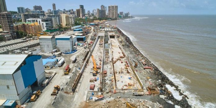
The solution currently taking shape along this stretch — the 5.15-km, six-lane elevated corridor through Porvorim — embodies this necessary engineering shift. By lifting through-traffic several metres into the air within the existing highway right-of-way, the project doubles corridor throughput without consuming adjacent private land.
The use of precast segmental construction here is not merely an engineering detail; it is a civic imperative. Cast in off-site yards and launched girder-by-girder overhead, precast segments compress multi-year construction timelines and spare living urban neighbourhoods the suffocating, business-killing dust and disruption of protracted ground-level excavation.
Elevated viaducts, however, cannot become deaf concrete monoliths that bisect communities. An elevated road succeeds only if the space underneath is deliberately integrated: with grade-level pedestrian crosswalks, local access lanes, intelligent drainage to withstand ferocious monsoon cloudbursts, sound barriers near residential zones, and well-lit public recreational spaces carved out beneath the pier caps.
Also read: India’s east coast handles a higher volume. But the west coast has better economic outcome
The logistics multiplier and the multi-modal shift
The urgency of solving these urban bottlenecks extends far beyond commuter comfort; it goes to the heart of the national economy.
An urban bottleneck in public finance is never merely an issue of transit; it is a regressive tax on economic productivity. Fuel used up in first gear by idling freight vehicles waiting to unload cargo at the port, clogged taxis at airport hubs, and service workers trying to navigate bottleneck corridors all cost the economy, whether in the form of higher logistics costs, prolonged inventory holding periods, unreliable delivery schedules, or loss of attractiveness of the destination for high-value services.
For Goa, Mangaluru, Surat, and other tier-2 coastal towns, the way forward has got to be a bold multi-modal transit strategy. Airport corridors, rail terminals, ferry jetties, and bus terminals have got to integrate in some kind of schedule-based feeder network.
With electric buses and feeder shuttles running frequently enough, the arrival at an airport or rail terminal will no longer imply the need for putting another single-passenger car out on the highway. By combining peripheral park-and-ride centers with public transportation, cities may preserve the unique heritage and environmental attraction of the city itself.
India’s coastal economic growth cannot simply be paved over. The sea on one side and the hills on the other remind us that land is a finite gift. How intelligently we engineer the third dimension — and how swiftly we link our roads to a broader transit fabric — will decide whether these coastal cities remain engines of prosperity or choke under the weight of their own promise.
Savio Rodrigues is a BJP State Executive Member, political analyst, and national commentator & expert on Goa affairs. Views are personal.
(Edited by Aamaan Alam Khan)