



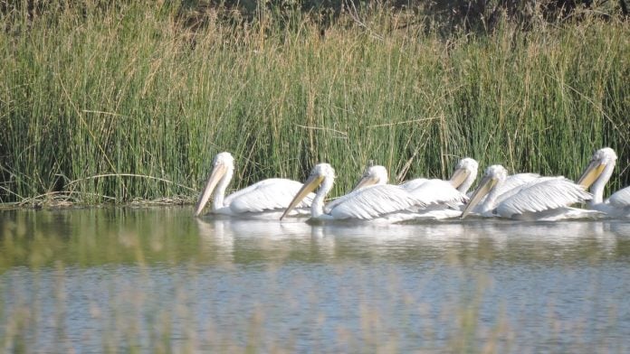
How many wetlands does Gujarat have today, and how many fall within each district? The answer depends on which inventory is consulted.
Over the years, several mapping exercises have recorded the state’s wetlands, but they have used different methods, scales and minimum size limits. Gujarat’s changing district boundaries add another layer of complexity. The figures also raise a larger question: does an increase in the total area classified as wetlands necessarily mean that the state’s natural wetlands are doing better?
What is needed now is a public wetland register that covers all 34 districts as they stand today. Such a system would provide a common foundation for researchers studying ecological change, students seeking reliable local information, district administrations planning development and conservation, and the State Wetland Authority responsible for translating scientific knowledge into policy and management.
Also Read: Chandigarh gets its first Ramsar site. Sukhna Lake is a 68-year-old man-made reservoir
Maps and mismatches
The first major reference point is the National Wetland Atlas published by the Space Applications Centre (SAC), ISRO. The national inventory was carried out at a scale of 1:50,000 using multi-date IRS-LISS-III satellite data from 2006-07. Based on this assessment, the Gujarat atlas recorded 14,183 wetlands measuring 2.25 hectares or more. It also identified 9,708 smaller wetlands, taking the total to 23,891. Together, these covered about 3.47 million hectares, or 17.56 per cent of the state’s geographical area. The atlas included district-wise wetland statistics and remains an important baseline.
However, administrative changes add an important complication to the interpretation of these district-wise figures.
Tapi, for instance, was carved out of Surat in 2007, around the time of the first-generation inventory, but the district-wise reporting in the 2011 National Wetland Atlas does not provide a clear, separate baseline for it. This illustrates a mismatch between the date of satellite observation, the publication date of an atlas and the administrative boundaries used to organise its statistics.
The administrative geography changed further in 2013, when Gujarat created seven new districts: Aravalli, Botad, Chhota Udepur, Devbhumi Dwarka, Gir Somnath, Mahisagar and Morbi. More recently, Vav-Tharad was carved out of Banaskantha in 2025, becoming Gujarat’s 34th district. These changes do not alter the physical location of wetlands, but they can affect how scientific information is organised, reported and subsequently used for district-level planning.
The next major exercise was the National Wetlands Decadal Change assessment. In the revised 2006-07 inventory, figures for Gujarat published by the Government of India show 14,734 mapped wetlands covering 3,449,413 hectares. In 2017-18, the number was 17,613, covering 3,499,429 hectares. The mapped area had increased by 50,016 hectares, or about 1.45 per cent.
These figures need to be read carefully. The original atlas included smaller wetlands in its total, while the decadal assessment only counted “wetlands having area equal to or greater than 2.25 ha”. The difference between 23,891 and 17,613 should not, therefore, be treated as the number of wetlands lost. The two totals are based on different inventory treatments and cannot be compared directly.
This also raises a broader question about successive wetland inventories. These exercises represent different stages in the evolution of wetland assessment, from establishing a baseline to measuring change over time and, more recently, mapping wetlands at a much finer spatial resolution. The official National Wetland Inventory and Assessment programme documents this progression in national wetland mapping.
The challenge is what happens after each new dataset is produced. If different inventories use different thresholds, classifications and administrative boundaries, the state needs a mechanism to reconcile them into a current and usable record. Better maps do not automatically produce a more accurate system of governance.
An ecological improvement—or not?
The category-wise figures tell a more revealing story. Between 2006-07 and 2017-18, the area recorded as coastal salt pans increased from 97,849 to 192,287 hectares—a rise of 94,438 hectares. Over the same period, the area of intertidal mudflats declined from 2,251,962 to 2,142,215 hectares, a reduction of 109,747 hectares. Mangrove area increased by 17,184 hectares, while the area recorded under creeks rose by 21,748 hectares. Overall, the mapped wetland area increased by 50,016 hectares.
Why does this matter? Salt pans are included in the coastal wetland classification used in national wetland inventories. Their expansion can therefore contribute to the total area classified as wetlands. But a salt pan and a natural mudflat do not perform identical ecological functions. An increase in the area classified as wetlands should not automatically be taken as evidence of ecological improvement.
The figures alone cannot establish that the additional salt-pan area directly replaced mudflats. That would require a spatial comparison showing where the land-cover changes occurred. Still, the contrasting trends underline the need to examine individual wetland categories rather than relying only on the total area.
There is also a difference between being recorded in a satellite inventory and receiving legal protection. The Wetlands (Conservation and Management) Rules, 2017 distinguish the scientific identification of wetlands from the regulatory process through which wetlands may be identified for notification and management. Certain human-made water bodies specifically constructed for activities such as salt production are treated differently under the regulatory framework.
A feature’s inclusion in a scientific mapping exercise does not, by itself, establish that it qualifies for notification under the same legal framework. A comprehensive inventory may record natural and human-made water-related features, while conservation authorities must determine their ecological significance, legal status and management requirements.
Better mapping, old problems
More detailed wetland mapping is now available. The SAC–ISRO National Wetland Inventory and Assessment Atlas platform includes a high-resolution assessment and a Gujarat atlas. The national high-resolution assessment identifies 2.49 million wetlands of at least 0.1 hectares as polygon features, along with 1.09 million smaller features represented as points, demonstrating how improvements in spatial resolution can substantially change what is visible and countable in an inventory.
This scientific progress is valuable, but it also makes reconciliation more important. A wetland mapped under Surat before the creation of Tapi, or under a parent district before the administrative changes of 2013, does not disappear when a new district is created. Similarly, wetlands now falling within Vav-Tharad would have been represented within the earlier geography of Banaskantha.
The central question, therefore, is whether different generations of scientific information have been systematically reconciled with Gujarat’s current 34-district administrative structure.
A current district-level baseline should make this information accessible without requiring users to reconstruct boundaries from older atlases or compare several generations of data. It should allow a researcher, student, district administrator or citizen to answer basic questions: How many wetlands are present in a district? What types of wetlands are they? How large are they, and what is their current status?
Researchers and students need reliable baselines to study ecological change. District administrations need them to identify local priorities and integrate wetlands into planning. Most importantly, the State Wetland Authority needs a clear and current understanding of the wetlands within the state to identify conservation priorities, develop management approaches and implement its statutory responsibilities.
Under the Wetlands (Conservation and Management) Rules, 2017, State Wetland Authorities have responsibilities related to preparing wetland inventories, identifying wetlands for notification and supporting their conservation and management. A reliable inventory is therefore a foundation for effective governance. Until the number, type, location and status of wetlands within a district are clearly understood, it is difficult to develop well-targeted policies and prioritise conservation action.
Also Read: Why India and Sri Lanka need a wildlife partnership
Gujarat needs a public wetland register
This is where greater transparency would help. Gujarat needs a public wetland register that brings the available records together and identifies each wetland by its location, area, type, mapping year, source inventory, current district and taluka, and verification status. Earlier records should remain available so that changes in mapping methods are not mistaken for changes in the environment.
Such a register could also assign a unique identification number to each wetland and indicate whether it has been field-verified, whether it is natural or human-made, whether it is under consideration for notification, and which agency is responsible for its management or monitoring.
It should also make clear the difference between a wetland identified by satellite, one that has been field-verified and one that has received legal protection or is under active management.
Gujarat has a substantial record of wetland mapping. It has the original atlas, a decadal assessment and newer, higher-resolution national assessments. The next challenge is to ensure that the information from these exercises can be compared, reconciled and used to establish a current, verified baseline for each of the state’s 34 districts.
The number of wetlands matters, but so does the kind of wetland being counted—and whether anyone knows its present ecological and administrative status. Gujarat has become increasingly capable of seeing its wetlands from space. The next test is whether that knowledge can be brought together into a single, transparent and accountable system that helps researchers, administrators and conservation authorities make better decisions on the ground.
Ronak R. Gadhvi is an Associate Fellow at the Centre for Forest Management and Governance (CFMG), Land Resources Division, The Energy and Resources Institute (TERI). Views are personal.
(Edited by Asavari Singh)