


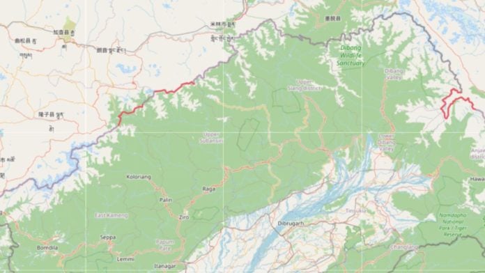
New Delhi: Over the last 30 days, there has been a noticeable increase in edits on a global open-source maps platform, OpenStreetMap, made in three locations along India’s borders to favour Chinese territory, multiple analysts and open-source intelligence (OSINT) have highlighted. These map edits seemingly come from contributors from China.
Y Nithiyanandam, professor and head of the Geospatial Research Program at Bengaluru-based Takshashila Institution, flagged that in the last month there were several edits being made on the OpenStreetMap platforms by community contributors whose usernames are appearing in Chinese characters.
The changes have mainly been made in three locations in the bordering districts of Arunachal Pradesh.
“Such frequent modifications demand continuous monitoring and timely correction,” Nithiyanandam said.
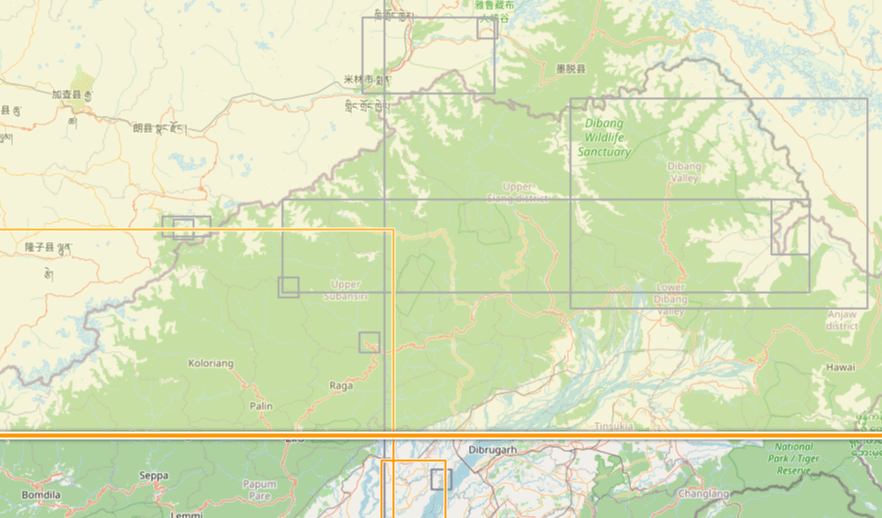
Credit: Y Nithiyanandam
The professor added that if these changes are ignored, these representations of territory can spread across global mapping platforms, UN-related datasets and other databases, influencing how the world sees India’s boundaries. “The adoption of free OSM basemaps is very high in geospatial applications.”
An OSINT, who goes by the username Damien Symon, also flagged this increase in edits on OpenStreetMap, shifting the boundary alignment near Taksing, Arunachal Pradesh, to favour the Chinese territory. This was one of the three regions flagged by Nithiyanandam.
“As Chinese construction activity continues opposite Taksing, in the Upper Subansiri district in Arunachal Pradesh, a disturbing change is visible on OpenStreetMap; unknown community map editors appear to have shifted the boundary alignment in the sector to favor Chinese territorial claims,” the account flagged on 18 November.
Past observations
A regular OSM contributor told ThePrint that such edits are being observed more frequently and at a larger scale since last year. This also became a topic of discussion in the OSM chatroom in July, 2025, when one contributor raised a concern about Chinese counterparts changing the names of the primary names of geographical features in Indian-controlled territory, replacing existing names with Chinese ones.
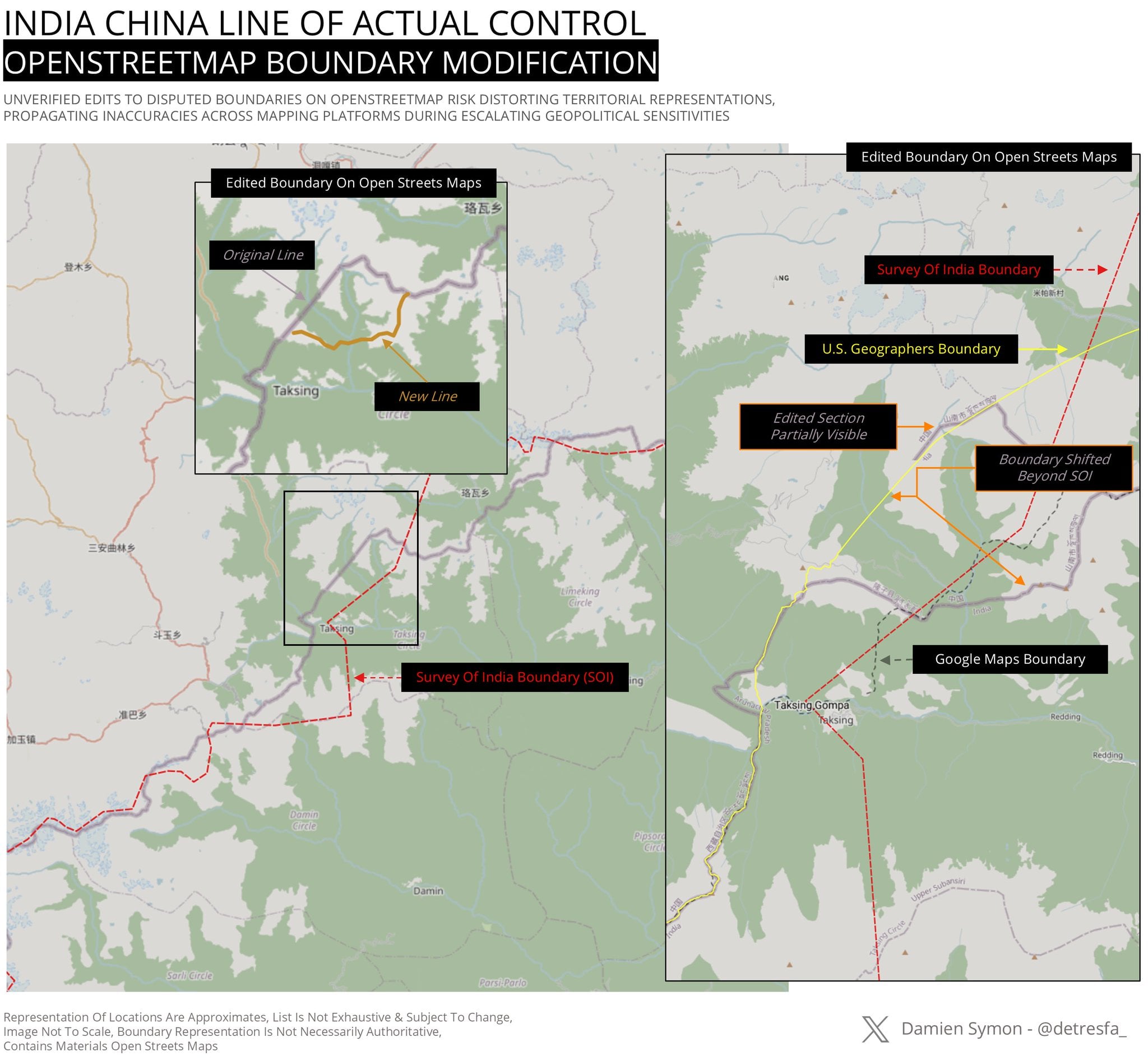
Credit: Damien Symon
These acts are called cartographic aggression or cartographic manipulation, where there is deliberate use of maps, place names, and visual depictions to assert territorial claims over areas outside a state’s actual control. It functions as a non-military and psychological tool in border disputes to normalise claims and shape domestic or international opinion.
“These edits are mostly around Arunachal Pradesh, obviously because that is where the Chinese interests lie,” the OSM contributor told ThePrint on the condition of anonymity.
The contributor explained that OSM allows for community members to add secondary or alternative names to places for better relatability among local residents. However, these accounts were changing the primary names.
“There were a few accounts that were flagged back then. But they keep making new accounts to come back and do the same thing,” the Indian contributor said.
Also read: India seeks to deepen ties with Small Island Developing States for coastal resilience at COP31
Most affected districts
Tenzing Dhamdul, a senior researcher at the Foundation for Non-Violent Alternatives (FNVA), highlighted in a June 2026 paper how China was using cartographic manipulations and geographical renaming as a long-term political and territorial strategy to legitimise its claims over disputed and occupied territories. Dhamdul said that China’s strategy was first pursued in Tibet and Xinjiang, and is now increasingly being applied to Indian territory, especially Arunachal Pradesh.
In his analysis, Dhamdul found that between 2017 and 2026, Anjaw, Dibang Valley, Tawang and West Kameng in Arunachal Pradesh showed the most alterations.
“One must clearly follow these developments because the arrow certainly seems to point towards a grander strategy in one-upping India by controlling the narrative to its domestic audience, sphere of influence, and larger global community,” the analysis read.
(Edited by Ratan Priya)