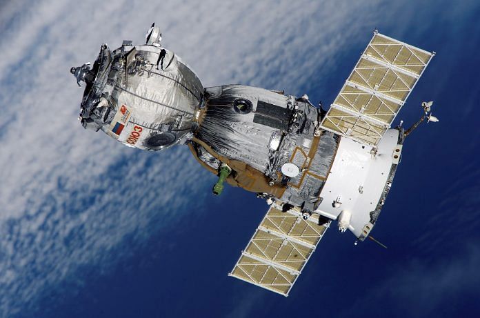
Satellites and other space technologies could be used to help mitigate the effects of climate change, as well as protect both animals and communities.
Satellite technology has long been used to predict the weather, with meteorological forecasts able to act as early warning systems for extreme weather events.
The technology is also key for documenting environmental changes and informing decision making by measuring sea levels, atmospheric gases and the planet’s changing temperature, among other factors.
There are currently more than 160 satellites measuring different global warming indicators, with more than half of essential climate variables only measurable from space, according to the World Economic Forum.
But the technology could do more. Here are five ways space tech can help improve life on Earth.
1. Frontier technologies to tackle climate change
The arrival of frontier technologies such as Space 2.0 systems – along with other innovations including artificial intelligence (AI), 5G, the Internet of Things (IoT) and robotics – offers further potential for supporting the fight against climate change.
Information and communication technologies could play a fundamental role in meeting the Paris Agreement’s target of limiting global warming to 1.5C, according to Frontier Technologies to protect the environment and tackle climate change, a joint report from the International Telecommunication Union and the United Nations.
Among these are Space 2.0 technologies, which build on those developed during the first space age of 1957-2000. Space 1.0 resulted in technologies such as the Global Positioning System (GPS), which became widely adopted commercially.
The report says it is vital that satellite measurements continue, and get more advanced over time, so that changes to geological features such as ice sheets can be accurately monitored.
Also read: Private sector can put Indian space mission into higher orbit. But ISRO must take it onboard
2. Satellites to track weather patterns
One such example is NASA’s Ice, Cloud and land Elevation Satellite-2 (ICESat-2) spacecraft, which launched in 2018.
ICESat-2’s predecessor showed the thinning of sea ice and how ice cover had disappeared from coastal parts of Greenland and Antarctica. NASA’s latest satellite was developed to provide extra information on how ice cover changes over the course of a year.
Scientists hope that information from next-generation satellites such as ICESat2 – which takes measurements every 85 centimetres along its ground path – could improve forecasts for rising sea levels, as well as global weather and climate patterns.
3. AI cameras to monitor wildlife crime
Satellites have also been used in Africa to help prevent big game poachers from killing protected species.
US nonprofit Resolve has worked with UK satellite provider Inmarsat to develop a Trailguard AI anti-poaching camera system that helps national parks detect, stop and locate poachers.
Testing at Tanzania’s Grumeti Reserve led to the arrest of 30 poachers and the seizure of more than 590 kilogrammes of bushmeat.
4. Sensors to track animals
The International Co-operation for Animal Research Using Space (Icarus) initiative is using a satellite on the International Space Station (ISS) to create an “internet of animals”.
Scientists hope to track the migratory patterns of birds and animals from space with the aid of thumbnail-sized transmitters attached to their backs.
The data is then beamed to the ISS, where it is transmitted to a ground station. The resulting synopsis of animal life on Earth could later be used to transmit other environmental data.
5. Satellite images transformed into data for farmers
Satellite imagery and climate data can also support other sectors such as agriculture and industry, with additional benefits to the communities they serve.
Digital Earth Africa uses Open Data Cube and Amazon Web Services to make global satellite data more accessible and highlight how it can be used to bridge social and economic inequalities.
Such information can be used to help farmers improve agricultural yield, thereby reducing hunger; tackle unregulated mining and its knock-on effects; and identify new opportunities for economic growth.
Natalie Marchant, Writer, Formative Content
This article was previously published in the World Economic Forum.
Also read: Why Indian space start-ups are feeling forced to set up base abroad


