



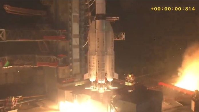
New Delhi: The Indian Space Research Organisation (ISRO) successfully launched its third next-generation navigation satellite, NVS-03, late Friday, in a mission that could help revive India’s currently defunct satellite navigation system, NavIC.
In a statement, the space agency said its GSLV-F18 rocket successfully lifted off from the second launch pad at the Satish Dhawan Space Centre in Sriharikota at 11.51 pm Friday. The rocket is to place the NVS-03 satellite in a geosynchronous transfer orbit.
ISRO chairperson V Narayanan said that with the successful launch of NVS-03, India had restored the positioning, navigation and timing services (PNT) of the NavIC system.
“We already have three functional satellites, but with this satellite we have the minimum satellites needed to restore NavIC’s PNT services. This was one of the most optimal performances achieved by any launch vehicle in the world,” he said.
NavIC, or Navigation with Indian Constellation, was designed as India’s independent satellite navigation system, along the lines of the US’s Global Positioning System (GPS), Europe’s Galileo, Russia’s Glonass and China’s BeiDou. The NVS series is the second generation of satellites, succeeding the earlier Indian Regional Navigation Satellite System (IRNSS) series.
NVS-03 is the third satellite in the next-generation NavIC network, which is intended to ensure continuity of navigation services provided by IRNSS. The satellite carries an indigenous atomic clock, along with procured atomic clocks. It also incorporates the L1 signal, in addition to the existing L5 and S signals, and is designed to provide coverage over India’s landmass and a region extending approximately 1,500 km beyond the country’s borders.
NavIC was developed to reduce India’s dependence on foreign navigation systems, particularly for critical applications such as military operations, disaster management, marine navigation and transport.
L1, L5 and S are radio frequencies used by navigation satellites to transmit signals that help receivers on Earth determine their location. L1 is the most widely used navigation frequency globally and is supported by GPS and many existing smartphones and navigation devices. L5, meanwhile, is designed to provide more robust and precise navigation, while the S-band is used by NavIC for its regional navigation services.
By adding L1 to its existing L5 and S signals, ISRO is making NavIC more compatible with commercially available devices, including smartphones. Compatible receivers will also be able to combine L1 and L5 signals to correct for atmospheric errors and improve positioning accuracy and reliability.
The mission is particularly significant because ISRO lost its NVS-02 satellite last year. Although the agency successfully launched the satellite aboard a Geosynchronous Satellite Launch Vehicle during its GSLV-F15 mission and placed it in an initial transfer orbit, the satellite became stranded after valves regulating the flow of oxidiser failed to open.
This prevented its onboard thrusters from firing, halting the satellite’s planned orbit-raising manoeuvres.
(Edited by Prashant Dixit)