



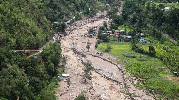
New Delhi: A recent study based on satellite data found that in the past 22 years, nearly 80 per cent of landslides in Nepal occurred in the immediate vicinity of earlier disasters in the area.
The study, published in Communications Earth and Environment, was conducted by researchers in the US, UK, and Kathmandu. They suggest that instead of finding better ways to predict where the next landslide might occur, monitoring existing landslides could be as important and effective.
“The majority of landslide hazard at any point in time in Nepal is closely associated with the locations of pre-existing landslides…Our observations provide a conceptual and geographical focus for hazard management, which can be concentrated on understanding and adapting to areas of existing landsliding, rather than anticipating entirely new landslides in currently,” read the study.
Nepal’s vulnerable landscape was recently highlighted when an ice-rock avalanche in Rasuwa triggered devastating floods along the Bhote Koshi River on 26 August, claiming thousands of lives.
Landslides in Nepal
According to the study, on average, at least 866 square kilometres of Nepal experience landslides every year, and at least 2.8 per cent of the country, nearly 2850 square kilometres, have gone through a landslide between 2000 and 2021. These figures are only based on land which is under the elevation of 4,000 m, suggesting that the actual landslide figures could be even higher.
The study highlighted that only 20 per cent of the landslide area visible in satellite imagery was “new” or “reactivated”. New landslides account for only about 70 square kilometres of land per year. Researchers added that after the first four years of the dataset, nearly 90 per cent of the mapped landslides had taken place either in an existing landslide-affected area or in its vicinity.
However, most landslides do not remain visible indefinitely on satellite imagery. Nearly 70 per cent of landslide-affected areas that were studied recovered within five years; however, about 200 square kilometres remained an active landslide zone throughout the 22-year study.
The number of climate disasters in Nepal has only grown in the past few years. While many of these disasters make it to headlines for a few weeks, their lasting impact is comparatively far less documented. Nearly half of the landslides triggered by the 7.8-magnitude Gorkha earthquakes that struck Nepal in 2015 were still in vulnerable regions even six years later. At the time, these earthquakes had claimed over 9,000 lives, left over 20,000 injured, and displaced many more.