


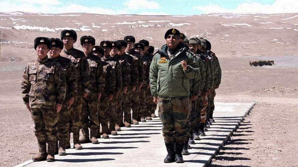
If Pangong was a case of rapid intrusions that lasted mere hours, Galwan was a case of a minor intrusion that lasted a few weeks. Satellite images from a classified and proprietary report in possession of the defence ministry, seen by one of the authors have been visualised below. Given the extremely high-resolution, sensitive and proprietary nature of the original images, we are unable to share them.
Those images have confirmed three things: 1) the intrusions in Galwan were at a single point, involving not more than 40 to 50 Chinese troops; 2) the Chinese intrusion lasted at best for two weeks and had been cleared by the third week of May, when the status quo was restored in the Galwan sector. 3) However, a serious situation has arisen due to China cutting off the waters of the Galwan river, which amounts to a weaponisation of China’s upper riparian rights. If not challenged immediately, this could lead to cutting off of waters to other rivers with serious consequences for agriculture and potable water in India.
Also read: Indian and Chinese brigade commanders meet at LAC — ‘No breakthrough but talks positive’
Galwan, second and third week of May
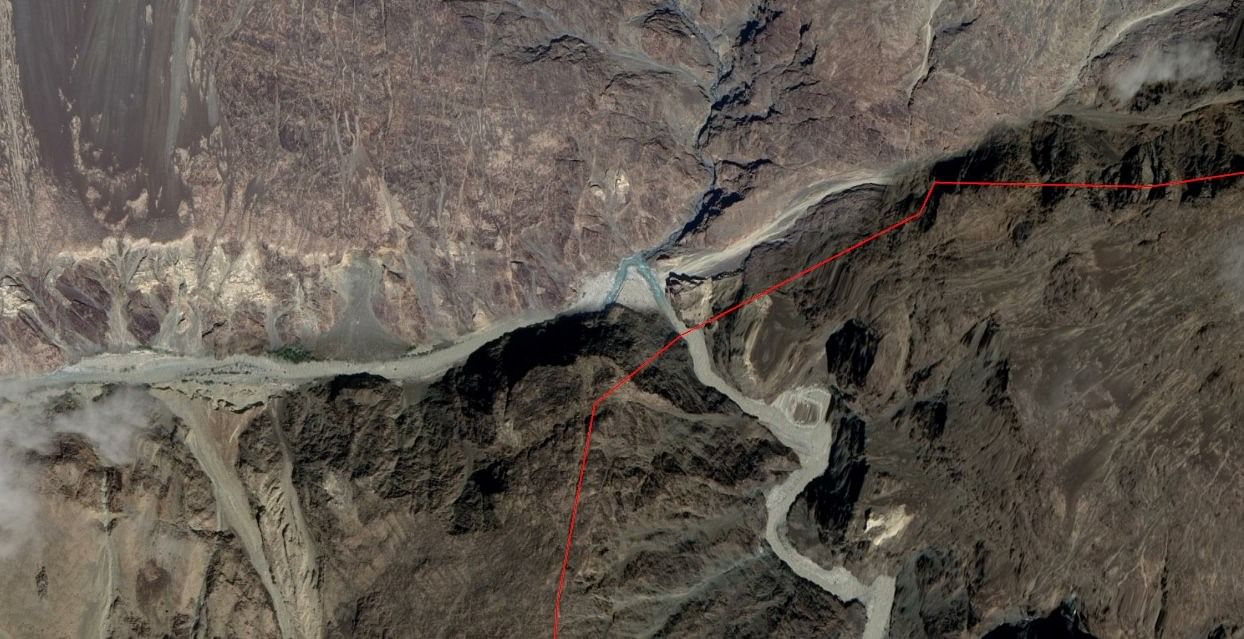
Below is the area of contention in Galwan at the moment, marked with a red cross. Its location with respect to the Union territory of Ladakh and Pangong lake can be seen here – the large, snake-like water body a few inches below.

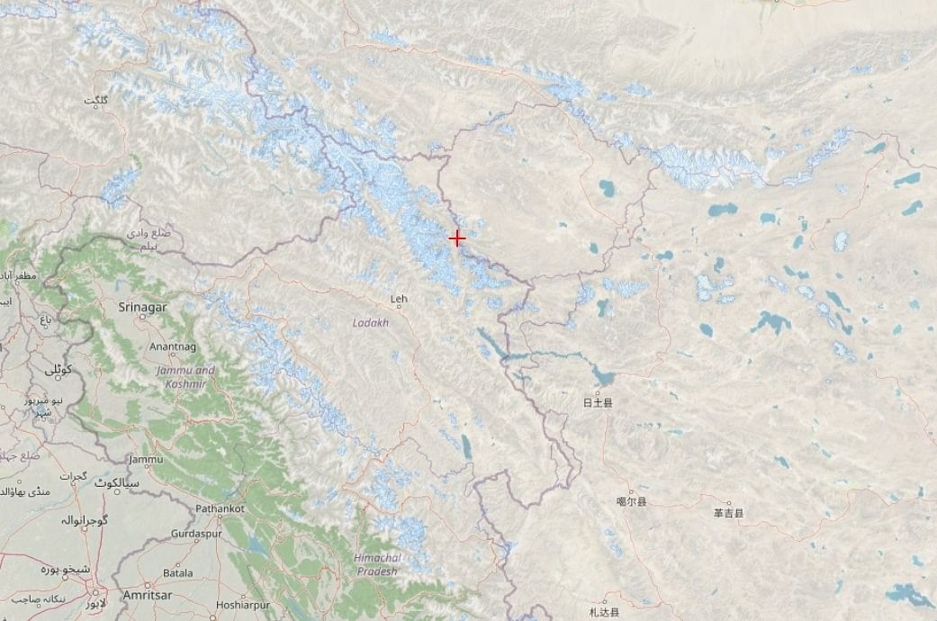
A zoom-in of this area (Image 2) on Google Maps shows the orientation of the Galwan river relative to Pangong and the Line of Actual Control (LAC). As can be seen, the Galwan, which is a tributary of the Shyok river, joins the latter just a few kilometres after crossing the LAC. It is the area where it crosses the LAC that is of interest to us.

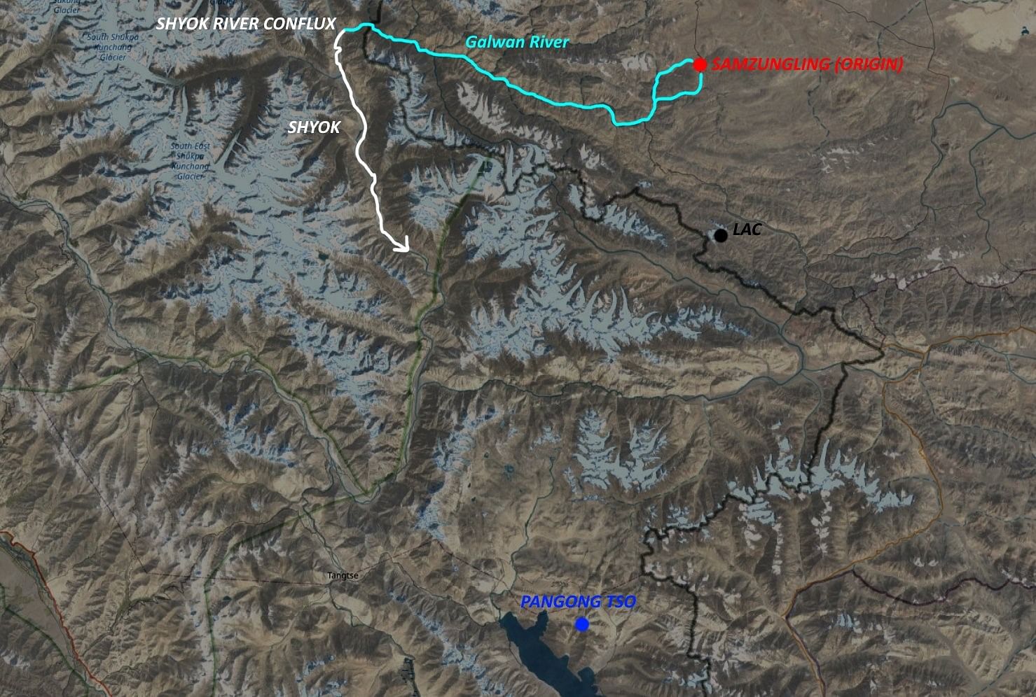
The disputed area in question has been superimposed here on Image 3.

To understand the dispute, the red line denotes the LAC with reference to the point of contention.

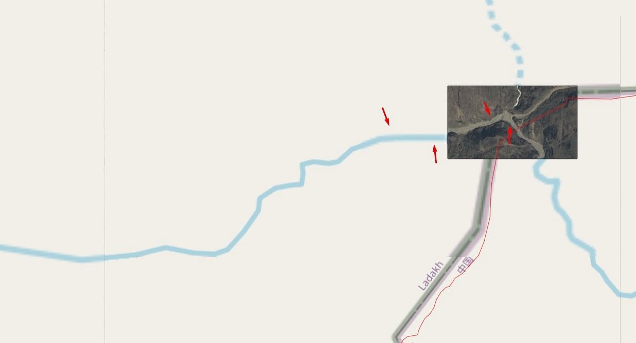
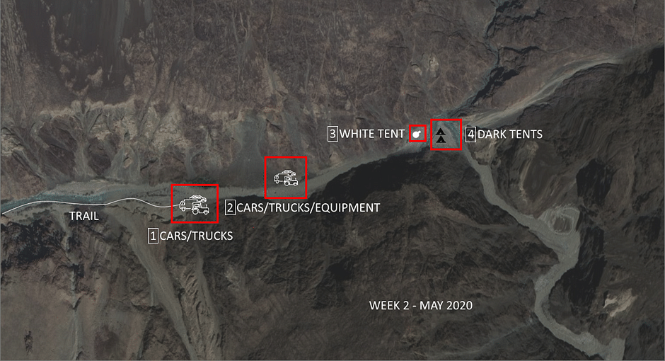
The following are the images of the area captured in second week of May. The four boxes are important here.
Box 1 shows the main Indian supply route – a white trail running parallel to the southern edge of the Galwan valley. Where this trail ends a congregation of Indian trucks can be seen. The original report confirms the trucks as being Indian manufactured.
Box 2 is the halfway supply point showing another concentration of Indian vehicles and equipment. The high resolution images seen by the author in the original report confirm that these are Indian manufactured trucks and equipment.
Box 3 is where things grow interesting. The white dot here is a large Indian tent that has emerged. We know this is Indian because persistent surveillance by us showed a steady stream of equipment being supplied to this tent from the vehicles in box 2.
Box 4 shows two small, dark-coloured Chinese tents, directly facing-off the Indian tent from across the fold in the river. A reference to Image 4 clearly shows that these two Chinese tents were on the Indian side of the LAC up until third week of May, with the fold in the river being entirely on the Indian side. Moreover, the supplies to these two tents were observed coming from the south, that is to say the Chinese side of the LAC.

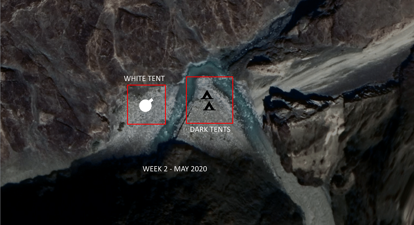
The close-up below shows the exact area of the face-off between the second and third week of May. The Indian tent is the large white tent on the left and Chinese tents are the two smaller dark tents on the right of the image. Note that the larger Indian tent can hold up to 30-40 soldiers while the smaller Chinese ones would hold approximately 15 to 25 soldiers each.

Also read: Standoff between India & China in Ladakh should be resolved bilaterally: Australia
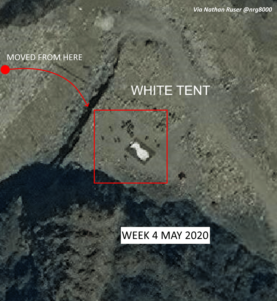
Galwan, fourth week of May
However, starting week four, everything changes. As can be seen in Image 7, the two Chinese tents are no longer there and the large Indian tent has moved across the river and set up in the fold of the river. Our surveillance also confirmed that this tent was now being supplied from box 2 in Image 5. This clearly establishes that by the fourth week of May, any Chinese intrusion had been repulsed and the integrity of the LAC had been re-established.

Scanning the entire Galwan area, this was the only tangible “infrastructure” one could pick up. In fact, not only was there nothing to report on the other points, where the Galwan runs close to the LAC, but even here, the maximum number of Chinese troops was 40 to 50 at best. Nowhere in this entire region was anything seen supporting either a large force or a large build-up of forces on the Chinese side. While it is possible that like in Pangong there may have been rapid drive through Chinese reconnaissance as described in part one of this report, the terrain simply would not support the rapid vehicles like the Dongfeng CSK131.
Also read: China says situation at border with India ‘stable and controllable’
The trouble
One thing, however, did stand out in the images (The images in the report with the Ministry of Defence) for second and third week of May, did show the Galwan river in full flow. However, by fourth week the flow had dried up completely, exposing the rocks in the river bed, indicating that the Chinese had stopped/diverted the waters. This is re-confirmed in Image 7. This is a serious breach of trust and runs contrary to the Chinese assurances at several international forums that it would not block or divert waters of south and westwards flowing rivers originating in the Tibet plateau.
What this means is that China has weaponised its upper riparian rights. If it is allowed to do so, without strong opposition and internationalisation, then China will in all likelihood start cutting off waters to other rivers flowing not just into India like the Brahmaputra but also Southeast Asia like the Mekong.
This is the second major source of the current tension apart from the deep (albeit temporary) incursions seen in Pangong.
Also read: China’s animosity record towards India reflects wolf warrior diplomacy: Taiwan representative
The case till now
The images collected throughout the month of May and seen in the report with the Ministry of Defence confirm as specific sequence in Galwan. The second and third week of May did see a minor ingress of Chinese troops, but by the fourth week this ingress had been turned back and the sanctity of the LAC restored.
However, the stoppage or diversion of the Galwan’s waters by the Chinese has serious repercussions in international law and the rights of lower riparian states as it indicates that China has breached past promises and is willing to use water as a geopolitical tool.
This is the second article in a three-part series, focussing on Galwan area. Part 1 focussed on Pangong and Part 3 will focus on the Hotsprings/Gogra area.
Abhijit Iyer-Mitra is senior fellow at the Institute of Peace and Conflict Studies. Views are personal.