


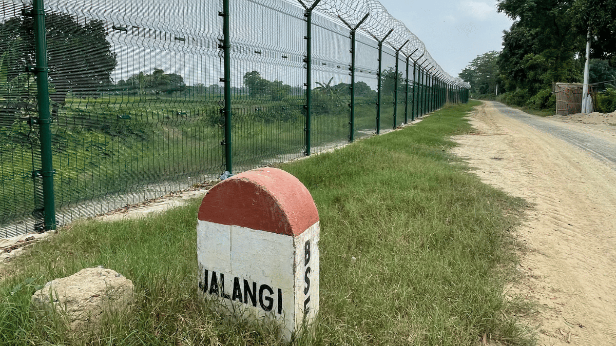
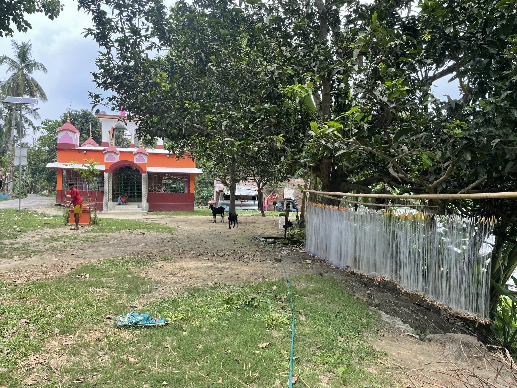
Murshidabad/North 24 Parganas/Siliguri/Cooch Behar: On a sultry June afternoon, a man with salt and pepper hair cycled through a 44-ft road in Murshidabad’s Jalangi village, which sits directly on the border with Bangladesh. He stopped briefly to put a gamchha around his face, frowning at the dust raked up by the ongoing construction.
On the right side of the road lay a bundle of concertina wire, and on the left stood a bulldozer and equally spaced iron pillars, planted in the ground and enmeshed to mark the border. A BSF official kept watch on the international border from just about 130 metres away.
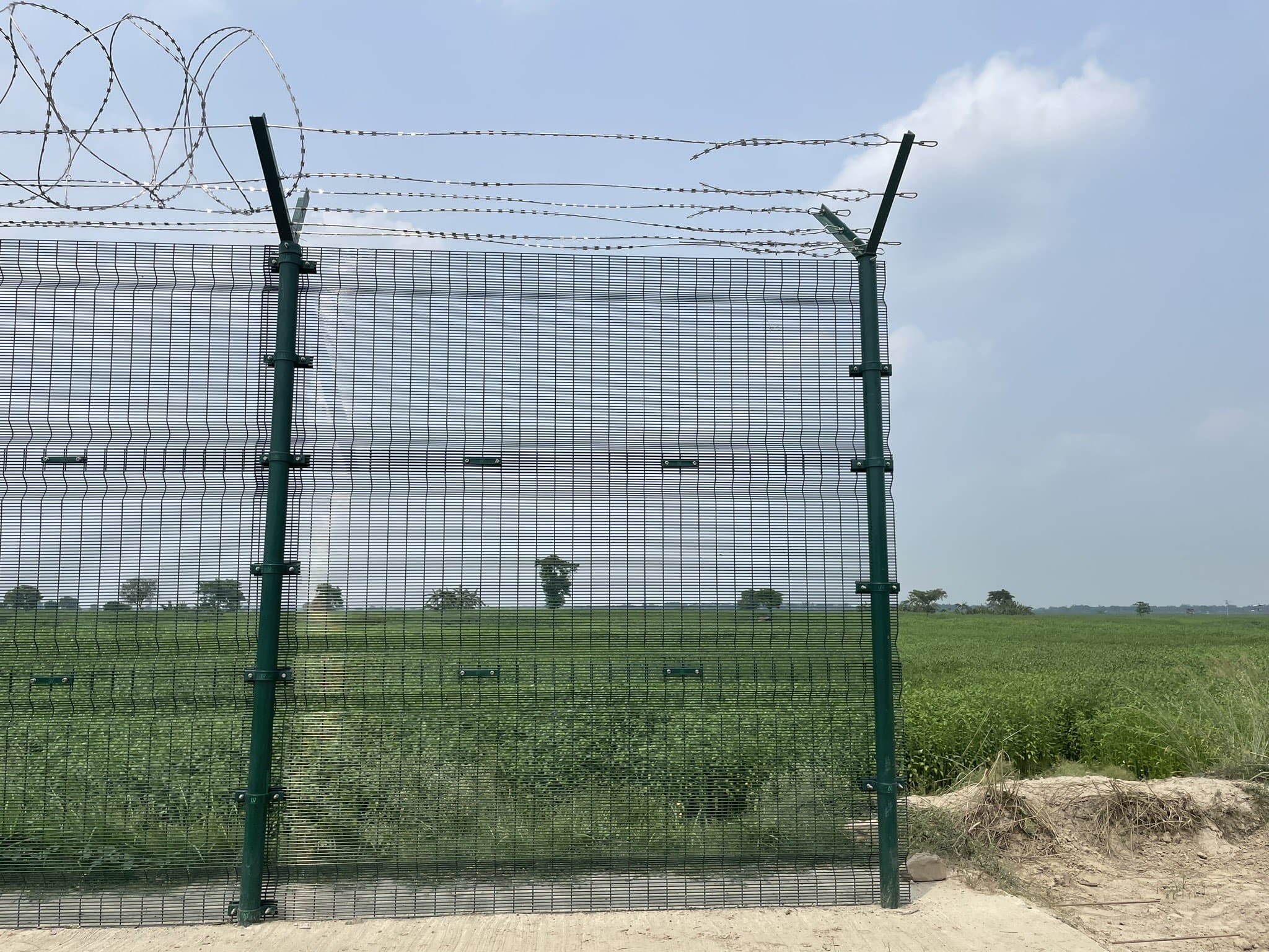
In Jalangi in West Bengal’s Murshidabad district, these green iron pillars had first been erected in October 2024 as part of the ongoing smart fencing project, launched in 2019 by then home minister Rajnath Singh. When ThePrint visited Jalangi village last week, work on the new smart fence in the same stretch was still ongoing.
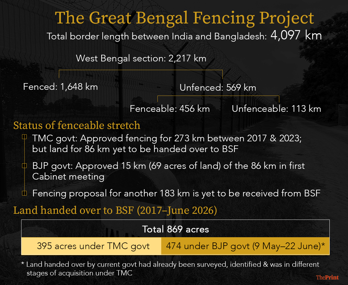
Land acquisition for the smart fence has gathered pace since the BJP government took over. According to officials, since taking office on 9 May, the Suvendu Adhikari government has handed over 474.50 acres to the BSF, with part of the land being earmarked for smart fencing along 15 km of the border, and other for building security infrastructure.
Smart border fencing is an advanced border security system that combines thermal imagers, infrared and laser-based intrusion alarms, aerostats, unattended ground sensors, and radar and sonar systems with a central command-and-control network that provides real-time surveillance and intrusion detection.
ThePrint found construction work similar to that in Jalangi underway in multiple areas, including Chakmuthura in Murshidabad, where a new fence was being built. Meanwhile, in places like Cooch Behar’s Kuchlibari village, the old concertina wire fence was being replaced by the new smart fence.
Till the Mamata Banerjee-led Trinamool Congress (TMC) was in power in West Bengal, the fencing of the India-Bangladesh border remained a contentious issue between the state and the BJP–led Centre.
The allegations against the Mamata government ranged from failure to cooperate with central forces in handing over land for fencing, to “benefitting from” and “encouraging” the entry of Bangladeshi nationals through unfenced stretches. These allegations gradually snowballed and became an election issue during the April Bengal elections, with the BJP promising to expedite the fencing if elected to power.
The BJP decimated Mamata’s TMC, and, sticking to his word, new Chief Minister Suvendu Adhikari on 11 May announced that his government would “hand over land to the BSF for fencing within 45 days (26 June)”.
On 27 May, Adhikari wrote on X that the West Bengal government has handed over 142.79 acres across the state to the BSF and that his government was taking proactive steps to expedite the land acquisition process.
At present, out of the 4,097 km of the international border between India and Bangladesh, 2,217 km falls under the jurisdiction of West Bengal. According to Ministry of Home Affairs data, 569 km in West Bengal is unfenced, of which 456 km is fit to be fenced, while 113 km isn’t.
The process involves Survey of India teams identifying alignments for the new fence, and the land demarcated with white flags. Landowners are then called for verification of ownership, and negotiations over compensation begin before sale deeds are registered and the land is handed over to the BSF.
The 45-day deadline to hand over the land to BSF set by CM Adhikari ended on 26 June. State government officials told ThePrint that 85 percent of the handover will be completed by August.
From demarcation of land to handover to the BSF, several rounds of negotiations over compensation are underway. While some are being settled peacefully, ThePrint witnessed demonstrations over low compensation in some villages.
Politicisation & missed deadlines
Historically, the fencing of the India-Bangladesh border has been a contentious issue. In the 1960s, regional politicians and then Assam chief minister Bimala Prasad Chalia of the Congress had first proposed fencing, alleging that “illegal immigrants” were entering his state from East Pakistan, which later became Bangladesh.
The demand later found its place in the Assam Accord of 1985, which also fixed 24 March 1971 as the cut-off date for determining citizenship in the state.
In 1989, the Rajiv Gandhi government took up the mammoth task of fencing the India-Bangladesh border, with the deadline set as 2007 for the states of West Bengal, Assam, Tripura, Meghalaya, and Mizoram.
That deadline has been missed multiple times.
Between 2017 and 2023, the BSF had sent a proposal for the fencing of 273 km, according to West Bengal government records accessed by The Print. “The BSF had sent a detailed proposal for the fencing of 273 km of the IB, of which the MHA had paid for 238 km, while payment for 35 km is yet to be received,” a senior West Bengal government official said.
The proposal of fencing this 238 km stretch was approved by the West Bengal government under Mamata. However, the handing over of land for 86 km out of the 238 km was pending when the BJP ousted the TMC from power.
Delivering on the poll promise of fencing the border, Adhikari in his first Cabinet meeting approved the fencing of 15 km (which would involve acquiring 69 acres of land) out of the pending 86-km stretch.
“Between 2017 and June 22, 2026, the BSF has received 869.5 acres of land for fencing, out of which 820.5 acres were private-owned land parcels and 49 acres were government-owned land,” a state government official said.
Out of this, 869.5 acres, the TMC government had handed over 395.02 acres, and the BJP government, after taking over on 9 May, handed over 474.50 acres till 22 June this year.
“Under the TMC government, 64 percent of the unfenced border, for which proposals were received, was fenced, and there were several delays in the handing over of the remaining 36 percent, as the private owners of the land parcels were in disagreement over several factors,” a second official said. “The remaining land parcels identified by the BSF were not just for fencing; in some areas, they were for constructing structures much deeper in the hinterland in the agricultural fields, which was opposed by the villagers.”
He added that while Mamata’s government took cognisance of these protests and put forward their demand to BSF officials, Adhikari’s new government has a much stricter approach in the land acquisition process, which is why larger plots of land were transferred even for covering a smaller length of the border, in comparison to the previous government.
Meanwhile, the West Bengal government awaits a proposal from the BSF for 183 km of the remaining unfenced border in West Bengal and payment for the remaining 35 km, whose proposal was already accepted by the previous state government.
The BSF is also surveying the 113 km considered unfit for the construction of a fence. “This included the riverine belts, which the BSF might be able to fence with new technological advancements,” said the officer.
Survey, demarcation & acquisition
Before the land acquisition process begins, officers from the Survey of India, the national mapping agency under the Department of Science and Technology, survey the land. “Our duty is to take the SoI officers to the border area and provide them security while they survey the land,” said a BSF officer.
SoI officials then, keeping a distance of 150 yards from the international border, identify the stretches that can be aligned to form a continuous fence on the land. “Sometimes, following the 150 yards rule, the spot from where the fence can be drawn is too near the river or is in an erosion-prone area. In such cases, the fence-marking happens a little towards the hinterland,” said the BSF official.
After the SoI officials have mapped the area, the Block Land and Land Reforms Office (BLRO), along with the Central Public Works Department (CPWD), visits the mapped area, along with BSF officials, and erects white flags to demarcate the stretch from where the fencing will happen. “We demarcate the stretch by putting white flags on bamboo poles,” said the BSF official.
From there on, the BLRO issues notices to the owners of the plots and asks them to appear before the officials with ownership documents, said Babu Lal Mondal, a BLRO (Jalangi) official.
“The owners are asked to provide documents of their ownership and are informed that a certain portion of their land is required for fencing or construction of BSF structures. The owners are also informed of the government-determined valuation of the land,” Mondal said.
Following this, an inquiry is conducted to determine the veracity of the ownership documents. “The owners then raise an issue over the price determined for their land plots, and after several rounds of negotiation, they are almost paid 2.5 times more than the first determined valuation, to ensure that they hand over their land,” said Mondal.
The owners are then called to the registry office, where they hand over the No Objection Certificate (NoC) and are given a cheque for their land parcels in exchange, the BLRO official added. The land parcels are then handed over to the BSF for fencing.
Mondal told ThePrint that the process is lengthy, as villagers often protest if there is too much distance between the international border and the fencing line or if the BSF asks for land to build their chhawnis (camps). This, the villagers argue, leads to more loss of land for them.
Citing the example of the protest over the acquisition of land for a BSF chhawni proposed to be built on Bhutgari maath (field), between Jalangi and Ghosh Para in Murshidabad, Mondal said such demonstrations are common.
“The chaawni was proposed to be built in the Bhutgari maath (field) area, which is 4-5 kilometres away from the IB, amidst agriculture fields and swampy lands, so the people protested,” he said.
Mondal, who has been working as a BLRO official for the past few years, told ThePrint that the villagers protested during the TMC government and have been protesting after the BJP government took over. “This is why newly identified land parcels take time to be acquired,” he added.
Other challenges
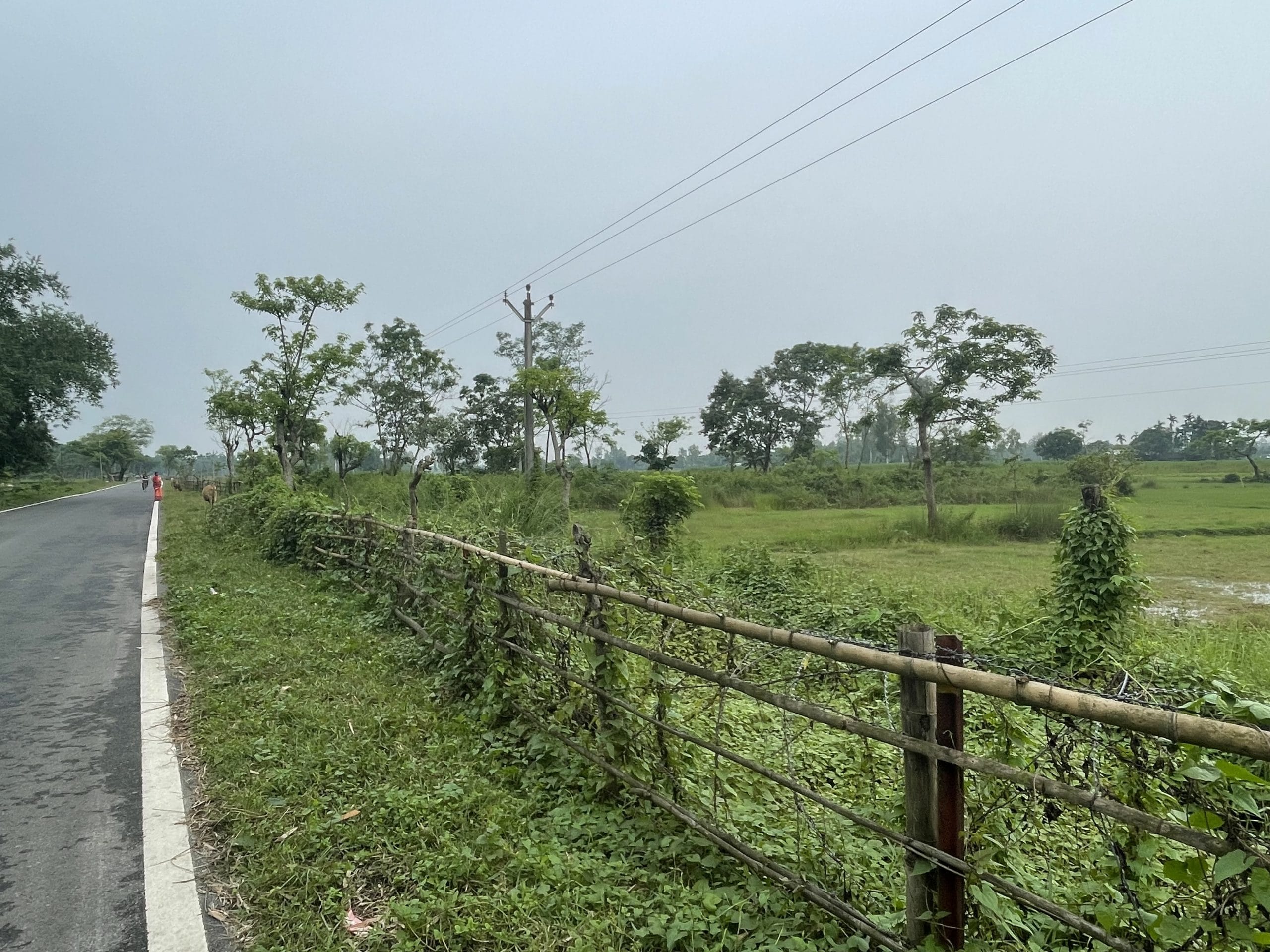
Not only land acquisition, the fencing project in West Bengal, much like in Assam, faces multiple other challenges: the 69-year-old Radcliffe Line, protests by border village residents, the ever-shifting rivers and char lands (riverine islands) that fall between the international border and the fence.
In 1947, from his office in Delhi’s Raisina Hills, when Cyril Radcliffe ran his proverbial red pencil on a map, he drew the line that would divide British India into India and Pakistan. Working against time and often with little knowledge of the ground, he drew a boundary that would determine the fate of millions living along it.
The language of the Radcliffe Award was precise. It began: “A line shall be drawn…” before proceeding to describe the boundary thana by thana. Paragraph after paragraph instructed where “the line shall run” or where “a line shall then be drawn”.
When translated on the ground, the boundary left several enclaves of East Pakistan—now Bangladesh—inside Indian territory, while Indian enclaves were stranded inside East Pakistan.
India and Bangladesh tried to resolve the issue with the Land Boundary Agreement in 2015, where 111 Indian enclaves in Bangladesh were exchanged for 51 Bangladeshi enclaves. But some enclaves continue to remain stranded on either side.
For example, even though areas like Chilahati, Boroshoshi, Naotori-Debottar, and Paranigram in South Berubari in north Bengal became part of India post the 1974 Indira-Mujib Land Boundary Agreement, they were not put on the Indian map, resulting in a population that has documents of Indian citizenship, but land records bearing Bangladesh’s name.
Speaking to The Print, Jagadish Roy Pradhan, the chairman of Berubari Protirokha Committee, said that until the land records are shown and reframed under Indian territory and put on the map, the villagers will not allow any fencing.
Similarly, in North 24 Parganas’ Swarupnagar block, villagers from Ghosh Para, Rajbangshi Para, and Mondal Para, where houses are built adjacent to the international border, the land acquisition process has hit a dead end.
“Villagers have sent demonstrations to seek rehabilitation before they give NoC for the land, as many of them do not own any land parcels towards the hinterland. These are mostly people who live on the IB and will fall beyond the fence once it is constructed, slowing down the land acquisition process,” said a West Bengal government official.
Protests in several places in Cooch Behar, Jalpaiguri, and Murshidabad, over land acquisition for additional BSF structures and low rates quoted by the government, have also proved to an impediment.
In Cooch Behar’s Mekhliganj, 42-year-old Amulya Singhsarkar was summoned by the BLRO and informed that he would have to give an NoC for the two acres of his land that fall beyond the fence. “They are quoting a low rate for our land, so we have clearly mentioned that until we get a fair share, we shall not give any NoCs… no matter how much they pressure us,” he said.
“The villagers, prima facie, are not against fencing. Many of them, being farmers, want less of their agricultural fields to be beyond the fence, fearing loss of valuation. Or they do not want to give land for the construction of chhawnis, hence they have been protesting. In certain areas. They want two times the rate the government is quoting for their land,” said the state government official.
Md. Azirul Mondal, a resident of Murshidabad’s Chakmuthura, has three acres of land, which would fall beyond the fence. While he believes that fencing is important and that he has no issues with it, he said the state government and BSF should be considerate in drawing the fencing line.
“I am a farmer and I grow three crops a year—bananas, jute and vegetables—which put food on our tables. We are requesting them to not build the fence closer to the hinterland as it will leave out majority of the farming fields beyond the fence,” he said.
Azirul’s brother echoed the sentiment. Once the land goes beyond fencing, the price drops, which impacts the ability to sell it in hours of need, he said.
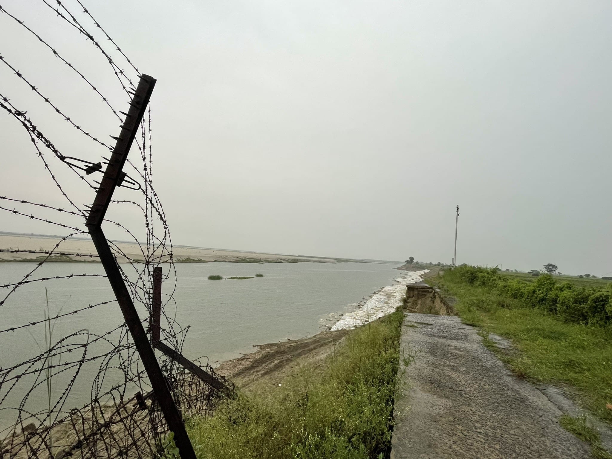
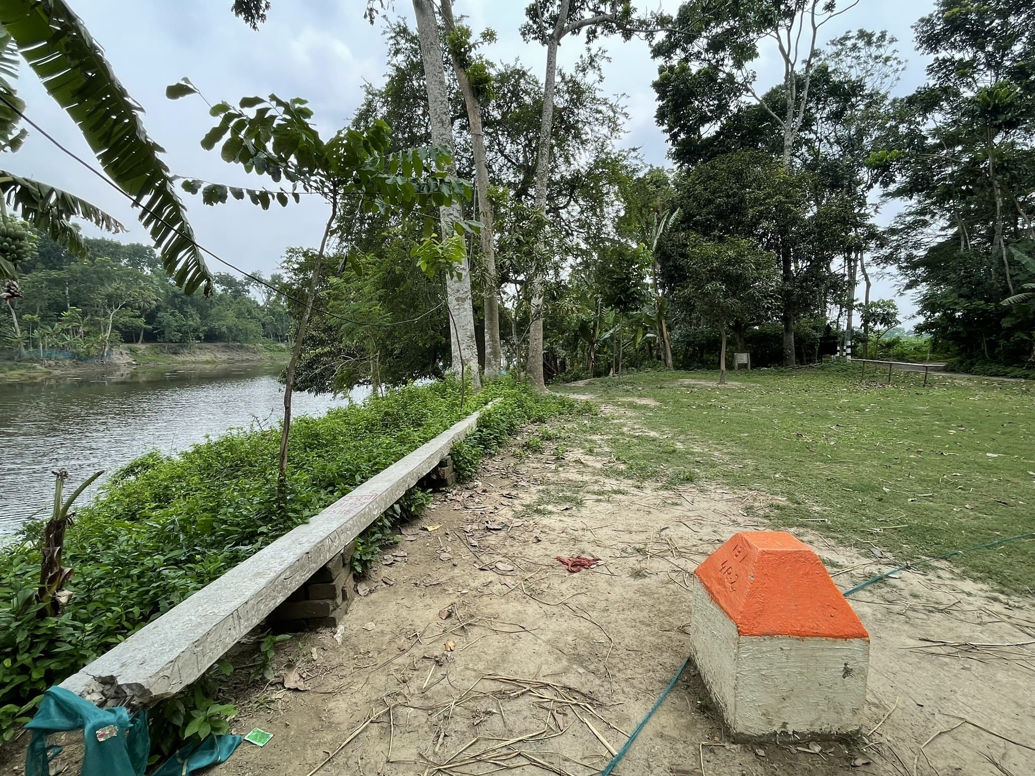
Another challenge to the fencing is the terrain itself. The stretch is marked by landslide-prone areas, char land, and several major and minor rivers.
“(In Murshidabad’s Lalgola area), the land on which the BSF road and the old fence stood eroded, breaking the fence when the Padma river flooded. The officers posted there tried to retrieve the fence but the road also broke away. Any fence built in this area can not stay put because of the shifting river,” said a BSF official aware of the matter.
Similarly, in char lands, BSF sources said that fencing might be challenging thanks to the terrain. “Char lands are shifting terrains close to rivers, where the river water completely floods it during monsoons, leaving residents and BSF to commute on boats. The same land stretch turns into a sand bed during monsoons, making fencing a difficult task,” another BSF official told ThePrint.
Officials on the ground told ThePrint that the process of transfer of land and fencing is going to be a herculean task to complete.
“Up to 85 percent of the 86 km (52 acres) land that the MHA has paid for, and was pending with the state government, will be handed over by August. The rest of the land acquisition and hand over of over 200 km of the border, with the complete fencing, will take longer, and can be done after we receive the proposal,” the official said.
(Edited by Ajeet Tiwari)
Also Read: Why Siliguri Corridor is top priority for Suvendu Adhikari govt. New border nexus brewing