New Delhi: The haze over northern India, especially in October and November, is not a new phenomenon. Slow winds keep the haze hanging over the region surrounding capital New Delhi, and schemes like the Delhi government’s odd-even traffic plan have failed to yield results in the past.
As public concerns as well as political bickering continue to mount over the toxic air, the main issue has not yet been tackled — stubble burning in Punjab, Haryana and Pakistani Punjab.
ThePrint looks at satellite images to understand the phenomenon, its causes, and the remedies available.
Also read: This is the real culprit behind Delhi’s poisonous Diwali air and PM Modi has a fix for it
Stubble burning
During the October-November period every year, Dussehra and Diwali celebrations produce the hazardous smoke of firecrackers, despite a ban by the Supreme Court.
Industrial pollution and vehicular emissions only add to the crisis. But the main culprit is stubble burning in Delhi’s neighbouring states and even in Pakistani Punjab, which is exacerbated by winds flowing from the north-west to the south-east and the Earth’s rotation.
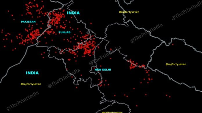
A NASA Earth Observatory image created from a combination of satellite images from 1 to 15 October suggested that stubble burning begins in the early part of the month, and peaks around the first week of November every year.
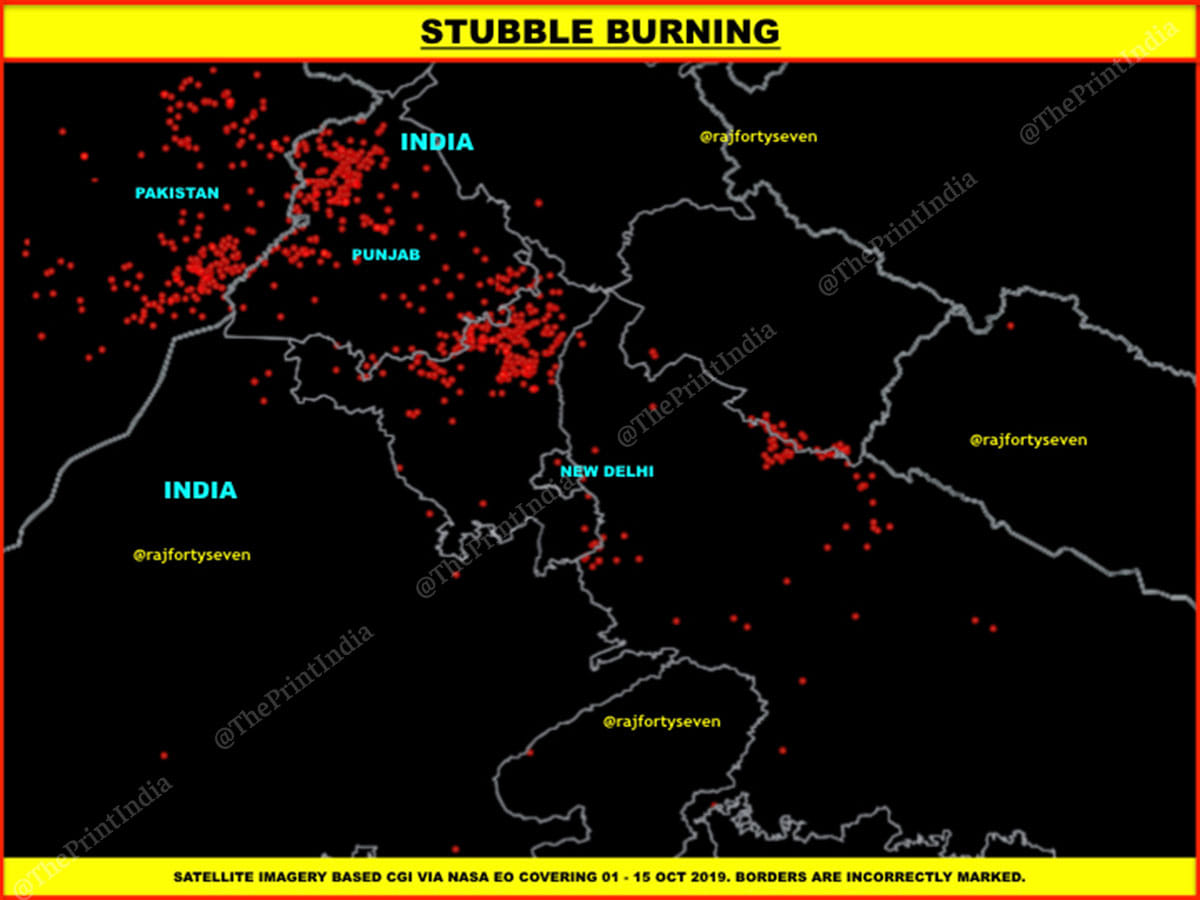
On an average, about 275 large new fires were observed every day in this period, adding to the existing pollution woes.
Urban population growth is also a major reason behind the worsening situation — a comparison of satellite images from 1984 and 2019 show that Delhi and neighbouring cities and towns have grown at a tremendous speed.
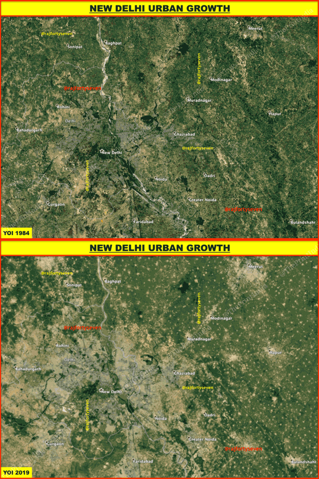
A NASA study claims that the geographical size of Delhi has doubled from 1991 to 2011, making it the fastest urban expansion in the world.
Also read: Band-Aids on stubble burning pollution won’t do. India must tackle it as food security issue
It’s not over yet
The satellite image taken Monday afternoon by NASA’s Aqua satellite’s moderate resolution imaging spectroradiometer (MODIS) camera shows the gravity of haze smothering northern India.
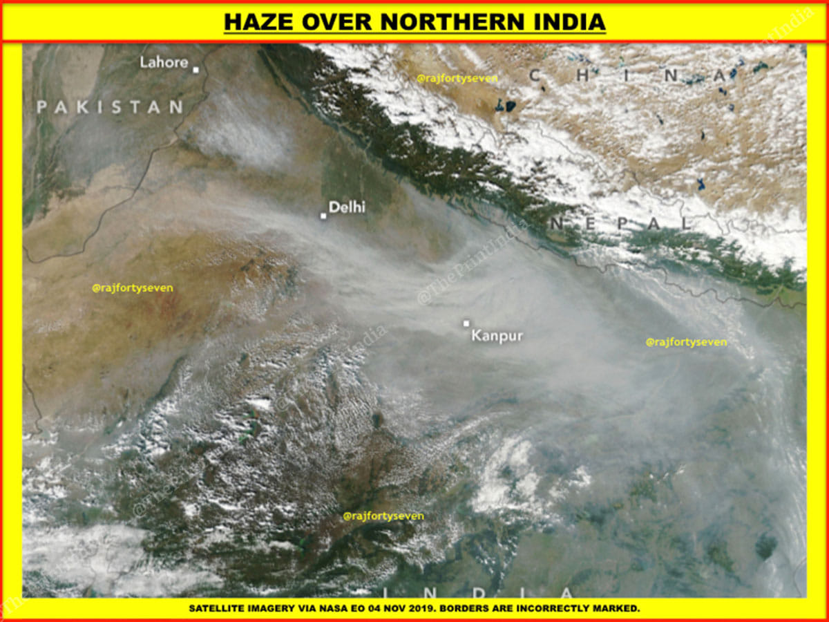
The natural colour satellite image shows the plume of stubble-burning smoke spreading over the entire corridor from Delhi to Kanpur and beyond. A large plume is seen hanging over Punjab, which is likely to travel south-east towards Delhi within a few days, depending upon the speed and direction of the wind.
Large air purifiers
Across the world, a lot of research and development is being done to construct large air purifiers that can clean polluted city air at a fast rate and on a low budget.
The first such air purifier was designed by a start-up from the Netherlands in 2015.
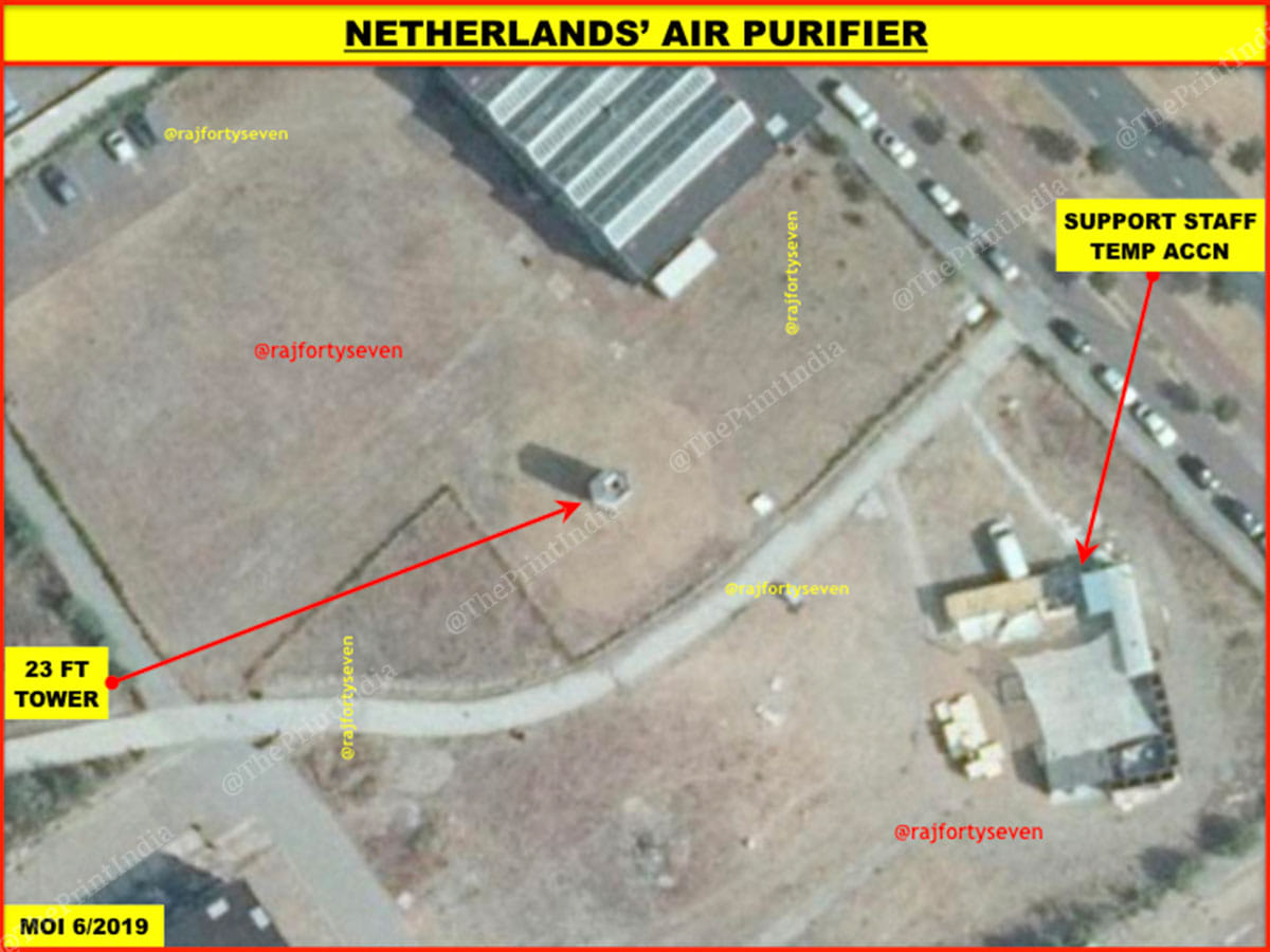
This satellite image from June 2018 indicates that the air purifier was being tested at Rotterdam Park. A large area can be seen covered with tented accommodation for support and research staff working on the experiment.
The 23-foot-tall filter turns smog into breathable air at 1,400 watts green energy consumption, with a capacity to clean almost 30,000 cubic metres of air every hour.
Meanwhile, in 2017, China constructed a large air purifier at Xian in Shaanxi province. The lantern-shaped purifier is lit up at night to improve aesthetics.
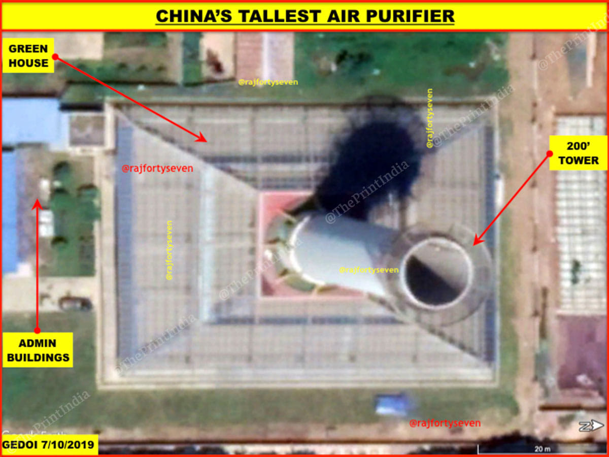
Latest satellite images show a 60m by 43m experimental air purifier — the world’s largest and tallest, with a 200-foot-high tower.
The base has a glass greenhouse, which traps the air and conducts it through many layers of filters in the tower, which cleans the air and releases it in the atmosphere.
However, the efficacy of such systems always depends upon the wind direction, which needs to be the main consideration while choosing a site for air purifiers.
Also read: Odd-even is a political gimmick. It has nothing to do with pollution


