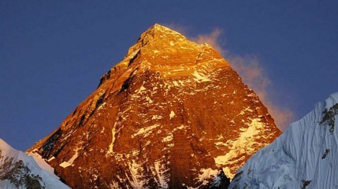
Bengaluru: The height of the world’s tallest peak, Mt Everest, was revised Tuesday jointly by Nepal and China. It now measures 8,848.86 metres — up by 0.86 metres — with both the countries agreeing on the number for the first time.
The previous height — 8,848 metres — was determined in 1954 by India’s national survey and mapping organisation, the Survey of India, a year after Nepal’s Tenzing Norgay and New Zealand’s Edmund Hillary made the first official climb to the summit.
Nepal had sent a team of surveyors to the peak in May 2019, while China had sent a team this year. The measurement of the height of the peak, which sits on the border between the two countries, was carried out using trigonometry.
The two countries had previously disagreed on the height, with China not counting the height of the snow at the peak and measuring only the rock height at 8,844 metres or 29,017 feet.
Nepal, on the other hand, factored in the height of the snow on the mountain and had marked the peak previously at 29,028 feet (8,848 metres). The new height is about 3 feet higher than Nepal’s previous measurement at 29,031 feet, and includes the snow height.
“The respect and pride of all Nepalis has risen along with this increase in the height” of Mount Everest, said Padma Kumari Aryal, Nepal’s Minister for Land Management, Cooperatives and Poverty Alleviation, at an event Tuesday in Kathmandu to celebrate the announcement.
New Zealand provided technical assistance to Nepal in terms of both personnel as well as the use of a navigation satellite. Nepal’s lead surveyor, Khimlal Gautam, lost a toe to frostbite during the stringent exercise last year.
The surveys conducted by both countries are believed to be the most accurate and were performed with new technology. The total snow height is believed to have come down due to ongoing global heating as well.
Also read: Nepal, China in ‘new era’ of strategic ties, vow to strengthen trans-Himalayan connectivity
Growth of Everest
The Himalayan mountain range and the Tibetan plateau were formed as the Indian tectonic plate collided into the Eurasian plate about 50 million years ago. The process continues even today, which causes the height of the mountain range to rise a tiny amount every year.
The peak of Mt Everest rises in height by approximately 2 cm each year. However, this process can be disrupted by other natural events like earthquakes. It is thought that the devastating quake of April 2015 in Nepal might have lowered the height of the peak, which prompted Nepal’s Survey Department to reevaluate the number.
There is very little life on top of the peak. The highest residing animal species, a jumping spider, is found at an elevation of 6,700 metres, and a moss found at about 6,500 metres is the highest altitude plant species in the world. Birds like bar-headed geese have been spotted flying over the summit.
Mt Everest was named in 1865 by the British Surveyor General of India, Andrew Waugh. After Waugh claimed to not being able to find a local name, he named the peak after his predecessor, surveyor Sir George Everest (last name pronounced “eev-rist”), who worried that Indian and Nepalese people won’t be able to pronounce it.
The peak is called Sagarmatha or ‘goddess of the sky’ in Nepalese, and Qomolangma or ‘Holy Mother’ in Tibetan.
Measuring mountain heights
Mountain heights are measured from mean sea level (MSL) on Earth, as determined by geodesists or those who model the shape of Earth. It is calculated by averaging high tides and low tides in a location, and its height varies by geography.
Such measurements are possible because of the oblate spheroid shape of our planet, which bulges out from the equator just a little due to rotation. On other near-spherical bodies like Mars and the moon, reference geodesic models, often called reference ellipsoids, are used to calculate a hypothetical global sea level.
On astronomical bodies that are not spherical, the geoid or the rough shape of the planetary structure is mapped and modelled with gravity measurements. Landmasses and mountains contain more material and are thus heavier, with more gravity. These differences are factored into the models, which are then used as standard global reference frames.
In gaseous bodies, heights of atmospheric cloud tops is calculated by obtaining a hypothetical seal level using pressure measurements. Atmospheric pressure of 1 bar, the pressure at the mean sea level on Earth, is considered the global sea level on gaseous bodies.
Also read: Trail to Everest is littered with bodies. But no one will say who is actually responsible


Does it cater for the sea level change? What is the base level?