



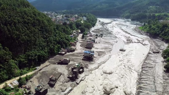
New Delhi: The Bhote Koshi river in Nepal saw a flash flood Wednesday morning, killing at least 95 people, with over 384 reported missing. The Rasuwa district, where the flood hit, sits on the boundary between Nepal and Tibet, where the river enters. According to the Nepal foreign affairs minister Shisir Khanal, the floods might have been caused by an avalanche or earthquake upstream in Tibet.
Originating in the Zhangzangbo Glacier in Tibet, Bhote Koshi is also called Poiqu or Boqu in Chinese. It forms a part of the mega Saptakoshi or Koshi river basin that flows from Tibet and Nepal into India through Bihar, and eventually drains into the Ganga.
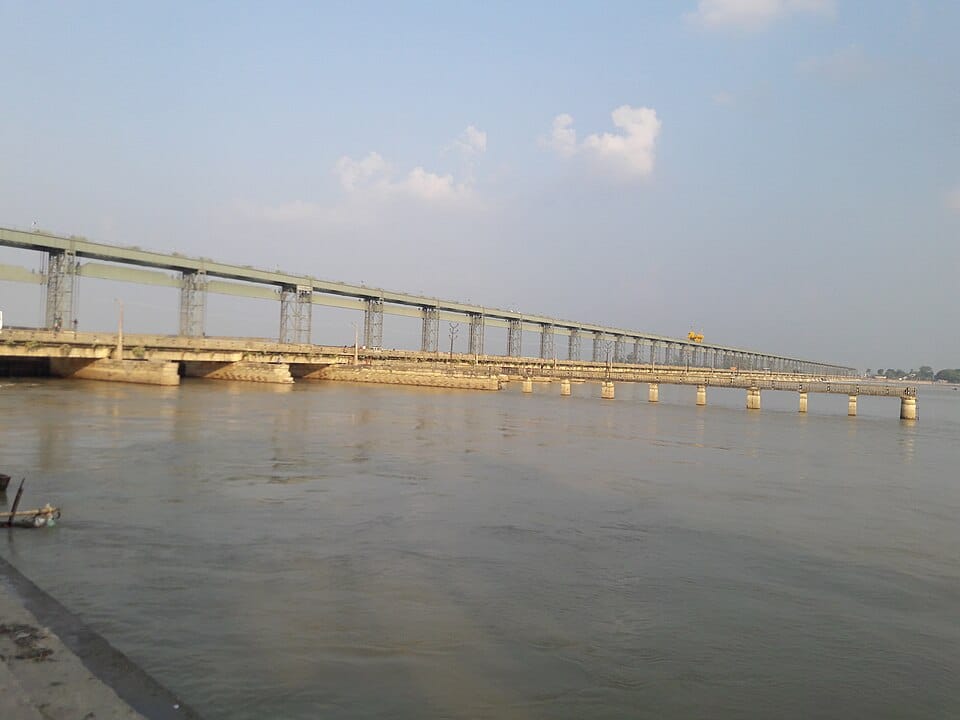
The main river length is around 720 km, and it flows across three countries: India, Nepal, and Tibet. It is mainly a free-flowing river, with one major barrage known as the Kosi Barrage situated in Sunsari, Nepal. Plans for a mega Saptakoshi High Dam, a bilateral India-Nepal initiative, are currently underway.
While it is one of the largest tributaries of the Ganga, Kosi has a much richer and older history, and its chief tributaries are even older than the Himalayas. It is a classic antecedent river—such as the Indus, Satluj, and Brahmaputra—meaning it maintained its original path even after the Himalayas formed.
The Nepal floods, however, point to a dangerous element of this 70-million-year-old river system’s history—its flooding risk. Christened the ‘Sorrow of Bihar’, Kosi has been associated with heavy, incessant flooding across its basin, with major events in 1954, 1968, and most recently, the 2008 Kusaha disaster, which affected over 2 million people.
Since 1954, Koshi has been managed by both India and Nepal through the Indo-Nepal Koshi Agreement, for both flood control and water sharing purposes.
Scientists have noticed, however, that the Kosi floods are unlike any other river. The water body carries an excess amount of silt with it from the Himalayas, and is uniquely prone to ‘avulsion’ or sudden course shifts. While this makes flood risk-mapping difficult, researchers globally have spent years studying what makes the Kosi move, and have pegged it to both natural and anthropogenic factors.
By repeatedly changing its course and depositing enormous amounts of sediment, Kosi has also created a megafan—a silt landscape—of around 10,000 sq km.
“The Kosi river is one of the most dynamic river systems, and has one of the most cited megafans in the world in the international literature,” said Rajiv Sinha, an IIT Kanpur researcher, in his paper on the river. “And the megafan is still growing, as Kosi continues to shift course.”
The history of the river
The Kosi River is also called the Saptakoshi in Nepal, since it is formed by the merging of seven different rivers. These include the Sun Koshi, Arun Koshi, and Tamur Koshi, which all converge at Triveni in Nepal.
Each tributary of the Koshi brings with it sediment, snow, and stories from across Nepal and Tibet. The Tamur originates from the Kanchenjunga in eastern Nepal, the Arun Koshi travels south from Nyalam in Tibet, the Sun Koshi is so called because of the gold-like hue of its sediment, and the Tama Koshi in Northern Nepal is home to the country’s largest hydroelectric project in Dolakha.
In its entire course, the Koshi River sees altitudes as high as 8,000 m above sea level and as low as 60 m above sea level, as it enters India’s alluvial plains. Herein lies the reason behind Kosi’s shifting nature, according to extensive research by the International Centre for Integrated Mountain Development (ICIMOD), a Nepal-based international research institute.
“Kosi has been a problematic river over the last several decades owing to its extremely dynamic channels and frequent flooding,” said a 2019 study by ICIMOD. “Combined, it has a total of ∼100 million tonnes annual sediment load at Chatara.”
This profusion of sediment comes mainly from the young Himalayas, which have been carved by the river. Moreover, the Kosi experiences a steep drop at the Chatra Gorge, from which it exits the mountains of Nepal to enter the plains of Bihar.
As it enters, this sediment gets deposited along the river’s banks, creating one of the world’s largest river megafans. Sedimentary deposits fundamentally change the river, as well as its floodplains, as explained by Jamia Millia Islamia scholars in a paper published in the Journal of Ecology and Natural Resources.
The researchers explained how, as sand and mud build up on the riverbed, the river rises until it is actually higher than the surrounding land. Eventually, the slope spilling out to the side becomes steeper than the slope running downstream, forcing the water to break out of its banks and carve a new path into the lower ground.
This ‘carving’ of a new path is what is referred to as avulsion, and it was because of one such avulsion that the Kosi River in Bihar had shifted 120 km to the west in 200 years. But in 2008, it breached its boundaries and went back 120 km east to its original course, flooding half of the state.
Why the flooding?
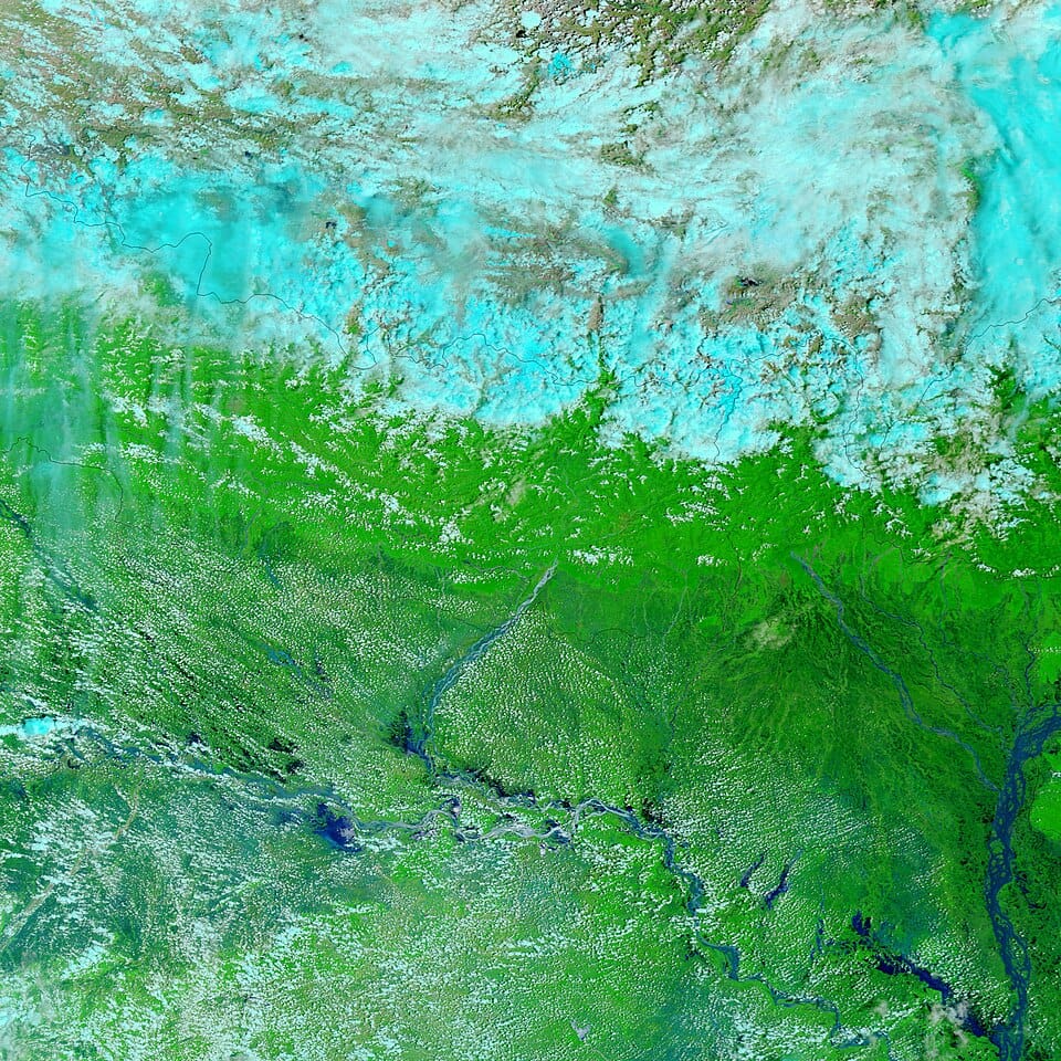
In Bihar and other lower catchment areas, the Kosi floods almost annually during the monsoon, making northern Bihar one of India’s most flood-prone regions. However, this flooding is dictated by the avulsive nature of the Kosi and the sediments it brings from the Himalayas.
Higher north, in places such as the Rasuwa district where the Bhote Koshi flooded on 26 August, the reasons for flooding extend from avalanches to Glacier Lake Outburst Flood (GLOF) events, which rivers in Tibet and Nepal are particularly prone to.
However, human-made structures such as embankments and bridges across the entire Kosi basin have increasingly contributed to flood risk. In the 1950s and 1960s, the Indian government built continuous sand and brick embankments and bunds around the river to contain its flooding in Bihar. Yet, a National Flood Commission report noted in 1980 that sediment-laden rivers such as Kosi must not be confined in embankments, as it leads to increased sedimentation and flood hazards.
A 2022 book titled The Koshi River Basin by ICIMOD listed various factors contributing to flooding in the Kosi: GLOFs, landslides, cloudbursts, embankments, and congestion on the river bed.
“Land use and land cover change is considered a major source of environmental change in the Kosi basin contributing to land degradation, soil erosion, landslides, and flooding,” said the book.
(Edited by Prasanna Bachchhav)
How is the Gen Z Youthful rapper PM if Nepal handling the situation?