



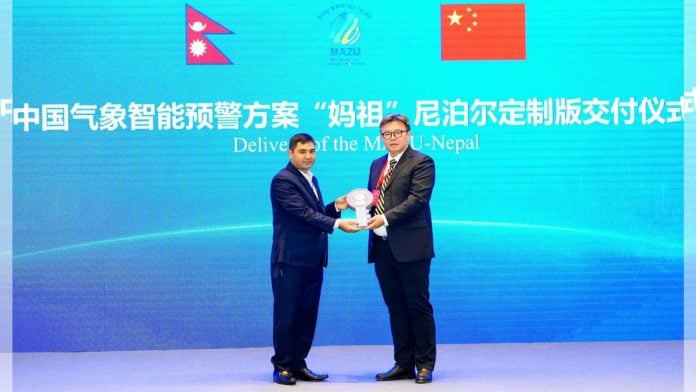
New Delhi: A month after the disastrous floods in the Tibet-Nepal border, which killed over 1,400 people, the China Meteorological Administration handed over a customised early warning system to Nepal on 22 September.
The ‘Multi-hazard Alert Zero-gap Universal’ or MAZU is a customised meteorological system developed in China, using information from the Fengyun series of satellites. The MAZU system has been tailored specifically for Nepal’s geography and terrain, and uses artificial intelligence along with physical forecasting models.
The system was officially handed over to the Nepal Meteorological Department (NMD) during the Second China-Central Asia Meteorological Cooperation Forum held in Urumqi, Xinjiang.
The 26 August floods originated from a glacial rock collapse in the Lhende Khola River on the Tibet-Nepal border, and travelled down to the Bhote Koshi River, which entered Nepal in the northern Rasuwa district. The first few villages at the Rasuwa-Tibet border had no warning of the deluge, and many people, houses, and bridges were swept away within seconds.
During the post-flood analysis period, Nepali authorities, including the National Disaster Risk Reduction and Management Authority (NDRRMA), pointed out that there was little to no glacial, meteorological, or hydrological information being exchanged between China and Nepal, despite Nepal being downstream of many rivers that originate in China.
“In the aftermath (of the floods), CMA (China Meteorological Administration) provided continuous meteorological support to Nepal, conducting joint video consultations and supplying forecasting and warning products,” said the press release by the CMA.
MAZU was built on a trial basis after the flood
Three days after the floods, when the glacial lake formed by the ice rock collapse showed signs of bursting, China sent warnings to Nepal informing the nation of a possible second flood. The two countries also agreed on information-sharing in the event of natural disasters; however, no formal bilateral mechanism has been established yet.
The MAZU platform was built on a trial basis in the week following the flood, and was provided to Nepali officials through cloud servers. The CMA used it to produce daily monitoring bulletins and reports for Nepal, as the platform integrated satellite observations with Chinese forecasting models such as Fengqing and Fengshun, while also being tailored for Nepal’s geography.
Now, China plans to deploy the MAZU-Fengyun satellite AI box and other equipment to Nepal, and also conduct training sessions for Nepali meteorologists and other engineers to use the system efficiently. Since Nepal does not have its own meteorological satellite system currently, this tool will allow the country to monitor and evaluate its natural disaster risk, as well as other weather-based phenomenon.
MAZU has also been customised for Pakistan and will soon be deployed in other Central Asian countries, as announced in the Forum.
(Edited by Prasanna Bachchhav)
Also read: India’s green hydrogen push could attract Rs 10 lakh cr investment by 2030—Hydrogen mission director