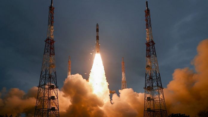
The latest mission of the Indian Space Research Organisation (ISRO), Cartosat-3, continued its successful run of using the Polar Satellite Launch Vehicle (PSLV) to place satellites in space.
Cartosat-3, a third-generation advanced high-resolution imaging satellite, is the most advanced imaging spacecraft India has flown so far. It packs several capabilities in imaging of the Earth, including the panchromatic mode (with a ground resolution of 0.25 m with 16-km swath), four-band multispectral mode (resolution of 1.13 m with 16-km swath), and hyperspectral mode (resolution of 12 m with 5-km swath), and can also capture images in the infrared spectrum with a resolution of 5.7 m.
In its annual report of 2017-18, ISRO laid out a very clear strategy of developing India’s Earth observation (EO) capabilities that is based on capturing different themes of land, water, cartography, ocean, atmosphere, and meteorology.
New missions such as the Geo Imaging Satellite (GISAT), which will enable real-time imaging, alongside the established Resourcesat, Radar Imaging Satellite (RISAT), Cartosat, Oceansat and the Indian National Satellite System (INSAT) constellation make India’s fleet of EO satellites one of the most comprehensive remote-sensing data sets in the world.
Also Read: ISRO has a data mine that can help save lives. More people should have access to it
Placing satellites in orbit is only the beginning
Satellites are essentially tools that can be used to achieve different objectives, from making observations meant to manage natural resources such as water, minerals and agricultural land, to gathering strategic intelligence on assets and developments across a range of areas of interest.
Assets like Cartosat-3 are essentially tasked by civilian or military operators to provide insights that help support decision-making to achieve certain objectives.
The traditional way of downloading satellite data involves using a ground antenna as the satellite passes overhead. The data thus beamed in is then downloaded into a localised data-storage facility. Depending on the sensitivity of the data or the nature of intended use, there are challenges in the way the data is then distributed to the stakeholder.
Once the raw data is made available, there is a process to correct possible aberrations caused by factors such as stability of the satellite in-orbit, atmospheric disturbances, clouds, etc. After this is done, satellite images can be used to get the necessary insights.
Software is changing the way data is used
Let’s take the example of a military analyst to understand how software is changing the way satellite imagery is being used.
The military has traditionally had geospatial analysts who are trained to recognise elements within satellite imagery. They assess the images and relay developments pertaining to areas of interest.
Software, however, is helping optimise the process by changing the way this can be done. Scientists and engineers are today trying to use machine learning techniques — artificial intelligence — on satellite imagery to be able to automate several routine tasks that were being performed manually by geospatial analysts.
Once this process is efficient enough, the army of geospatial analysts can be trained to use software to monitor several hundreds of thousands of areas or incidents of interest rather than trying to focus a handful of them.
We’re looking at a realm in the not-so-distant future where satellites can be directly tasked by an individual solider or even a machine with a specific area of interest — not just the data, but the insight or intelligence attached to that area of interest can be processed and made available in almost near real-time.
This has tremendous implications in the ways organisations are used to request, gather and distribute data, and make decisions based on such data.
India needs a cloud and computing strategy
Ultimately, satellites are just one among tens of data and intelligence sources, including good-old human intelligence, cyber intelligence.
Having disparate data sources and using the resulting information in silos isn’t nearly as efficient as using them together, a process that can improve decision-making and improve the accuracy of insights.
ISRO is doing a tremendous job of developing state-of-the-art satellites and equipping them with sensors that are generating data for the country.
However, these satellites and sensors can only be of great value once they are integrated with other data feeds based on the requirements of end-users.
Several countries, for example, are now using cloud and cloud-based computing strategies for agile decision-making.
Depending on the end-user (civil or military), policymakers in India need to develop a strategy to use space and non-space data to keep abreast with such developments, and make sure we are not left behind in the race to extract crucial insights.
Also Read: Want to be a space entrepreneur in India? This is how ISRO is helping you be one


“Cloud computing strategy” — writer seems to have a buzzword strategy. Cloud computing is a tool, not a “strategy”.