





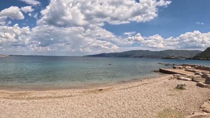


New Delhi: Christopher Nolan’s The Odyssey has indeed sparked fresh interest in Greek mythology and language. But scientists seem to be doing more than just Googling about ancient Greece. A team of researchers and students from the University of Delaware recently completed an underwater survey of the ancient Greek harbour of Kenchreai using autonomous robots, sonar systems, drones, and scientific divers, collecting more than a terabyte of geospatial data that researchers say will help create a digital reconstruction of the submerged port.
Announced by the university on 4 August, the project is part of the Kenchreai Coastal and Marine Survey, a three-year interdisciplinary archaeological campaign to explore the long-term human and environmental history of the ancient harbour. The university said the survey is designed to document one of the Mediterranean’s most important ancient maritime gateways and to create a detailed digital record for future research, conservation, and education.
A major trading harbour in the Greek and Roman periods, Kenchreai was one of the main port-towns of ancient Corinth located on the eastern coast of Greece. Much of the ancient port is submerged today, making it difficult to study using conventional archaeological methods.
Using an autonomous underwater vehicle, multibeam sonar, side-scan sonar, aerial drones, and scientific divers, the team mapped the drowned landscape. Together these methods generated more than a terabyte of geospatial data, providing detailed information about the seafloor, submerged harbour structures, and the ancient port landscape.
The researchers found that the different methods of surveying yielded different kinds of information. The depth and contours of the seabed were measured with multibeam sonar, and objects and archaeological features on the seafloor were imaged in high resolution with side-scan sonar.
The autonomous underwater vehicle surveyed areas difficult or time-consuming for divers to examine, and aerial drones recorded images connecting the underwater survey with the surrounding coastline.
Also read: New studies link good sleep to higher grades in school and university
Making a ‘digital twin’
The next part of the project is to turn the data into detailed maps and three-dimensional models. Researchers are working toward creating a digital twin — a highly detailed virtual replica — of the ancient harbour that can be explored and studied without disturbing the archaeological site.
“We’re going to spend months turning that data into maps, models, and scientific results, and ultimately we’re working toward creating a digital twin of this ancient harbor landscape,” said Art Trembanis, professor at the University of Delaware’s School of Marine Science and Policy, who led the survey team.
“Using all our data, we’ll be able to essentially drain the water away. That will allow us to walk over the site in detail and share it in ways that otherwise would not be possible,” he added.
According to the university, the digital twin could help archaeologists, marine scientists, and engineers to examine the layout of the harbour, study dynamic coastal and tectonic settings, and better understand how the ancient port operated over time. It could also be a permanent digital record of a culturally significant place in a coastal region influenced by natural shoreline changes and tectonic activity.
The virtual reconstruction could be used for teaching, public engagement, and research. When finished, it would enable students, teachers, and the public to virtually explore the harbour and see what the harbour would look like if the water had been drained away, providing a better picture of its layout and historical importance.
The University of Delaware’s announcement describes data collected during the latest field campaign and the project’s future goals. It does not indicate that the work has been published in a peer-reviewed journal.
(Edited by Aamaan Alam Khan)