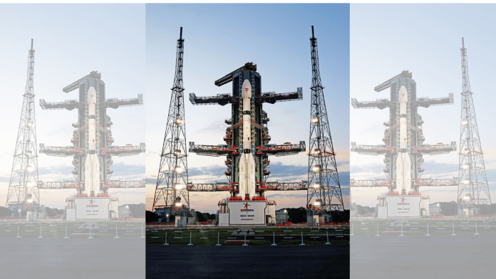
New Delhi: Post its launch Wednesday evening, the world’s most expensive and powerful Earth observation satellite, NASA-ISRO Synthetic Aperture Radar (NISAR), will undergo a series of actions for nearly 90 days before it starts releasing its scientific observations.
NISAR, which took off at 5.40 pm from India’s Sriharikota space port, will produce high-resolution images and data on various aspects of the planet, including key information for predicting disasters such as landslides, volcanic eruptions, floods and earthquakes.
It is the first satellite to be mounted with dual SARs—L and S bands—operating in different frequencies.
Aravind Ravichandran, Earth observation consultant and communicator, and founder and CEO of TerraWatch Space, an independent advisory and strategic communications firm, said in a statement that NISAR is the “most important Earth observation (EO) satellite ever” because of the global impact it promises.
“NISAR will complement foundational EO missions like Sentinel-1 by offering consistent, freely available SAR data, which also becomes valuable for training foundation models. It will have a significant global impact, especially in the Global South, where persistent cloud cover and limited ground infrastructure have led to data gaps,” he said.
Also Read: Lift the veil, abandon Soviet-era approach. Indian science community wants ISRO to up its PR game
What will happen after launch?
In a press conference announcing the launch of NISAR, scientists from the US National Aeronautics and Space Administration had said that Indian Space Research Organisation’s GSLV-F16 will place the 2.8-tonne satellite into a sun-synchronous polar orbit. The mission is carrying a 12-metre-wide reflector, which will serve as a radar antenna.
Since such a large piece of equipment cannot be carried in its original form, it was folded up compactly during the launch, and once the satellite reaches its intended orbit, it will be opened up using a complex multi-stage boom system.
This deployment process is expected to begin on the 10th day after the launch. Before the radar antenna is unfurled into its complete form, engineers will undertake pre-deployment checks. In its last leg of deployment, the satellite will perform a “yaw manoeuvre” to precisely orient itself before beginning operations, according to NASA.
In its mission handbook, NASA states that NISAR’s global and rapid coverage will provide unprecedented opportunities for disaster response, providing data to assist in mitigating and assessing damage, with observations before and after disasters in short time frames.
“NISAR will also be capable of measuring changes in groundwater reserves across the land. Climate change, coupled with growing populations, is causing increasing stress on groundwater resources globally,” it adds.
The US space agency, which is partnering with India’s ISRO for the first time for a SAR satellite, said that by measuring changes in Earth’s surface, the scientific community across the world will be able to understand processes occurring below the surface.
“Subsidence (downward vertical movement of the Earth’s surface) is often the first indication of changes in reservoirs or over-exploitation of aquifers. Subsidence that continues for too long can lead to irreversible collapse of the aquifer system. Informed decisions allow us to make the most of our resources sustainably and economically,” it says.
Experts also highlighted the scale of data that NISAR will be dealing with and how the mission places India as a trusted partner in the global space domain.
Yashas Karanam, co-founder and COO of Bengaluru-based Bellatrix Aerospace, a space start-up, said the collaborative effort shown by ISRO in providing the launch service and the S-band SAR, and NASA providing the L-band SAR on this project, truly exemplified what global cooperation focused on the well-being of the planet should look like.
“What sets NISAR apart technically is its interferometric SAR (InSAR) capability, which will provide a meter-scale resolution. It marks a shift in our ability to model, mitigate, and adapt to climate change and natural disasters,” Karanam told ThePrint.
“In many ways, it stands as a civilisational asset, providing foresight and data necessary to potentially avert the impact of natural and anthropogenic threats,” he added.
(Edited by Nida Fatima Siddiqui)
Also Read: ‘Today’s the day!’ $1.5 bn ISRO-NASA partnered NISAR satellite set for liftoff


