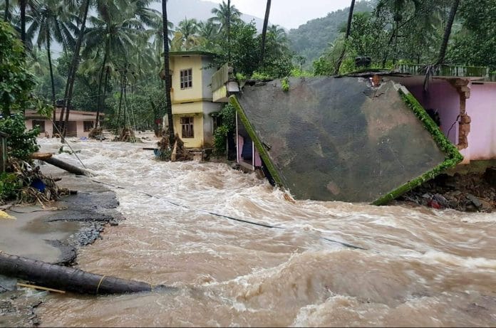
Meanwhile, an innovation from students at IIT-Mandi can predict landslides and help effect quick evacuations.
Bengaluru: Researchers at IIT-Bombay have developed an AI algorithm that can help track natural disasters on the ground, monitor cities from the skies, and help security forces identify insurgents in the dark.
The algorithm, teamed with a technology that promises monitoring immune to atmospheric quirks, can help save crucial time for rescue operations during disasters.
Traditionally, weather and disasters have been monitored through data from satellites that take real-time pictures and beam them to the ground. However, physical blocks in the atmosphere, such as heavy smog or cloud cover, can create problems in this method of observation. This is a major impediment during the monsoon, when a large part of India is prone to flooding.
As radar can pierce through cloud cover, radar satellites have emerged as an alternative.
Also read: Swift wars are a myth, India needs to prepare for other modern forms of warfare as well
When radar bounces off surfaces, its reflection helps create an image of the surface. However, while several radar satellites have been deployed to monitor the weather over the past few years — like Sentinel-1, RadarSAT-2, and the upcoming NISAR — radar images are notoriously hard to interpret.
The task often requires highly skilled manual work by people trained in the physics of radar scattering — how radar signals are deflected by surfaces — which is extremely expensive. Urban landscapes, where numerous shapes throw up complicated images, make the task more daunting.
The algorithm devised by Shaunak De and Avik Bhattacharya, researchers at IIT-Bombay’s Microwave Remote Sensing Laboratory, can accurately interpret these images like a human would.
To pull this off, the researchers relied on deep learning, a method where a computer is repeatedly fed large volumes of similar data of the kind that needs to be identified later.
For example, an algorithm can repeatedly be fed millions and millions of cat pictures from all over the world so that it understands how a cat’s face is structured. Then, when it looks at a picture of a different cat, it can immediately identify the animal as such.
The IIT-Bombay algorithm has been fed massive amounts of data on urban landscapes and their resulting radar images. Thus, it can look at the result of a radar-scattering and identify the type of building or structure that caused it. The computer algorithm was essentially trained just like a human would have been.
“The algorithm has been demonstrated to outperform state of the art techniques and has human-like target identification accuracy,” said De. “Although the training is a time-consuming process, once the model is created it can be applied to a large number of radar images in seconds. Thus we are able to efficiently, cheaply and accurately map urban targets in large swaths of radar data.”
The algorithm promises to be a timely intervention. In 2017, the United Nations estimated that more than 54 per cent of the world’s population – over 3.8 billion people – lived in urban areas, a number that continues to grow dangerously fast. Worryingly, a lot of this growth is unplanned and entails reckless expansion, often at the cost of effective management, urban design, optimal utilisation of natural resources, and environmental safety.
Also read: Kusala Rajendran: What we know about Indian earthquakes, we know through her
As a result, a lot of urban areas are prone to artificially aggravated natural disasters like flooding, and ill-equipped for effective disaster management.
In case of natural disasters, the algorithm can promptly create a map of all settlements in a location and, within a matter of hours, a proper mitigation or evacuation plan can be put into place and even fed into Google maps to help locals.
On other days, the system can also be used to monitor illegal constructions or by security forces to spot bunkers or insurgent movement as it can effectively “see” in the dark.
Another breakthrough at another IIT
Disaster management seems to be a driving force for India’s budding engineers, with students at another branch of IIT coming up with an inexpensive monitoring and warning system for landslides, which kill dozens in India each year.
Landslides are triggered by earthquakes or rains, or even changes in groundwater pressure. They are aggravated by human activities such as deforestation and construction.
Students of computer science and civil engineering at IIT-Mandi, based in landslide-prone Himachal Pradesh, have created a system that monitors weather and soil movement. Whenever any of the sensors detects a significant soil shift, it sets off a warning through blinkers alongside roads, alerting vehicular traffic. Each of the sensors is also capable of sending bulk SMSes to locals, a boon for times that require prompt evacuation.
IIT-Mandi tied up with the local administration to deploy their equipment at 10 locations in town, creating the largest landslide warning system in India’s history.
The team that developed this system is called the iIoTs (Intelligent IoT Solutions) and has filed for patent.
The system reportedly only costs around Rs 20,000.


Praiseworthy. With climate change, such innovation will be especially required and valuable.