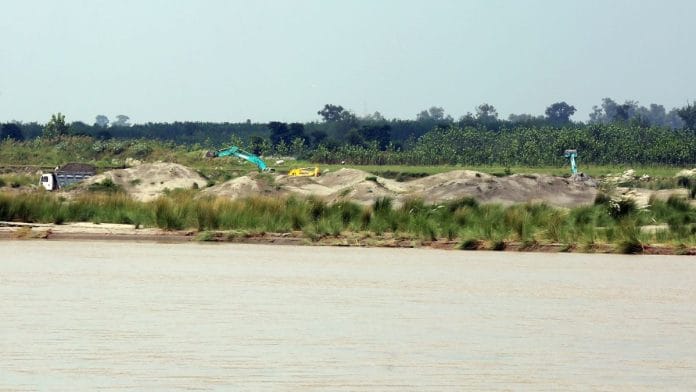
Agra: More than 5,000 constructions in Agra, including several high-rise buildings and residential societies—housing hundreds of families—are at risk of demolition following the demarcation of the floodplain of the Yamuna river by the Uttar Pradesh government.
The government, on 22 January, issued a notification demarcating the Yamuna floodplain, following an order in this regard from the National Green Tribunal (NGT), which had been hearing a petition from Agra environmentalist Dr Sharad Gupta.
The contours of the Yamuna floodplain were determined scientifically, based on records of the past 100 years, according to the government.
The notification declared a 5.09-kilometre stretch on the right bank of the Yamuna and a 2.55-km stretch on the left bank flood-prone. It banned new constructions in this zone with immediate effect and declared existing constructions illegal. The Yamuna flows for roughly 167 km within the border of Agra. In UP, its total length from Asgarpur to Naav is 1,056 km. Along the Yamuna, the government-demarcated flood area is 15,925 square km.
The future of the more than 5,000 constructions in the Yamuna coastal areas, some of which were approved by the Agra Development Authority (ADA), now hangs in the balance.
Also Read: 4 yrs after NGT order, 4 states assess their hill cities to strike balance between tourism & ecology
NGT orders & demolitions
Hearings over the demarcation of the flood area along the Yamuna have been ongoing in the NGT for the last three years. The NGT first sought information from the irrigation department on whether there was any demarcation of the flood area.
On receiving a negative answer, the NGT constituted and directed a high-level committee to demarcate the flood area from Haryana to Prayagraj. The river coast in major cities, such as Delhi and Agra, was then divided into three categories for the study.
During the flood in 2010, water reached Jaganpur, Manoharpur, Khaspur and Nagla Godown in the Lokhandibagh area. Earlier in 1978, the flood affected the Belanganj, Balkeshwar, Florin Bagh and Runakta areas.
On the orders of the NGT, 2016 saw demolitions of many illegal constructions in the flood area of Yamuna. Ganpati Buildtech Pvt Ltd Managing Director Nikhil Agarwal told ThePrint that several projects in the flood plains of Yamuna were demolished that year—including parts of his company’s project and those of other builders. All these projects, he claimed, had approvals from the Agra Development Authority.
The UP government notification was the outcome of another study conducted by the state water commission in collaboration with organisations, such as the National Institute of Hydrology (NIH), the Ganga Flood Control Commission (GFCC), the National Clean Ganga Mission (NMCG), and the Central Water Commission.
The new notification has confused the irrigation department—which has no information about the latest floodplain demarcation. Earlier, the National Remote Sensing Centre geotagged pillars marking the floodplain, and the irrigation department did not have any information about fresh demarcations under process.
Agarwal said only unapproved projects stood in the previously demarcated floodplain.
However, in case of any fresh demarcation, the builders, he said, will have to seek legal counsel to prevent further damage to their projects. The ADA, he said, had duly approved all the projects before construction started.
Beginning of NGT case
(Edited by Madhurita Goswami)


