


Chamoli/New Delhi: Drones, ground penetrating radars, remote cameras, sonar systems and VSAT antennae — the rescue teams on the ground in Uttarakhand are relying on a host of technologies as they search for nearly 200 people who remain missing since the floods struck Sunday.
A landslide at Ronti peak in Chamoli district triggered a sudden deluge of water and slush Sunday morning that left a trail of death and destruction in its wake. So far, 32 bodies, mainly of workers of the Tapovan Vishnugad Hydropower and the Rishi Ganga Hydropower plants, have been found.
“We have several tools (to assist the rescue operations). If required, we will use a sonar system, and other sensitive systems also,” said National Disaster Relief Force (NDRF) Commandant P.K. Tiwari at the site of the Rishi Ganga Hydropower Plant, where over 50 workers are reported to be missing.
“We have cutting and breaching devices. They (the teams) are working to detect bodies,” he added.
According to Tiwari, the rescue framework has undergone a massive change in the eight years since the 2013 Kedarnath floods.
“I was a commandant in the 19th battalion (ITBP) in 2013, when the Kedarnath floods happened. The disaster management structure was not as strong back in those days. But, now we have SDRF (State Disaster Response Force), NDRF (National Disaster Response Force) teams that are working very efficiently and the ITBP (Indo-Tibetan Border Police) team is also very experienced,” he said.
Aiding them in their efforts is the expertise of the Defence Research and Development Organisation (DRDO), the Indian Space Research Organisation (ISRO), and the Council of Scientific and Industrial Research (CSIR), and some start-ups.
Also Read: Uttarakhand disaster likely caused by landslide, not glacial outburst, satellite images reveal
A difficult operation
The floods in Chamoli tore through the two hydropower projects and a bridge, burying dozens of workers under piles of slush and mud. At Tapovan, workers remain trapped inside two tunnels. The first responders, ITBP personnel, had managed to rescue 12 from one by Monday, and operations continue to find 34 others stuck in the second tunnel.
ITBP Deputy Commandant Nitesh Sharma said the workers in the second tunnel are stuck in a “bifurcation” that is difficult to access.
“The tunnel is 2.5 km, so it is not certain as to which part of the tunnel the personnel are trapped in exactly,” he added. “It will be clear only after we are able to dig through this tunnel.”
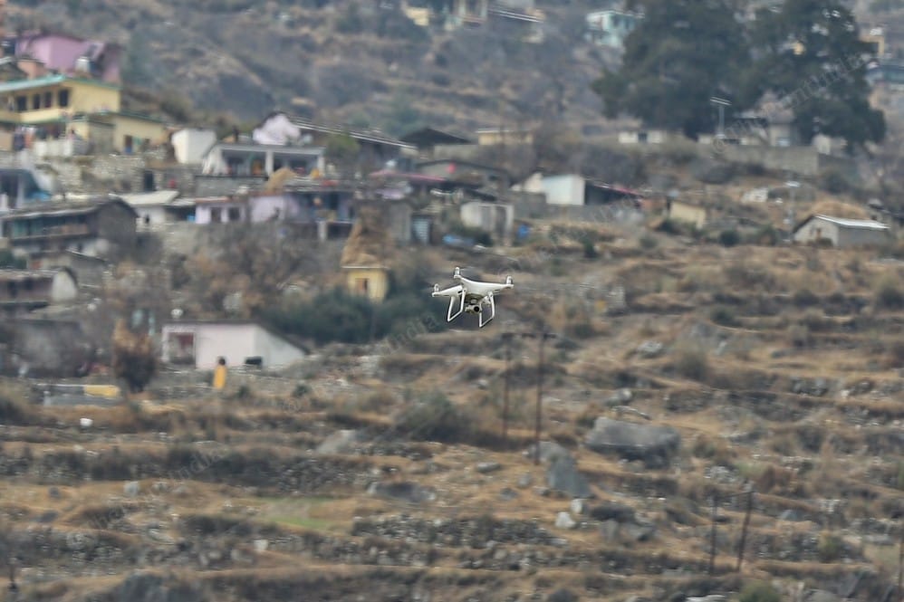
Three JCB machines stationed outside the tunnels are being used in turns to take out the slush and mud from inside. Additionally, the rescue teams have been intermittently sending in drones to scope out their depths.
As and when sections of debris are taken out, rescue teams equipped with “victim-locating cameras” — comprising a camera at the end of a long, extendable stick, a screen, a drill, and in-built speaker and receiver systems — are sent into the tunnel.
“They (the cameras) are very helpful. If there is a building or ditch, we have a breaching system that makes a hole in the wall and the rocks. When the inspection hole is made, we use the victim-locating camera to go inside and look for the victim,” said Lalit Kumar, a sub-inspector with the NDRF.
Tiwari pointed out that the camera is “extendable up to 10 feet, and rotates 360 degrees to take a view of all around”. “That way, this camera has proved essential during search operations,” he added. “Through the mic-headphone system, you can hear the sound of the victims trapped inside.”
In addition to this, the teams also have access to sonar systems that can trace people who have drowned, rescue radars to locate those alive and trapped inside tunnels or other closed spaces, and VSAT (Very Small Aperture Terminal) Quick Deployment Antennae.
Also Read: How dams can help control floods — what experts said after 2013 Uttarakhand disaster
Technology & coordination
While the radars, remote cameras and antennae were sourced from the DRDO and the CSIR, start-ups were contacted for hi-tech drones.
“To start with, we had our in-house technology of radars, cameras and drills. We then took assistance from drone start-ups who helped us with resources. Even IITians pitched in resources,” NDRF Director General S.N. Pradhan said.
“With the help of VSAT Quick Deployment Antennae, we could visually see the situation before our eyes, and it helped us plan operations in a more meticulous manner,” he added.
Using the antennae, the DRDO could survey the glacier where the landslide occurred, he said. ISRO assisted in the mapping efforts by providing the NDRF with before-and-after satellite images of the location.
“Moreover, helicopters of the CSIR flew over the disaster site along with radars, to give us a sense of where the sludge was in the tunnel and help us plan the operations better,” said Pradhan. “With their help, we were able to map the points that had the sludge, where people could be stuck.”
The radars were helpful in detecting air pockets under the dam and where the sludge was trapped, critical for mapping out “strategic points”.
Tiwari said the rescue operation currently under way is more “technical than manual”.
“During the 2013 floods, I was with ITBP mountaineering force… we had limited equipment,” he added. “This time, the NDRF has state-of-the-art equipment… that way, our disaster resilience and preparedness in respect to our country has achieved greater things, and we are better prepared to handle disaster,” he added.
The scenario (of disaster management infrastructure) has changed in the last few years, he said.
Pradhan added that, along with technology, “coordination between agencies plays a major role during such situations”. “Teams of ITBP, who are on the ground, along with NDRF, have been working tirelessly and here we are coordinating each operation at the highest level,” he said.
Also Read: Satellite images reveal 550m ‘scar’ left by Uttarakhand landslide in Nanda Ghunti glacier