


New Delhi: A cyclonic storm has developed off the eastern coast of India over the east-central Arabian Sea and Lakshadweep area, according to the India Meteorological Department (IMD).
As of 1 June, the cyclone is located about 360 km southwest of Panjim (Goa), 670 km south-southwest of Mumbai (Maharashtra) and 900 km south-southwest of Surat (Gujarat).
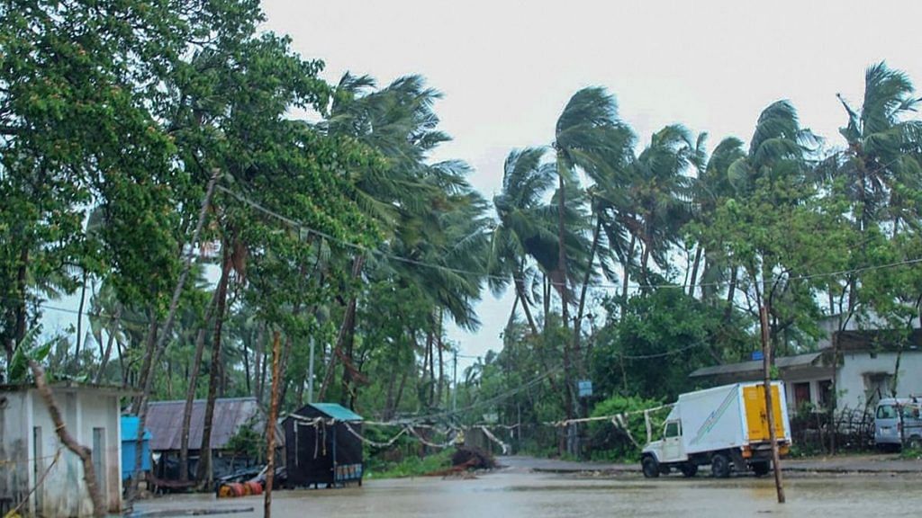
It will cross north Maharashtra and south Gujarat coasts between Harihareshwar (Raigad, Maharashtra) and Daman during the evening of 3 June.
Unlike cyclone Amphan, which was categorised as an extremely severe cyclonic storm that devastated parts of West Bengal, the cyclone Nisarga is expected to be less intense when it hits the coast.
Konkan and Goa are likely to receive extremely heavy rainfall in isolated places from 3 June. Parts of Maharashtra will also experience heavy rainfall on 3-4 June.
Wind speed reaching 65-75 kmph gusting to 85 kmph is expected over east-central Arabian Sea and along the Karnataka-south Maharashtra coasts from the morning of 2 June.
By 3 June, wind speed will reach 90-100 kmph gusting 110 kmph over east-central and northeast Arabian Sea along Maharashtra and Gujarat coasts.
Also read: Cyclone Amphan timely lesson for states to upgrade infra in rural areas, says NDRF chief
How was the cyclone named?
The IMD has released a new list of 169 cyclone names adopted by the World Meteorological Department (WMO) panel in April.
The list will be used to name tropical cyclones forming over the north of Indian Ocean.
The name Nisarga is the first in the list proposed by Bangladesh.
How are cyclones formed?
Tropical cyclones form over warm ocean waters near the equator. The heat causes the warm, moist air to rise from over the ocean, creating an area of lower air pressure.
Cool air from surrounding areas then rush in to fill in the low pressure area. However, this new air too becomes warm and rises, causing more cool air to gush in. This process continues causing a cyclonic storm.
The warm air — containing water vapour — rises and cools, forming clouds. This whole system of clouds and wind spins and grows. This system is continuously fed by the ocean’s heat and water evaporating from the ocean surface.
As the storm system rotates faster and faster, an eye forms in the centre. Conditions are very calm and clear around the eye. When the wind speeds reach 119 kmph, the storm is officially a “tropical cyclone”.
Tropical cyclones usually weaken when they hit land as they are no longer being “fed” by the warm ocean waters. However, they dump many centimetres of rain and often cause heavy wind damage before they die out completely.
The strong winds also bring water into the shore, which can lead to flooding. The phenomenon, known as storm surge, can be dangerous for coastal areas.
Cyclones are classified into five categories depending on the strength of the winds produced and the damage it is expected to cause.
Also read: Cyclone Amphan: Why India’s east coast is a magnet for cyclones