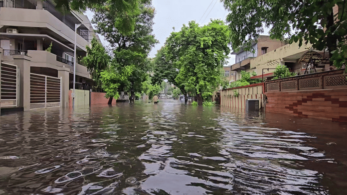
New Delhi: A monsoon cyclone is set to form over the Kachchh-Pakistan coast Friday, which scientists are calling a “rare” weather event.
In a statement issued late Thursday, the India Meteorological Department (IMD) said the ongoing heavy rains in Gujarat will intensify into a tropical cyclone over the Arabian Sea.
The downpour is expected to persist before the cyclone enters the sea in the next two days, it said.
Tropical cyclones usually form over the Arabian Sea and the Bay of Bengal either during the pre-monsoon season (March to May) or after the monsoon season (October to December).
However, the impending cyclonic storm had its genesis over land, where it intensified and moved westwards towards the coast, IMD scientists explained.
Unusual weather event
Only three cyclonic storms have developed over the Arabian Sea in August in the last 100 years — the last being in 1976.
“The development of cyclonic storms in the month of August over the Arabian Sea is a rare activity. Between 1891 and 2023, only three cyclonic storms developed over the Arabian Sea in 1944, 1964 and 1976. The cyclone of 1976 was over Odisha. It moved west-northwestwards, emerged into the Arabian Sea, made a looping track and weakened over the northwest Arabian Sea near the Oman coast,” a senior Met official said.
In 1944, the cyclone intensified after emerging from the Arabian Sea and weakening over it. Another short cyclone developed near the south Gujarat coast and weakened near the coast in 1964.
Over the Bay of Bengal, there have been 28 such weather systems in August since 1891 — the year from when cyclone data was officially recorded.
Forecast: No major damage
On 24 August, the Met department predicted a well-marked, low-pressure area—an area in the atmosphere where the pressure is lower than those of the surrounding region at the same level—over central parts of north Madhya Pradesh.
The forecast said the system would intensify into a “depression” over west Madhya Pradesh on 25 August and then into a “deep depression” over south Rajasthan and adjoining north Gujarat by 27 August.
Weathermen, however, have assured the cyclone is unlikely to cause any major damage and is expected to move away from the Indian coast in the next two days.
At least 28 people have died in Gujarat due to torrential rains in the last four days. Flooding has also been reported in several low-lying districts since the Vishwamitri River breached its bank due to the downpour.
The IMD has issued a “red alert” for the Kachchh and Saurashtra regions, covering the districts of Kachchh, Dwarka, Jamnagar, Morbi, Surendranagar, Junagadh, Rajkot, Botad, Gir Somnath, Amreli, and Bhavnagar. A “yellow alert” has been issued for north, central, and south Gujarat.
(Edited by Tikli Basu)


