


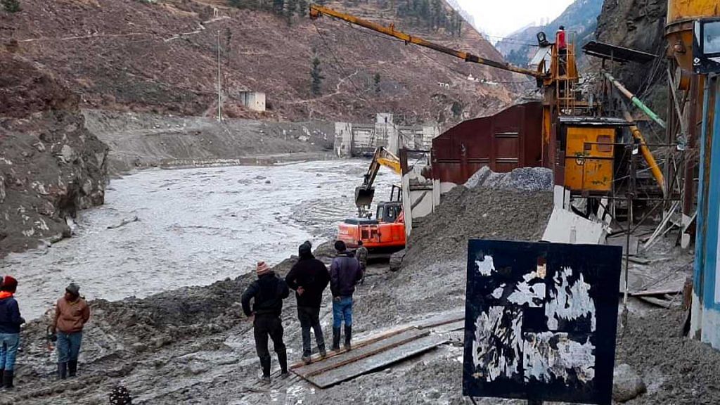
Coimbatore: International geologists and glaciologists studying satellite imagery say the cause of the Chamoli flooding disaster in Uttarakhand appears to be a landslide and not a glacial outburst as widely believed.
The first identification was done by Dr Dan Shugar of University of Calgary, who specialises in high altitude glacial and geologic environments. Shugar used satellite images from Planet Labs, captured before and after the disaster, to deduce that a landslide triggered the catastrophic flash floods along the Alaknanda and Dhauliganga rivers, as also evidenced by a trail of dust visible in the satellite imagery.
Actrually, it looks like it may have been a landslide from just W of the glacier. See here. Possibly from the steep hanging glacier in the middle of the Google Earth image. pic.twitter.com/6ImcwI91d7
— Dr Dan Shugar (@WaterSHEDLab) February 7, 2021
Earlier reports stated that the flooding was caused by a glacial lake outburst flood (GLOF), which occurs when a natural lake is formed from a glacial ice melt and the lake is breached. However, available satellite images seemingly do not show the presence of a glacial lake before the flooding event.
No lakes of any size visible on the surface but unfortunately the satellite imagery doesn't show farther upvalley and so can't tell if it was from a large supraglacial landslide that might have broken up the glacier.
— Dr Dan Shugar (@WaterSHEDLab) February 7, 2021
Instead, glaciologists and geologists identified a steeply hanging bit of a glacier which likely developed a crack and caused a landslide, triggering an avalanche and the subsequent flooding.
3D rendering of @planetlabs image collected 7th Feb showing the source of the Uttarakhand disaster located by @WaterSHEDLab. Appears to be a complete detachment of a previously glaciated slope #Chamoli #Disaster #Landslide pic.twitter.com/SElrZh36kH
— Scott Watson (@CScottWatson) February 7, 2021
Images from Copernicus’s Sentinel 2 satellite also showed the formation or opening of a crack in the Nanda Devi glacier that is believed to have triggered the landslide.
I think we can see the #Chamoli / #UttarakhandDisaster crack opening on these @CopernicusEU #Sentinel2 images (27 Jan to today). It points to a #landslide indeed. @davepetley @iamdonovan @WaterSHEDLab pic.twitter.com/lojNY0ES7L
— Julien Seguinot (@pyjeo) February 7, 2021
updated with arrows. would need to go through more @sentinel_hub images to see when these first appear, if they are actually new crevasses https://t.co/LAOeAeWZwU pic.twitter.com/kFdYieiM2y
— Bob-o McNabb (@iamdonovan) February 7, 2021
What likely happened
In all likelihood, a steep, hanging portion of the Nanda Devi glacier broke off at Trishuli, in what is called a ‘rockslope detachment’. This potentially caused nearly 2,00,000 square metres of ice to drop 2 kilometres vertically, causing a landslide, impacting the valley floor and shattering instantly. This debris, rock, and ice then flowed downslope in the form of an avalanche, identified by the dust trail in the satellite imagery.
This avalanche flowed onto the glacier itself. Such intense flows of rock can cause tremendous heat generation, melting ice and causing transient, slushy lakes and/or water flows.
Additionally, there was likely more ice-cored moraine, or ice covered by sediment, as well as stagnant glacial ice downstream, as identified by Matt Westoby, a physical geography lecturer specialising in glacial analysis in Northumbria University.
These large volumes of ice, spanning nearly 3.5 km, would have further melted due to the heat generated by the landslide and avalanche, leading to the huge volumes of water that flooded the rivers.
It's late, and I'm squinting, but looks to be ~3.5km-worth of stagnant glacier/ice-cored moraine downstream of the point where the avalanche hit the valley floor. If so, there's your source of additional water for flow bulking. pic.twitter.com/cuGMRCxXGC
— Matt Westoby (@MattWestoby) February 7, 2021
This theory was confirmed by landslide experts too. According to Dave Petley of University of Sheffield, the event is similar to the 2012 Seti river flooding in Nepal, which was also triggered by a rockslope failure.
Saurabh Vijay, assistant professor at IIT-Roorkee who studies glaciers, identified from satellite images large amounts of freshly fallen snow over the last week that likely contributed to both the avalanche and the volume of water.
Adding Feb 2 image to Feb 6 and 7 images indicates the role of freshly fallen snow cover in inducing massive landslide. Needs further investigation though. @GlacierResearch @BhambriRakesh @irrfank pic.twitter.com/XBEZAzPbrc
— Saurabh Vijay (@saurabhvergia) February 7, 2021
While landslide-triggered flows could cause enough heat to form temporary, transient dams of water that get quickly washed away in a flooding event, the event is not a ‘glacial outburst’.
What is GLOF?
A GLOF event is where a naturally formed lake of glacial meltwater is breached, causing a catastrophic release of large volumes of water downstream.
Glaciers on mountain tops and the sides of mountains accumulate ice from snowfall. This ice melts in a process called ablation, adding water to downstream water bodies and rivers. The process is continuous and is a part of the Earth’s natural water cycle.
As a glacier retreats, i.e., reduces in size because of melting, it leaves sediments in the melted freshwater in the form of clay and sand as well as rocks, boulders, and gravel. These deposits often create natural dams called moraines that contain meltwater within.
These natural dams or glacial lakes can overflow or be punctured/breached, leading to flooding downstream.
Breaching of moraines can be triggered by avalanches, earthquakes or a natural collapse of moraines due to excessive pressure from water. Also contributing to GLOFs are anthropogenic (human-induced) activities such as deforestation and pollution, which change local climate. Pollution exacerbates the potential for disasters through the release of black soot particles, which can settle on ice, absorbing more heat and accelerating melting.
Fragmentation of glacial ice can also trigger a breach in terminal moraines or dam boundaries, either through direct impact or by displacement waves, which compromise the stability of the dam. This is what was originally suspected to have occurred in Chamoli.
It is as yet unclear what triggered the original landslide that led to this week’s disaster. Newer satellite imagery, survey data, and further investigations are expected to reveal more information over the next few days.
Also read: 14 bodies recovered, 15 rescued in Uttarakhand following glacier burst