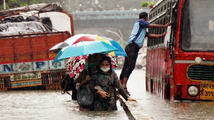
New Delhi: India received a total of 95.8 cm of rainfall this monsoon, the third highest ever recorded, according to data released by the Ministry of Earth Sciences Thursday.
The India Meteorological Department (IMD) had predicted in May that the rainfall this year would be 102 per cent of the Long Period Average (LPA) — the average rainfall received in the monsoon season between 1961-2010, which is 88.0 cm. But actually, the rainfall recorded this monsoon was 109 per cent of the LPA.
August was also the wettest it has been in 44 years, receiving 127 per cent of average rainfall, the fourth highest in 120 years.
The wettest monsoon on record is 1994, when the country recorded 112 per cent of LPA. Last year, rainfall was the second highest on record, at 110 per cent of LPA.
This means in consecutive years, India has had above-normal monsoon rainfall. The last time this happened was in 1958 and 1959, when India recorded 110 per cent and 114 per cent of LPA respectively.
Also read: Kharif crop expected to be hit as excessive monsoon rain floods fields, sparks pest attacks
Region and state-wise distribution
Monsoon rainfall this year was particularly heavy in southern India, with the region recording 129 per cent of LPA.
Taken together, the east and north-east received 106 per cent of LPA, while the central region registered 115 per cent. The north-western region, though, had deficient rainfall — 84 per cent of LPA.
Among the meteorological subdivisions that received deficient rainfall are Nagaland, Manipur, Mizoram and Tripura, western Uttar Pradesh, Uttarakhand, Himachal Pradesh, Jammu & Kashmir and Ladakh.
Month-to-month variation
According to the statement by the earth sciences ministry, this year is also uniquely placed in the historical record because of the contrasting month-to-month variations in rainfall. While June saw rainfall over 118 per cent of the LPA, July had deficient rainfall at 90 per cent of LPA.
August was the wettest month — it registered 127 per cent of average rainfall, the highest since 1976 (128.4 per cent) and the fourth highest in 120 years. The highest deviation from the LPA for the month of August since 1901 was in 1926, when it was 133 per cent of LPA.
September registered 104 per cent of average rainfall.
The formation and movement of cyclone Nisarga over the Arabian Sea helped the monsoon advance into mainland along the west coast in June. Subsequent features favoured timely advance, and the monsoon covered the entire country by 26 June, instead of the normal date of 8 July. But in July, unfavourable features — which impede the progress of the monsoon — appeared, resulting in deficient rainfall for the country.
The weak monsoon in July was mainly due to absence of any major monsoon disturbance over the Bay of Bengal. This also led to an atmospheric trough close to the foothills of the Himalayas on many days. As a result, north-eastern India, Bihar and the adjoining areas of eastern Uttar Pradesh experienced frequent and prolonged floods.
During August, the formation of back-to-back low pressure systems over the northern Bay of Bengal and their movement towards Gujarat and south Rajasthan caused higher-than-normal rainfall over central and western India. For four successive weeks — from the week ending 12 August to the one ending 2 September — India received 13 per cent to 41 per cent above-LPA rainfall.
Monsoon withdrew from western parts of India on 28 September — 11 days later than normal.
As of 1 October, the southwest monsoon has withdrawn from Punjab, western Himalayan region, Haryana, Chandigarh, Delhi and many parts for Rajasthan and some parts of Uttar Pradesh.
Also read: Why August rains hold the key to India’s economic recovery after erratic monsoon
Prediction errors
The IMD, on 15 May, had predicted that the monsoon would hit Kerala on 5 June. The actual onset was on 1 June, but since the model used by the IMD has an average error of four days, the forecast is considered to be correct.
However, the forecast on the quantity of rainfall was off by more than the margin of error expected from the model.
In April, when the first stage forecast for the season was issued by the IMD, it had predicted a normal monsoon (100 per cent of LPA), with a model error of 5 per cent.
The forecast was upgraded to 102 percent of LPA with a model error of 4 per cent in the updated forecast issued in May. However, the actual seasonal rainfall was more than the predicted value.
Also read: Why India got more rainfall in September 1917 than 2019 but there were no major floods


