New Delhi: In light of the recent spate of landslides in Himachal Pradesh, a team of experts constituted by the highways ministry recommended that no proposed widening of highway stretches in the state should be allowed till slope studies and a stability analysis, of both the hill and valley side of the national highway, are undertaken.
A report, prepared by the team after analysing landslide sites in the state, further noted that road developers also need to determine the effect of anthropogenic (human) activities on the roads.
Submitted to Road Secretary Giridhar Armane last week, the report, accessed by ThePrint, also called for an audit of all the national highway (NH) stretches in the hilly terrain from a landslide hazard safety perspective and recommended drawing up remedial measures within the ambit of ongoing contracts.
The team also said that the Detailed Project Reports (DPC) should also include slope protection measures and methodology of construction. “The Detailed Project Reports (DPRs) shall invariably provide for detailed construction methodology before and after hill cutting,” the report said.
It added, “Standard Operating Procedures laying down steps to be taken after the occurrence of landslide may be prepared and made part of EPC document so that immediate measures at the site could be taken by the agency working at the site minimising the losses.” An EPC document is a contract document that stands for engineering procurement construction mode where the government bears 100 per cent funding of the project being implemented.
The team also said that vulnerable locations on each and every NH in Himachal Pradesh should be identified based on the landslide hazard studies prepared by Geological Survey of India and DRDO’s Defence Geoinformatics Research Establishment (DGRE), while the road ministry’s regional officers should carry out quarterly inspections of all such sites.
The inspection team, which included engineers from the road ministry, Public Works Department, Himachal Pradesh, and a scientist from DGRE, visited two locations in the state that witnessed massive landslides.
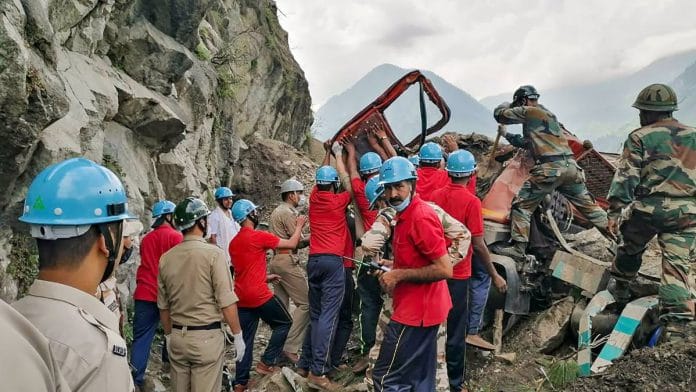
The first site was located on NH-5, which connects Shimla with Shipki La at the India-China border, where a landslide led to the deaths of 30 people on 11 August.
The second landslide occurred on NH-707 that connects Paonta Sahib to Hathkoti on 30 July. A 100-metre stretch of road collapsed on the highway, which was being upgraded into a two-lane roadway.
A road ministry official told ThePrint that the inspection team recommended a host of immediate, medium- and long-term measures to address the situation. “The ministry is going through the report before deciding on measures that could be adapted,” the official said.
The immediate measures include installing cautionary signs in the vicinity of potential landslide locations and round-the-clock vigil to forewarn commuters of any imminent landslide hazard at active landslide locations.
Also read: Govt expects Rs 1.6 lakh cr from monetising 104 NHs by 2025 despite lukewarm investor interest
Need to create database of vulnerable locations
While the team did not directly blame road construction activities for landslides, it observed that such sites are vulnerable to landslide hazard.
It noted that anthropogenic activity was observed at NH-5, where the 11 August landslide occurred.
“Anthropogenic activity was observed in the area adjoining the crown of the slide failure. An electrical transmission tower at 30 meter distance of the crown, with inclination of 60 degrees and a small house at an inclination of 75 degree have been observed,” the report stated.
According to the report, such landslides have highlighted the need for preparation of a database based on interdisciplinary studies to arrive at landslide susceptible locations on the national highway network so that potential locations may be identified and monitored.
“The graded atlas based on the potential human and asset loss/damage vis a vis traffic intensity, importance of connectivity (could) be prepared and the priority based remedial plan to rectify all locations may be drawn up,” the report noted.
Also read: In Manipur’s worst-connected district, these villagers have given up their rights to get a road


