Drive to Sundarbans sees paddy lands turned into fishing ponds by cyclone Amphan
In PicturesIndia

Drive to Sundarbans sees paddy lands turned into fishing ponds by cyclone Amphan

The Sundarbans, a mangrove forest & UNESCO World Heritage Site, covers about 10,000 sq km & is home to hundreds of flora and fauna species.

   
To prevent flooding due to cyclone Amphan, villagers had built bunds using sandbags | Madhuparna Das | ThePrint

To prevent flooding due to cyclone Amphan, villagers had built bunds using sandbags | Madhuparna Das | ThePrint

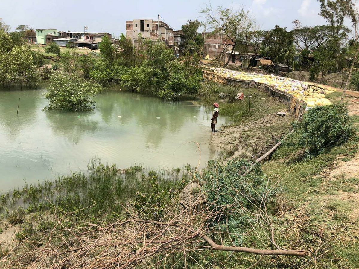
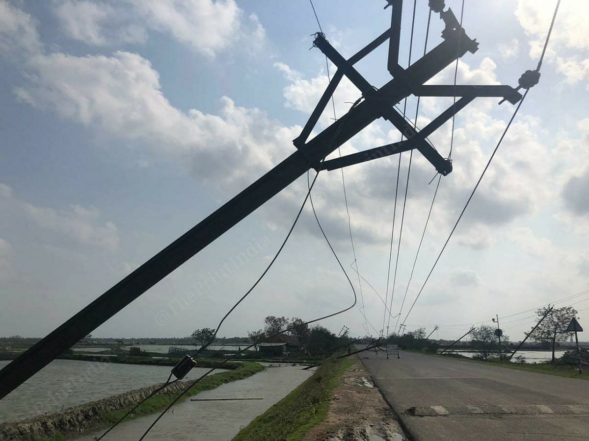
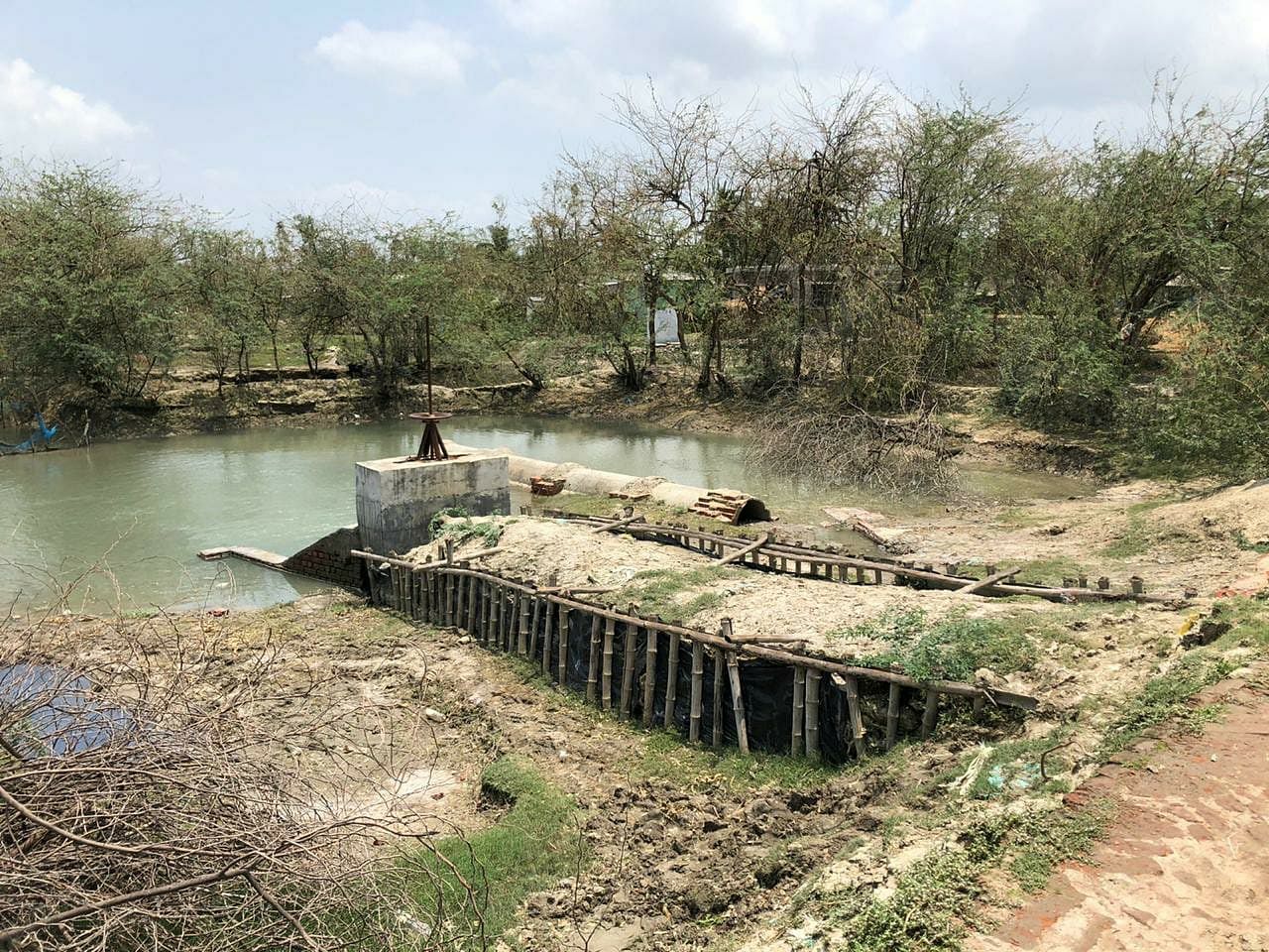
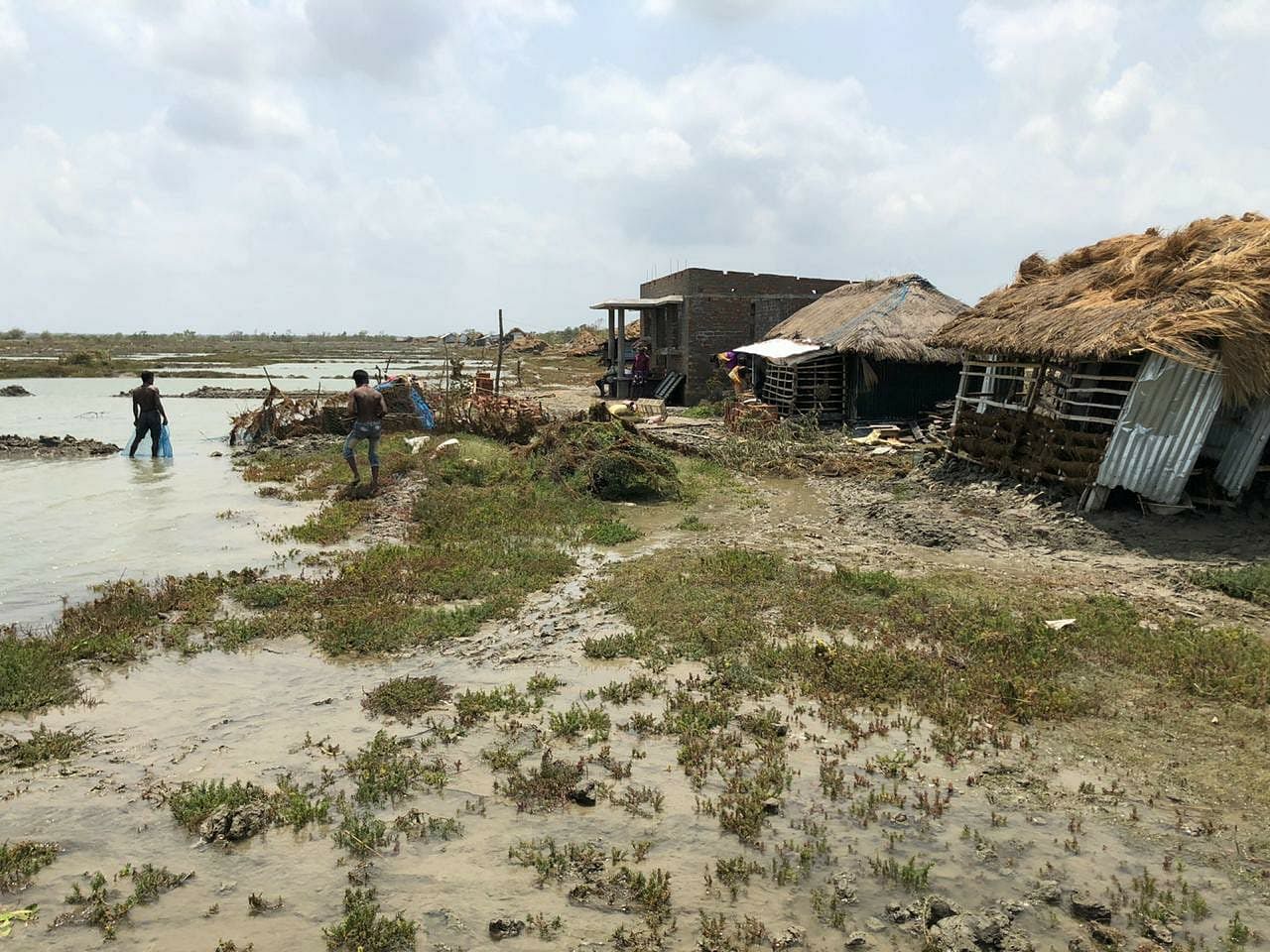
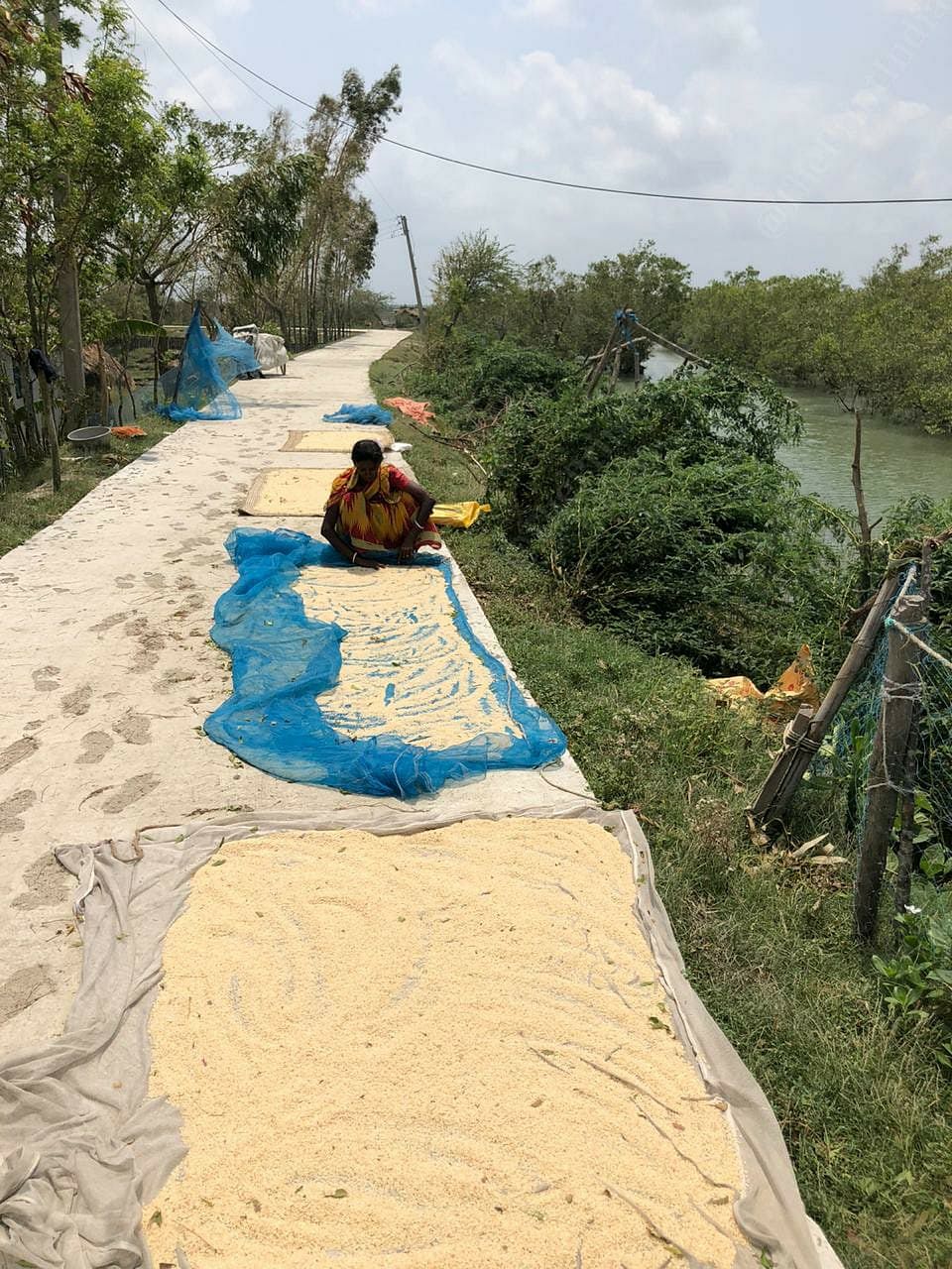
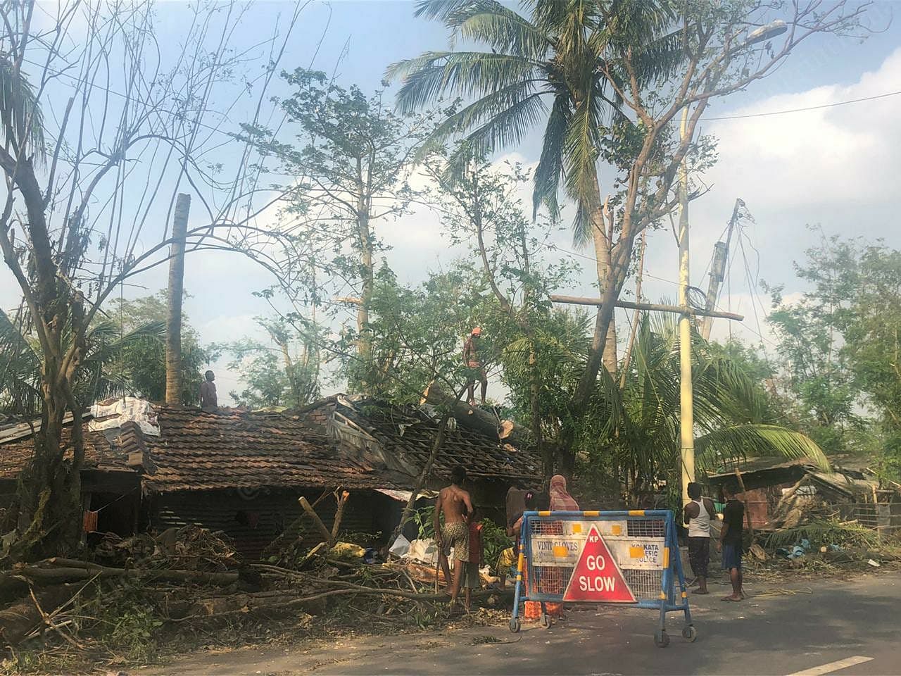
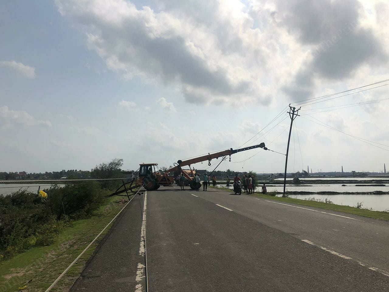
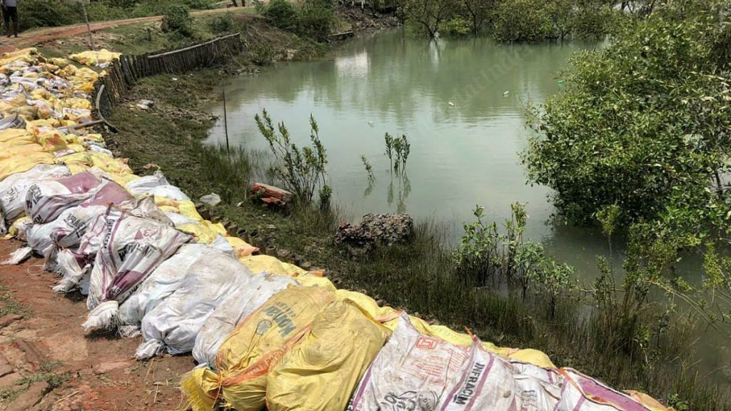
Sundarbans: It’s been five days since West Bengal was hit by cyclone Amphan. The 130-km stretch between Kolkata and the Sundarbans that is usually a feast for the eyes, with paddy fields, fish ponds and a lush green canopy, is now a wreck. Uprooted trees, mangled electric posts and flooded croplands are what one gets to see now.

ThePrint’s Madhuparna Das brings you some glimpses from the mangrove forest and the journey from Kolkata.

A villager in the Sundarbans’ Jharkhali panchayat works on a breached embankment after Cyclone Amphan | Madhuparna Das | ThePrint
Hundreds of electric posts were uprooted, leaving the village in darkness | Madhuparna Das | ThePrint
Seawater entered the villages and flooded the cropland while it also left roads submerged | Madhuparna Das | ThePrint
Villagers now fish on the land they used to cultivate | Madhuparna Das | ThePrint
The heavy rain drenched all stocked grains. Women now try to dry these stocks | Madhuparna Das | ThePrint
Villagers have rallied their folk to remove uprooted trees and repair the damage caused by the cyclone | Madhuparna Das | ThePrint
Local agencies are working to restore electric posts on the road | Madhuparna Das | ThePrint