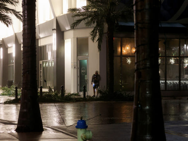
Washington, DC [US], October 10 (ANI): Hurricane Milton made landfall on Wednesday night as a “dangerous Category 3” storm near Siesta Key, on Florida’s central west coast, according to the National Hurricane Center.
Siesta Key is a barrier island located just south of Sarasota. Milton had sustained winds of 120 mph at landfall. However, its strength diminished as it moved inland.
The hurricane center asked people, who were living in the Tampa and St Petersburg areas to shelter in place as “extremely dangerous hurricane-force winds” were spreading through the area.
After landfall, Milton will continue across Florida while rapidly weakening after losing the fuel of the warm Gulf waters. However, it still maintains its hurricane status. Milton will exit into the Atlantic Ocean and transition into a tropical storm on Thursday.
As of Wednesday morning, a little over 23 per cent of Florida gas stations were without fuel, including more than 59 per cent in the area around Tampa Bay and St. Petersburg, CBS News reported, citing GasBuddy. Those numbers had witnessed a rise since Tuesday night.
Earlier, the National Weather Service in Miami observed at least four twisters, including a “multi-vortex tornado,” as meteorologists said that storm surge starting to arrive along the southwestern Florida coast.
Tornado warnings were issued for various cites, in addition to hurricane and storm surge warnings already in place for many of those same places.
After unfurling into an explosive, massive Category 5 storm with winds topping 180 mph on Monday, Milton’s sustained wind speeds started to reduce as the storm was about to make landfall. Earlier, forecasters termed it a “catastrophic” hurricane.
Serious damage and flooding were expected after the storm reached powerful Category 3.
Speaking to CBS News, Jeff Masters, a scientist who formerly worked with the National Oceanic and Atmospheric Administration’s hurricane hunters, said, “Some of the biggest catastrophes in hurricane history were from weakening storms.”
Masters said, “Katrina was weakening as it was approaching the shore and it caused USD 190 billion in damage. It was a Cat 3 at landfall and it was formerly a Cat 5. Well, here we have another former Cat 5 that’s going to be a Cat 3 at landfall, and the storm surge is baked in.”
He said, “It’s going to do unprecedented damage in this part of Florida.”
A Hurricane warning has been issued for the Florida west coast from Bonita Beach north to Suwannee River, including Tampa Bay, and the state’s east coast from the St Lucie-Martin County line north to Ponte Vedra Beach.
Storm surge threats were a major concern for the west coast of Florida. Apart from Hurricane warnings, storm surge warnings were in effect from Flamingo northward to Yankeetown, including Charlotte Harbor and Tampa Bay.
A storm surge warning was also issued for Florida’s east coast, from the Sebastian Inlet in Florida, to Georgia’s Altamaha Sound, including the St Johns River.
Various areas were under tropical storm watches and warnings, including some areas of Georgia and the Bahamas.
The National Weather Service stated, “If you are in the Storm Surge Warning area, this is an extremely life-threatening situation and you should evacuate if ordered to do so by local officials.”
The hurricane center warned that storm surge in the Tampa Bay area could be between 8 to 12 feet above ground level. The prediction was a few feet lower than it was mentioned in earlier forecasts, which initially suggested Tampa could see surges up to 15 feet.
As of Wednesday afternoon, a stretch of Florida’s west coast from Anna Maria Island down to Boca Grande, including Sarasota, was forecast to see peak surges between 9-13 feet, CBS News reported.
The numbers mentioned in afternnoon were revised down a touch from earlier ones. However, Florida officials and forecasters stressed that even the lower estimates were extreme.
In an advisory on Monday afternoon, the hurricane center said, “The deepest water will occur along the immediate coast near and to the south of the landfall location, where the surge will be accompanied by large and dangerous waves.”
“Surge-related flooding depends on the relative timing of the surge and the tidal cycle, and can vary greatly over short distances,” it added, according to a CBS News report.
Forecasts show heavy rainfall, which could cause “catastrophic and life-threatening flash and urban flooding, along with moderate to major river flooding” in parts of the Florida peninsula through Thursday.
While addressing a briefing on Tuesday, Florida Governor Ron DeSantis said warned people that “we’re going to have impacts far beyond wherever the eye of the storm is.”
He further said, “The impacts will be broader … specifically with respect to storm surge.”
On Wednesday, he said, “There will be fatalities.” DeSantis said, “I don’t think there’s any way around that when you have 10 feet of storm surge. There are going to be people who stay behind, and they’re going to be in distress.”
DeSantis said officials have set up 149 shelters in Florida that are open for people, with capacity to hold around 200,000 people. People in Florida who were in the potential path of the hurricane lined properties with sandbags boarded up doors and windows, and moved their boats ahead of the storm’s arrival, CBS News reported.
In an emergency orders over the weekend that now include 51 counties, whose residents, he said should prepare for power outages, stock up on enough food and water to last a week and be ready to leave their homes if necessary.
He urged people in or around evacuation zones who had not left yet to seek shelter at local or state-run centers established as a response to Milton, saying that time was running out. (ANI)
This report is auto-generated from ANI news service. ThePrint holds no responsibility for its content.


