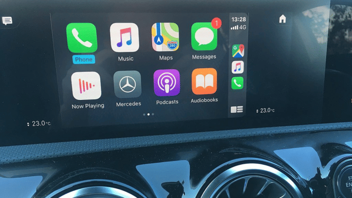
A few weeks ago, I tweeted about the trouble I faced with Google Maps on the Hyundai Tucson I was driving, and my switch to Apple Maps thereafter. For the past few years, I have been using Apple CarPlay on the infotainment system on most vehicles that I drive. That is simply because it is a user experience I am used to and different brands of cars have different digital user interfaces in addition to varying driving experiences.
In fact, having been a jury member for the Indian Car Of The Year (ICOTY) Award 2023, one of the things I evaluate in a vehicle is its digital system and its operation, a critical aspect these days. But I digress.
Rohan Verma, CEO of MapmyIndia, which provides location-based products and services, replied to my tweet and mentioned how his company’s data powers Apple Maps in the country. After a bit of back and forth on Maps, I decided that it would be a good idea to meet Rohan at his office in Delhi’s Modi Mill complex. I had met Rohan several years ago, well before digital maps pervaded our lives. But sitting in MapmyIndia’s ‘experience centre’ on the top floor of its office, it became quite apparent just how critical digital maps have become today. Rohan was keen to show me some of the things that the 30-year-old company, founded by his parents, was doing, particularly in the automotive space.
Also read: EVs are duping you about carbon emissions. Govt should let diesel cars run longer
Some of MapmyIndia’s works
Apple isn’t MapmyIndia’s only client. The company provides maps data to most automakers in India, and, for clients such as Mahindra and MG, it has actually integrated software solutions inside vehicles. MapmyIndia also offers its own application called Mappls (a portmanteau of Map Applications) on the Apple App Store and Google Play.
“It is great that we are available both on the vehicle and the vehicle management application on smartphones for most carmakers in India, but our own application takes it a step further,” Verma says. “We give 3D landmarks on our maps and add some small things like when you are approaching a flyover or underpass, we show which way you are supposed to go, up or down. Our application also gives users accurate speed limit information as well as warns them if they are breaking the limit.”
MapmyIndia also plans to provide users with a feature that tells the status of the next traffic light. In addition, with electric vehicle (EVs) ranges dependent on the quality of the roads and whether it goes uphill or downhill, Rohan says that the Mappls App will provide the most ‘range efficient’ options. Since MapmyIndia also provides altitude information on its software, carmakers who use such data are provided with far more effective ranges, particularly for EVs. I learnt this first-hand while driving the Audi e-tron to Kasauli.
Also read: Mercedes to Hyundai—car audio has come a long way. A key feature to brave…
Monitoring vehicles
MapmyIndia’s other projects with automakers are quite fascinating too. There are simple ones like automotive gadgets that are fitted on vehicles and allow easy tracking like monitoring of e-commerce deliveries on smartphones. Invariably, it is a MapmyIndia map that tells you how far away your pizza or cab is. If you own a car, you can track it with MapmyIndia.
“Most vehicles are connected vehicles nowadays, and our gadgets can not only give you information about where your vehicle is, but you can also set up a ‘geofence’ or speed alert. So, if your car goes above a certain speed, you can get an alert on your smartphone,” Verma says. With this feature, technology will make it much tougher for teenagers to sneak out in their parents’ cars.
Some of the latest ‘gadgets’ that Verma has to show include dash cameras, which monitor the road and interiors of the vehicle besides putting a time and location stamp on the automotive — just like a moving CCTV unit. “In a country where people drive badly, such cameras can prove whose fault it was in an accident. It will also make insurance claims simpler. In fact, you are noticing several such videos being released on social media nowadays,” the CEO says. The company has also released a recording unit that can be installed on helmets worn by two-wheeler riders.
Strategic importance
It isn’t just automotive work that MapmyIndia is involved in. Verma speaks of the strategic importance of an Indian company that owns and designs maps data. “Recent events in Ukraine should have taught policymakers its importance. It is also why India is developing the NaVIC system, and MapmyIndia is completely compatible,” says Verma. Besides these, it is ISRO and ‘Made In India’ drones that provide all sorts of granular data.
Over the years, MapmyIndia has acquired data that can help a host of companies, particularly start-ups, analyse localities and potential markets. “Our data can help companies decide where to set up stores, what sort of clientele they can attract. It was our data and maps that were used on the CoWin application, so it isn’t just industry but also government, at every level that uses our information,” Verma proudly states.
From a company that was founded to help soft drinks major Coca-Cola’s general counsel in Atlanta understand descriptions of bottler distribution areas in India after they bought Parle’s soft drink division in 1995, MapMyIndia has come a long way. Today, it is a great example of Atmanirbhar Bharat.
@kushanmitra is an automotive journalist based in New Delhi. Views are personal.
(Edited by Humra Laeeq)


