


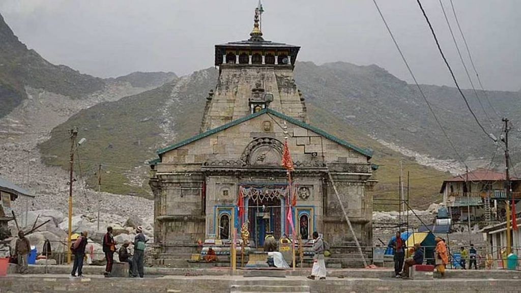
Dehradun: A five-member expert committee formed by the Uttarakhand government to probe a series of avalanches in the hills around the Kedarnath shrine in the past two months has advised a complete ban on construction of buildings and temporary shelters on the “highly unstable and active debris slope above (the) Kedarnath temple”, ThePrint has learnt.
In a report submitted to the government Thursday, the multi-institutional committee told the Pushkar Singh Dhami government in Uttarakhand to instead build concrete wedges and mounds on the higher slopes above the temple to reduce the momentum of avalanches originating at heights of about 5-6 km above the shrine.
ThePrint has a copy of the report.
Three avalanches were reported from the hills surrounding the Kedarnath shrine in Uttarakhand’s in Rudraprayag district, between 22 September and 2 October, all at a distance of reportedly 3-4 km from the temple site.
Last year, on 23 April, a temporary shelter housing labourers working for the Border Road Organisation (BRO), a road construction executive force, was hit by an avalanche, killing 16 people. A few months later, on 2 October, seven mountaineers lost their lives in an avalanche near mount Trishul.
In 2013, flash floods and landslides in the Kedarnath area wreaked havoc, killing many.
The expert committee report also mentions other avalanches from further back — one in October 1998, which killed 27 pilgrims, while another on 23 June, 2008, in which 20 people, including eight pilgrims, were severely injured. More than 100 lives have been lost in avalanches in the higher hills of the Chardham region in the past 10 years, according to the report.
On 1 October, following two of the past months’ three avalanches, the Uttarakhand government constituted an expert committee to undertake geological, glaciological, and geomorphic investigations around Kedarnath.
The five-member panel — which included the executive director of Uttarakhand State Disaster Management Authority (USDMA) Piyoosh Rautela, Wadia Institute of Himalayan Geology scientists Manish Mehta and Vinit Kumar, and Indian Institute of Remote Sensing’s C.M. Bhatt and Pratima Pandey — were tasked with ascertaining the causes of recurring avalanches in the area, assess risk factors and suggest remedial measures.
In its report, the panel recommended a “complete ban” on “constructions of building or any form of shelters over the highly unstable and active debris slope that includes scree fans (fan-shaped rock fragments)” since construction activities at such heights may “lead to changes in direction and slopes of the unconsolidated materials” lying between the avalanche sites and the shrine, thus strengthening the falling snow mass.
The report also recommended slope modification and structural changes on the slopes as protection against avalanches.
“Benching of the slope at different elevations along the steep gradients of snow drift or channels to the north of Kedarnath temple would reduce overall slope angle and retard the velocity of downward movement of snow and debris mass” added the report.
Suggesting some “concrete wedges be constructed along the mid-slope of avalanche chutes to prevent and divert the force of descending ice mass” for “total protection from avalanche hazard”, the expert committee report said, the “design, size and number of these structures can be decided after detailed field investigations”.
ThePrint reached Uttarakhand state disaster management secretary Ranjit Sinha via phone calls for a comment on the report, but had not received a response till the time of publishing this article.
Also read: Uttarakhand disaster likely caused by landslide, not glacial outburst, satellite images reveal
Origin in glaciers
According to the report, the three recent avalanches originated 6 kilometers above the temple, from the peaks of the Companion Glacier, adjacent to the Chorabari Glacier.
The town of Kedarnath is located on the outwash plains (that occur in front of a melting glacier) of Chorabari and Companion glaciers. The channels of the Mandakini river, which originates from Chorabari and Saraswati, that flows down from Companion glacier, encircle the plane terminating towards the south of the temple — the meeting point of the two rivers.
According to the report, “These streams (Mandakini and Saraswati) are observed to actively erode their banks. Avalanche is a major threat in the higher altitude regions.”
It was the Chorabari lake burst which triggered the devastating 2013 flash flood.
The report also mentioned that 3.5 km of the total 4.5 km long Companion Glacier lies parallel to the Chorabari Glacier. The only source of deposits (snow and debris) at the base of the Companion is avalanches, the report further added.
It observed that three recent avalanches in Kedarnath and the others in the past originated from the accumulation zone of the Companion Glacier.
“Deposition zones of these avalanches are located 5 km uphill of the Kedarnath temple. The avalanche activity thus poses little or no threat to the temple township. Appreciable snowfall was experienced over high-altitude areas in September. The accumulation of heavy snow on top of the ridges facilitated avalanche events to the north of Kedarnath.”
The report stressed, however, that “presence of several avalanche chutes in the accumulation zone of the Companion Glacier suggests that the glacier is mainly avalanche-fed and avalanches are common for that glacier.”
(Edited by Poulomi Banerjee)
Also read: Recent flash flood in Uttarakhand had nothing to do with Char Dham project, Centre tells SC