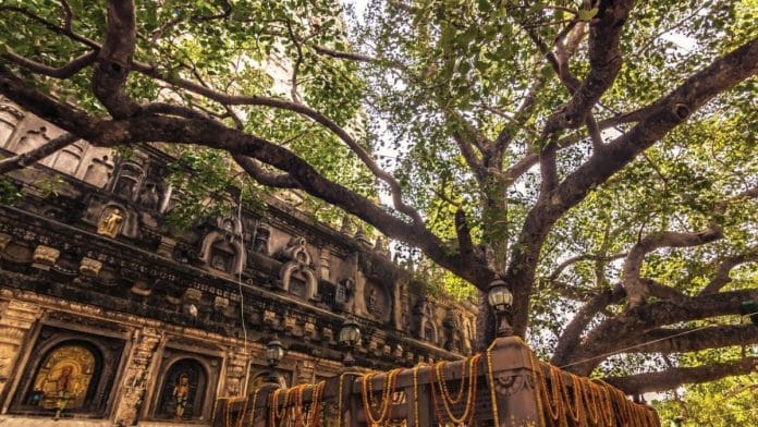
New Delhi: Despite its prominence in Buddhist sacred geography and long history of worship, the precise historical extent of Mahabodhi’s sacred landscape remains unknown. Now, with the use of geospatial data available through declassified images taken from US satellites, a researcher is reconstructing the geographical history of the World Heritage Site.
Associate Professor at the National Institute of Advanced Studies, MB Rajani is identifying geographical features and applying insights to heritage preservation in the backdrop of rapid urbanisation.
The current course of the Lilajan River, on the banks of which Buddha attained enlightenment, bisects the landscape of Bodh Gaya and the historical site. It has also inundated several structures and potential settlements adjacent to Bodh Gaya, found Rajani in her latest research.
“This region has high potential for GPR (Ground Penetrating Radar) survey, especially the river bed,” said Rajani, presenting her research at Delhi’s India International Centre (IIC) under the title Beyond Boundaries: New insights into Bodh Gaya’s ancient landscape. Rajani’s presentation is a part of Ashoka University’s lecture series South Asia Beyond Boundaries.
Rajani was joined by Upinder Singh, historian and professor at Ashoka University. Among the audience were historians and culture enthusiasts.
Also read: Nehru used Bodh Gaya to make India a culture superpower. ‘Navel of the earth’
Mapping cultural landscapes
Professor Singh said Rajani has developed a methodology to detect signs of past human activities using satellite imagery, integrating these findings with historical data to generate new inferences about historical landscapes.
Rajani’s work cuts across the boundaries between science, archaeology, and history. It has important implications for conservation and heritage management.
For many years, Rajani has been a one-woman army travelling all over the country holding workshops, trying to spread awareness on the importance of geospatial and remote sensing techniques for students.
“She has really been training young people, the next generation of scholars, in these techniques, and I consider this part of the invaluable contribution that she has made and continues to make,” said Singh.
Rajani said humans scar the landscape when they construct structures like canals, tanks, and road networks. “These scars, which can survive for many centuries, are also material records of past human activity, and are therefore worthy of study,” she said.
But these scars, she said, are difficult to discern at ground level and their value was largely unrecognised until they were observed from an aerial perspective. The researcher added that studying a site with remote sensing and GIS (Geographic Information System) has multiple uses.
“It creates new knowledge about the site’s history and it can help in drawing better boundaries,” she said, adding that we can’t stop development but we can probably regulate it.
Because in most sites, she said, what is protected is a fraction of what the past landscape was.
“And in sites such as Bodh Gaya, we see with satellite imagery, that there’s been a sudden spurt of development after it became world heritage in 2002,” said Rajani. The professor questioned the use of World Heritage recognition for such sites without drawing adequate boundaries.
Also read: How Buddhists lost out to Brahmins in Nalanda. Even before the Turks came
Bodh Gaya’s changing landscape
To know the original state of the Buddhist site, Rajani studied Chinese monk Xuanzang’s descriptions of Bodh Gaya’s landscape. He had left records of what he saw during his India visit in the 7th century CE.
“He [Xuanzang] describes a far more elaborate Mahabodhi landscape with rich memorial structures. He enumerates 62 distinct features including Pragbodhi hill, Lilajan river (also known as Niranjana and Falgu), stupas, ponds and monasteries painting a picture of a thriving sacred landscape at his time,” said Rajani.
The associate professor said we’re lucky India didn’t have industrial landscape changes before the 80s. It’s why the images taken from spy satellites of America are great for her research.
“These images show us a landscape before large-scale development happened,” she said. Her study contends that the sacred landscape of Mahabodhi historically encompassed all these features on the same west side of the ancient course of river Lilajan.
Bodh Gaya is located on the western bank of the river Lilajan also known as Falgu river. Rajani said for nearly 2,000 years, the Bodhi tree held a preeminent position in Asian Buddhist sacred geography. Despite its tremendous religious significance, the historical expanse of Bodh Gaya’s sacred landscape remains uncertain.
(Edited by Theres Sudeep)


