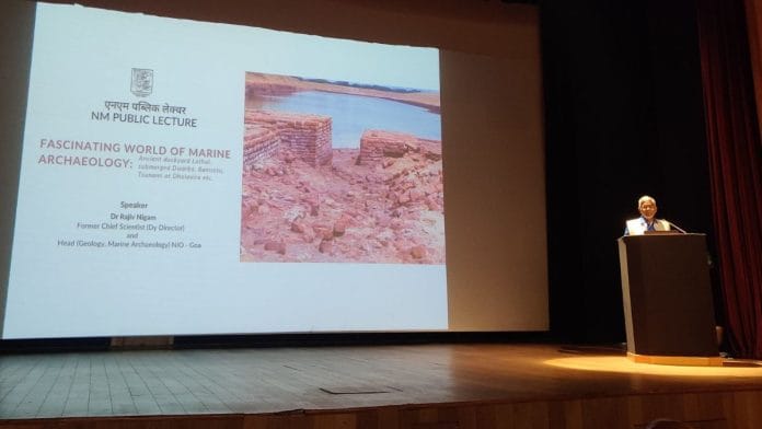
New Delhi: In 2016, when geologist Rajiv Nigam visited the UNESCO World Heritage site of Dholavira, it was the 18-metre-thick wall around the citadel that piqued his curiosity the most. What could be its significance? In his two-hour-long lecture at the National Museum in New Delhi, he sought to answer this question. His findings link it to sea levels at different points in history.
Nigam’s work underscores the profound impact the sea has had on shaping the rise and fall of ancient cities along our coastlines.
In one of the seminars, Nigam posed the Dholavira question to archaeologist RS Bisht who had extensively excavated the site between 1990 and 2005. Bisht had no exact answer and said it was because of some protection.
“These questions are haunting me. Protection against whom? As many of the forts in India when the cannons existed, none of the forts had this much thick wall. Even the China wall is not that thick,” said Nigam, former chief scientist at the National Institute of Oceanography, Goa, during the lecture titled Fascinating World of Marine Archaeology on 28 February.
He said the wall was made to protect the Harappan-era town from a tsunami as the Dholavira site is located on the Makran coast, a tsunami-prone area. With this, Nigam reached the conclusion that Indians knew how to protect themselves from tsunamis.
The geologist added that Dholavira was a port city because 5,000-6,000 years ago the sea level was higher than today. “It means this site was almost on the sea and the people living in this area were aware of the tsunami. Because of their strategic position and business, they had to build the city. It means the city must have been built when it was a land”.
Among the audience were archaeologists, students, and the director general of National Museum, BR Mani.
“Marine archaeology is a branch of archaeology where we have not done much and it has got great potential for working in future,” said Mani.
Knowledge of the past
Nigam said although we are taught in childhood that the sea never crosses its limits, it is not the truth. The sea has repeatedly done that.
“It is the sea which has shaped the destiny of many ancient Indian coastal towns,” he said, adding that evidence of changes in sea level in the past are everywhere in religious records, including in the Gita, Quran, and Bible.
Nigam said people asked him on multiple occasions why archaeologists were taking the world backward when everybody was looking ahead. “My answer is that knowledge of the past is a guiding factor for having a better future”.
He said despite the huge potential of archaeology in India, we are limited to offering the tourists the Mughal era. Archaeology has different aspects—from science to cultural heritage to economics.
“Many of the countries in Europe are totally surviving because of tourism. In India also, now the government has realised and started it. But we have to understand that India is not only Delhi and Agra. How many people know that the world’s oldest dockyard and the oldest evidence of how to protect the cities from tsunami exist in India?” said Nigam.
As per archaeologists, the ancient port city of Lothal is around 4,500 years old. Nigam located the period on a sea-level curve and found that the sea level then was higher than today.
“When the sea level went down, it (Lothal) became out of use and became an abundant city,” he said.
Also read: Tree trunk to stone to human face—how deity worship evolved in Hinduism
An underwater kingdom
Nigam’s work also sheds light on the submerged ancient city of Dwarka. He argued that the tale about the kingdom and Lord Krishna is true and not an imaginary one.
“There is an ancient city that exists about six to eight metres underwater. It is now submerged,” said the geologist.
Recently, the Archaeological Survey of India (ASI) conducted underwater investigations off the coast of Dwarka in Gujarat, after a gap of two decades. The exploration is part of the revived Underwater Archaeology Wing (UAW) of the ASI.
Nigam said many people questioned how the city submerged as it couldn’t have been built six-eight metres underwater.
“It means the city must have been built when there was land. It can only be submerged when the sea level will go up,” said Nigam, adding that the city of Dwarka went under the water about 3,500 years ago.
(Edited by Aamaan Alam Khan)


Lothal became an ‘abundant city’. Really? Or did it become abandoned?