


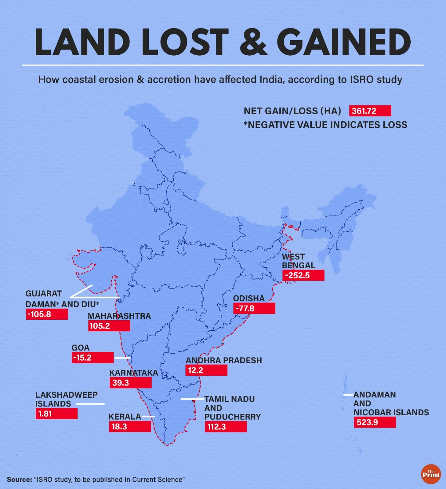
New Delhi: India lost over 3,680 hectares of land due to coastal erosion in the course of 10 years, with West Bengal and Gujarat bearing the maximum brunt, according to a study by the Indian Space Research Organisation (ISRO).
The research, conducted by ISRO’s Space Applications Centre, Ahmedabad, on comprehensive data available between 2004-06 and 2014-16, shows that 15 per cent of India’s coastline — amounting to nearly 1,144 km — is undergoing erosion. Meanwhile, 14 per cent — that is 1,084 km — of the Indian shoreline is accreting.
The world’s shorelines are constantly changing due to natural processes such as coastal erosion and accretion, as well as human activities that affect sediment transport.
However, the anticipated sea level rise, increased wave activity, and projected increase in the frequency and intensity of tropical cyclones due to climate change are expected to cause more rapid and severe shoreline changes in the near future, the researchers say in the report, to be published soon in the peer-reviewed journal Current Science.
Coastal erosion means acres of land are disappearing. This can lead to a habitat reduction for local fauna and flora, and make people living in coastal areas vulnerable — their land disappears, and they are closer to the sea.
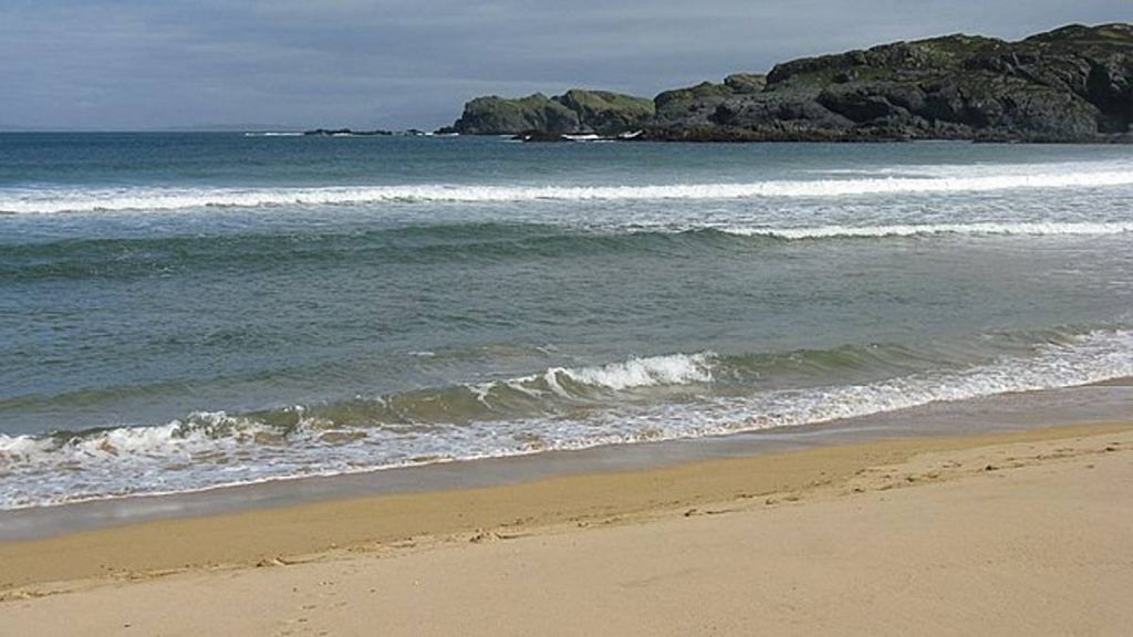
Accretion is the process of coastal sediment returning to the visible portion of a beach or foreshore after a submersion event. A sustainable beach or foreshore often goes through a cycle of submersion during rough weather and accretion during calmer periods.
Accretion can be beneficial in some cases, as there is an increase in the land area. But it can harm marine life — like sea creatures suddenly finding their waters getting shallower, or turtle habitats moving away from the shoreline.

According to the research team’s estimates, India gained 4,042 hectares of coastal area between 2004-06 and 2014-16. Although there is a net gain in the total coastal area (due to settlement of sediment/sand), the stretch under erosion is greater than the accreting shoreline.
Also Read: El Niño forecast: Too early to predict its effects, need to wait and watch, say scientists
Changing shorelines
According to a 2020 European study, the world is set to lose half of its sandy beaches by the end of the century due to coastal erosion driven by rising sea levels.
Coastal environments naturally tend to maintain balance in sediment supply along the coast — taking away sediments and then bringing them back to the shore in cycles — but high wave activity during monsoons, cyclones and human activities such as coastal construction and dam building, can disrupt this equilibrium, leading to shoreline changes.
Keeping track of shoreline changes helps in planning measures to carry out sustainable development activities along the coastal region.
Mapping HTA with ISRO satellite images
The researchers considered the High Tide Line (HTL) as the coastline. Using images from the LISS-IV sensor aboard ISRO’s Resourcesat-1 and 2 satellites, the team was able to map the HTL of the Indian coastal states with a spatial resolution of 5.8 m corresponding to 2004-06 and 2014-16 time frames.
For different states, the HTL is represented by different landscape indicators — such as mangroves, cliffs, seawalls, or permanent vegetation lines. The team used a digitisation technique to map out the shorelines for each of the states.
The team found that the Andaman and Nicobar Islands have the longest eroding coastline (231 km) and the longest accreting shoreline (256 km). Erosion is lowest in Lakshadweep Islands (12 km), and the lowest length of the accreting shoreline is in Goa (7 km).
The percentage of eroding shoreline is highest for West Bengal (36 per cent), followed by Odisha (32 per cent), Kerala (23 per cent) and Andhra Pradesh (23 per cent). The remaining maritime states have less than 20 per cent of eroding shoreline, with Lakshadweep recording the minimum (8 per cent).
Andhra has the highest percentage of accreting coastline (26 per cent), followed by Tamil Nadu, Odisha and West Bengal (22 per cent each), and Kerala (21 per cent).
The percentage of stable shoreline is highest for Gujarat (87 per cent), followed by Lakshadweep (82 per cent). The figure is 80 per cent for Maharashtra and Goa.
Shoreline changes higher on eastern coast
Shoreline change is higher along the eastern coast of the Indian peninsula than the western coast.
West Bengal, Gujarat, Odisha, and Goa have suffered a net loss of coastal area due to erosion in the course of 10 years. The loss is the largest for West Bengal (252 hectares).
Meanwhile, Tamil Nadu, Maharashtra, Karnataka, Kerala, Andhra Pradesh, and Lakshadweep have gained coastal land. The gain is the largest for Andaman and Nicobar Islands (524 hectares).
“As coastal erosion is a serious threat to both the ecology and economy of the country, the shoreline change inventory is the primary information required for planning coastal development activities,” the researchers say in the report.
“The shoreline change atlas depicts the changes in the shoreline. However, the planning for coastal developmental activities should also encompass the assessment of shoreline changes anticipated under a climate change scenario,” they write.
(Edited by Geethalakshmi Ramanathan)
Also Read: Mumbai among cities facing biggest threat as global sea levels rise, warns UN agency WMO