New Delhi: Nepalese Prime Minister K.P. Sharma Oli reiterated the country’s claim to Limpiyadhura, Lipulekh Pass and Kalapani Tuesday, after his government endorsed a new political map incorporating these ‘disputed’ regions and claimed these Indian territories as its own.
PM Oli also recently blamed India for the spread of coronavirus in Nepal and said that the virus strain from India “looks more lethal” than from China or Italy.
“Those who are coming from India through illegal channels are spreading the virus in the country and some local representatives and party leaders are responsible for bringing in people from India without proper testing,” Oli said in a speech Tuesday, his first in the Parliament since the Covid-19 outbreak.
This sharp reaction to Lipulekh Pass looks like it was on another country’s behalf. It seems like Nepal is repositioning itself towards China, and China is using the country to send a message to India.
Also read: Won’t accept ‘artificial enlargement’ of territory — India hits back as Nepal redraws map
LAC not demarcated precisely leading to hostilities
China has consistently used such tactics to send messages to India and other countries. For instance, to send a message to Japan and neighbouring countries, it usually starts some conflict in the South China Sea.
It is possible that China is doing so because it is under global pressure for its initial handling of the Covid-19 pandemic or perhaps it wishes incite a nationalist feeling within the country since its leader is facing internal criticism.
The disputed boundary between India and China, known as the Line of Actual Control, is not demarcated precisely. The two countries disagree on the exact location of the LAC in various areas.
The two armies try and dominate by patrolling the areas that they believe is their territory and this often brings them into conflict, leading to incidents such as the border skirmish in Nathu La in Sikkim earlier this month.
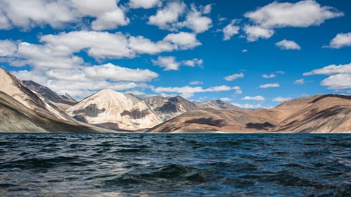
The LAC mostly passes on the land, but the Pangong Tso lake area is a unique case where it passes through the water as well.
Chan Chenmo, the barren mountains on the lake’s northern bank, protrude in major spurs, and the Army calls them ‘fingers’. India claims that the LAC runs along Finger 8, while China, whose border posts are on Finger 8, believes the border passes through Finger 2.
This frequently results in disagreement when either side is patrolling.
China will keep using this tactic against India, but the two big nations can settle their issues. However, it will be difficult for future Nepalese leadership to unwind what Oli is doing. Nepal is a natural partner of India given the shared history and geography.
Watch the latest episode of CTC here:


Yeah absolutely right so let’s annex pak ,Bangladesh and srilanka cuz they were part of India during 1816 like China did to Tibet
Dont you think indian army is a gay??i am ab Indian but i am forced to tell so🇮🇳🇮🇳🇮🇳
Postak S: how can you say you have no evidence?! Don’t type as you know everything?!
India signed the trade-pact with China in May 2015 to open the trade route via the disputed region without knowledge of Nepal. In Nov 2019, India unilaterally published the map that showed the disputed area as the Indian territory. Nepal government sent diplomatic notes to India in both the cases, but the Indian government never responded to these. Now, when the Nepal government includes the disputed region in the map, it becomes a ‘unilateral’ act! Why is this double standard? Stop presenting China as a scarecrow when Nepal has a legitimate concern. Sit in the dialogue with the Nepal government and dig into the historical facts. Sugauli Treaty of 1816 indicates the Kali River is the border and has its source in Limpiyadhura, not the Lipulekh pass. Why is India reluctant to sit in for the conversation with Nepal? Because you have no evidence, you are merely flexing your muscle, being the largest and the most powerful in the region.