


New Delhi: Since Article 370 of the Indian Constitution was scrapped on 5 August, the state of Jammu and Kashmir was placed under a lockdown, pending its bifurcation into two union territories. Life in the region was disrupted, with no telephone or mobile services, no internet, and the imposition of Section 144.
Three months on, the world has witnessed many claims and counter-claims about normalcy returning to the region, especially to the Kashmir Valley. While post-paid mobile services were restored last month, other services remain suspended. Schools and colleges are still poorly attended, shops only open for a few hours each morning and evening, and politicians from the Valley’s mainstream parties are under arrest/detention.
The government, meanwhile, has said the situation is returning to normal, with National Security Advisor Ajit Doval saying “not one bullet has been fired” and “economic activity is coming back” as far back as 7 September. But the administration also put out full-page advertisements in local newspapers last month, questioning the “people’s curfew” and asking “Are we going to succumb to militants?”.
Militants have killed non-Kashmiris in a spate of attacks since October, while 28 members of the European Parliament have visited the Valley to witness the “normalcy” for themselves.
ThePrint has compared satellite imagery from April 2019 and October 2019 and to see what sort of differences can be spotted in Kashmir’s capital Srinagar before and after the scrapping of Article 370 and the clampdown.
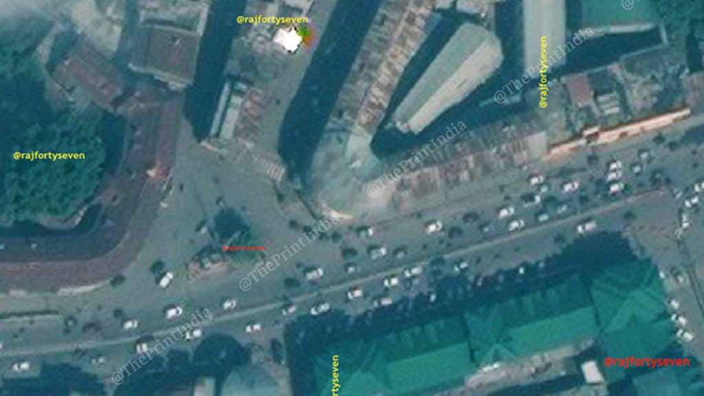
Budshah Chowk
Budshah Chowk is located barely 160m north of Srinagar’s famous Lal Chowk. The exclusive commercial satellite images of 5 October have been compared to images from 10 April and 28 February 2019 — the February image has been added because there was 50 per cent cloud cover in the area on 10 April.

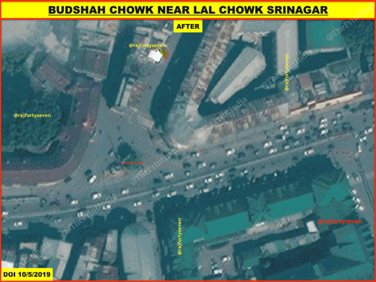
More traffic can clearly be seen on the roads in the October image compared to February or April. However, there are fewer parked vehicles in the October image than in the past (visible after zooming in where the building’s shadow is falling).
Budshah flyover
This flyover was recently constructed over Exhibition Chowk, which stands close to most government offices, including the Jammu and Kashmir High Court.
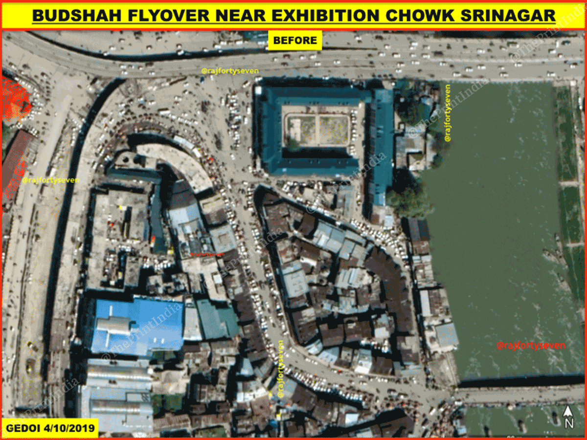
The traffic on the roads in the October image (with the flyover) is much higher than that seen in the April image (before the flyover was completed), while parking areas also seem to be fuller.
Karan Nagar
Karan Nagar is where the Government Medical College, Sri Maharaja Hari Singh Hospital and Government Dental College are located.
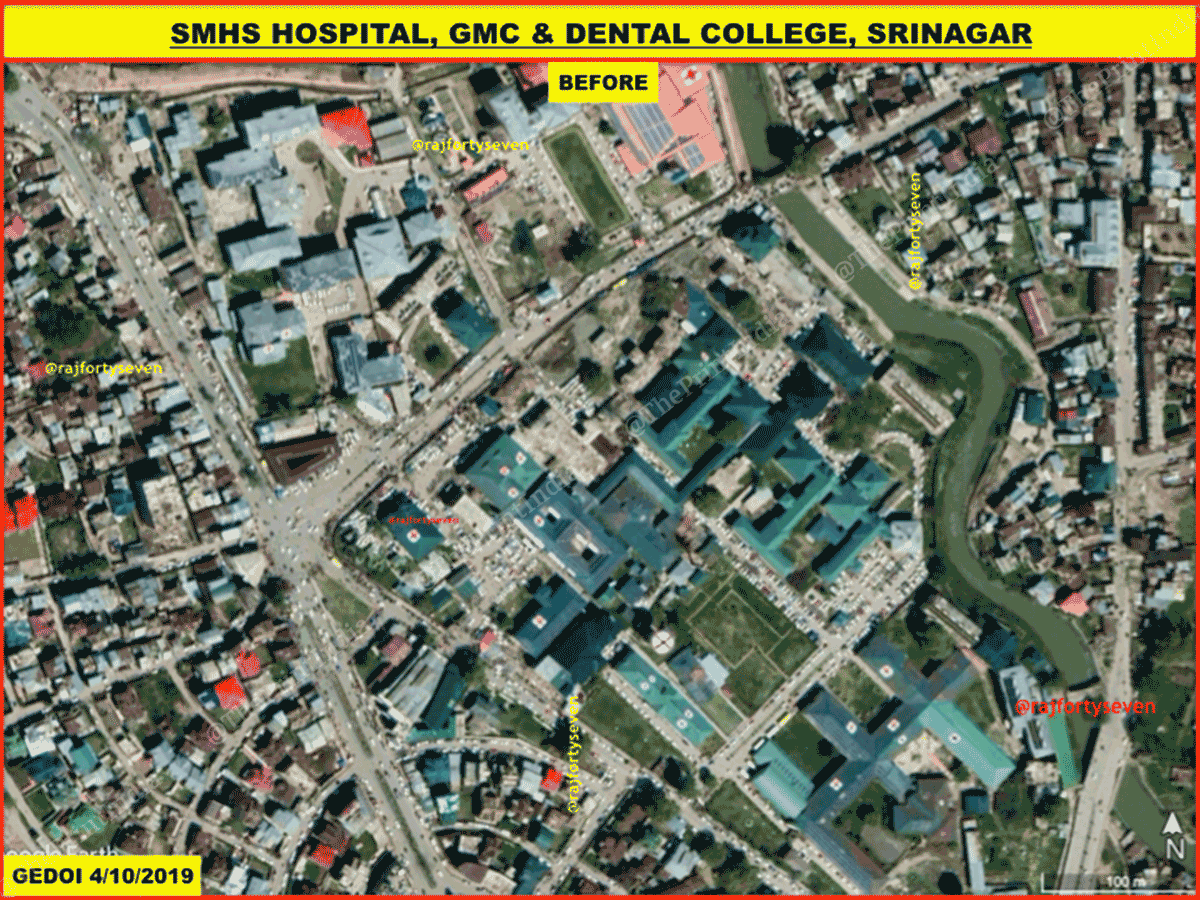
This area also shows an increased number of moving as well as parked vehicles in October compared to April. This indicates that the hospitals are bustling with activity.
Chanpora Bypass Bridge
This is one of the entry points to Srinagar which does not cross the cantonment area of Badami Bagh.
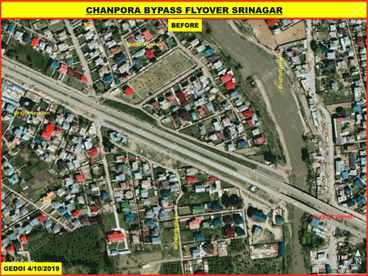
On this new flyover too, there is a considerable increase in traffic in the October image compared to April, though it is interesting to note that outward traffic is more than incoming traffic.
Educational institutions
The area of Nawakadal has been chosen to show the situation at educational institutions, especially for women and girls — the Government College for Women and the Girls’ Higher Secondary School both stand there.
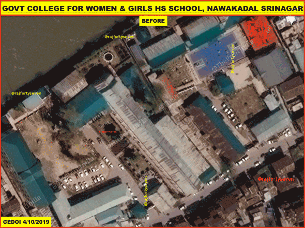
In the October image, the college premises look totally empty, with the main gate closed. No vehicles belonging to teachers or staff members can be observed inside the premises.
Vehicles parked outside the gate of the college, probably belonging to the students and noticeable on previous satellite images, are also not seen in the October image.
The girls’ school, however, has some vehicles parked inside the premises, indicating the presence of teachers and/or staff.
No barricades
None of the satellite images show any barricades, zig-zag barriers or other traffic management measures, and traffic can be seen flowing smoothly and regularly.
There is also no noticeable deployment of forces in the areas covered.
Also read: North India’s toxic air: NASA images show just how big the stubble burning problem is