


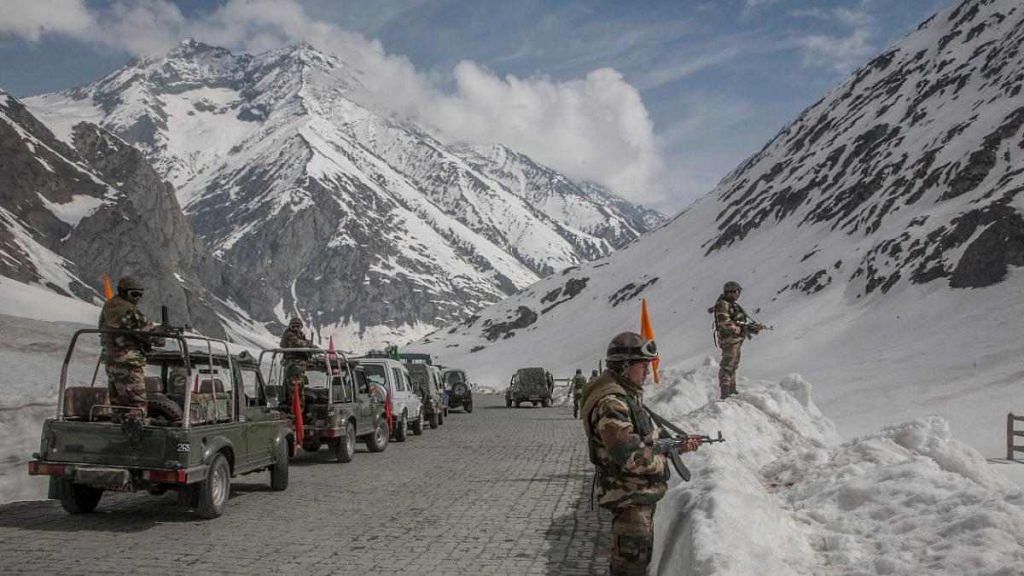
New Delhi: The face-off Monday night between the Indian and Chinese armies marked the first instance of violence at Galwan Valley in Ladakh since the 1962 war.
The valley lies along the western sector of the India-China border, the Line of Actual Control (LAC), and close to Aksai Chin, an Indian territory under Beijing’s control. Its location thus lends it deep strategic importance along a sector of the border that remains largely undefined.
The valley derives its name from the river Galwan, which is named after Ghulam Rassul, a British-era explorer from Leh. The river flows from the Aksai Chin region.
The river is to the west of China’s 1956 claim line in Aksai Chin. However, in 1960, China advanced its claim line and managed to capture it fully during the 1962 war.
Since then, both sides have maintained peace and the 1960 claim line is considered as the de facto Line of Actual Control (LAC) in this valley. Even so, no maps have been exchanged in this area and all understanding between the forces is established at a local level.
Also Read: Why the serene Pangong lake lies at the heart of India-China border dispute in Ladakh
China’s suspicions
The Galwan Valley area comes under Sub Sector North (SSN), which lies just to the east of the Siachen glacier and is the only point that provides direct access to Aksai Chin from India.
As reported by ThePrint, the current tensions can be traced to Chinese objections over India’s road construction activities here. China is believed to be particularly concerned about a bridge that India is building across the Galwan nallah.
The bridge is part of a network of feeder roads that India is building connecting the strategically important Shyok-Daulat Beg Oldi road, inaugurated by Defence Minister Rajnath Singh last year.
Defence sources have told ThePrint that, even though the bridge is about 7.5 km from the LAC, the Chinese have objected because they are suspicious of India’s aims on account of New Delhi’s claim over Aksai Chin.
Analysts say China is suspicious that the Indian constructions in the area are meant to facilitate quick movement of soldiers if any attempt is made to recapture Aksai Chin.
‘Status quo ante 1950’
Aksai Chin was captured by China in 1962. According to Lt Gen. H.S. Panag (Retd), from the strategic point of view, China had secured all Indian territories it needed to before 1962, that is primarily Aksai Chin, required for the Tibet-Xinjiang NH 219.
Following the 1962 war, it vacated all additional captured territory, barring some tactically important areas in Ladakh, denying access to Aksai Chin and NH 219 as per its 1960 claim line in Depsang, Galwan River, Sirijap-Khurnak Fort north of Pangong Tso, and Kailash Range 10 km north of Demchok, he said.
China, he added, believes that, India’s strategic aim in the long term is to restore the status quo ante 1950 by recovering Aksai Chin and other areas captured/secured by China.
India’s alignment with the US, the presence of Tibetan government-in-exile in India, and the aggressive claims on Pakistan-occupied Kashmir (PoK) and Gilgit Baltistan — through which the China-Pakistan Economic Corridor (CPEC) passes — only strengthen China’s suspicion.
Also Read: 3 Indian soldiers including CO killed in Ladakh in first violent clash with China in 45 yrs