


New Delhi: Barring some forward locations in Galwan Valley, Hot Springs and Pangong Tso, the Chinese presence in Ladakh has only grown since May this year with the deployment of additional equipment and defensive structures such as trenches and berms at existing encampments, satellite imagery experts have revealed.
This is despite multiple diplomatic and military talks between the two countries, including four corps commander level talks, and discussion between National Security Advisor Ajit Doval and Chinese Foreign Minister Wang Yi.
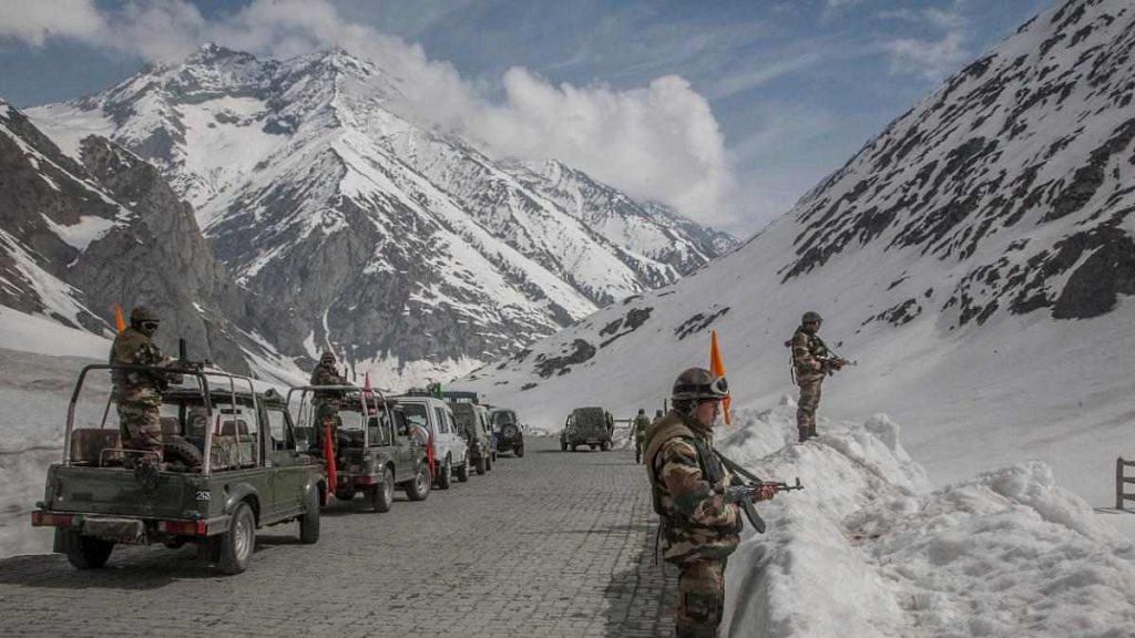
Defence sources have told ThePrint that there has not been any movement from the Chinese positions since the last corps commander level talks between 14 corps commander Lt Gen. Harinder Singh and his Chinese counterpart Major General Lin Liu on 14 July.
After the last talks, the Army had said that both sides have agreed to discuss “complete disengagement” in Ladakh, but had added that the disengagement process at the Line of Actual Control (LAC) would be intricate and require complete verification.
Talking to ThePrint, Sim Tack, a Belgium-based military analyst with Force Analysis and Statfor said that a continuous growth of the Chinese presence in Ladakh has been observed over the past months.
“This means that we have seen the deployment of additional equipment and new encampments, as well as additional defensive structures such as trenches and berms at existing encampments,” he told ThePrint.
He added that China is also still working rapidly to upgrade the roads connecting these positions, which will facilitate future deployments.
“The only locations where we have seen a reversal in this trend have been the forward positions at Galwan Valley, Hot Springs and Pangong Tso, where mutual withdrawals have led China to remove its encampments within several kilometers of the Line of Actual Control,” he added.
Some military experts, however, said such Chinese build-up might be “posturing” and a display of their equipment, while some suspect it could be “deception”.
Also read: Chinese deception at LAC is just like Pakistan in Kargil — former Ladakh corps commander
‘Satellite images could well be used for display’
Some military experts felt that such images might as much be for display by the Chinese to be captured by commercial grade satellites for psychological operations.
Former 14 Corps Commander Lt Gen. P.J.S. Pannu told ThePrint in an interview that when considering satellite images for analysis, multiple factors have to be taken into account.
“For example, even at one metre resolution for a satellite, you cannot recognise if there is a soldier standing there or some other object or a stone,” he said.
“Also the fact that these satellites are crossing over and they are taking pictures when they are going over the area and may not even have the same angle when passing over the area,” he added.
Pannu said that for a professional military like the People’s Liberation Army (PLA), the way these pictures were displayed on TV, it seemed they were more to show (their display of equipment) than to hide.
“In normal warfare, one is conscious in the military that satellites should not be able to detect where they are. So if the PLA is trying to put in the open lot of tanks, tents and trucks, it was more of a posturing … We don’t know how many are real and how many are dummy,” he said.
The Chinese, he said, are masters in creating tunnels, and hiding their intentions and military forces.
“Why would they want to show it? So, I would like to look at those things, which are not picked up by the satellites, instead of those, which have been so easily available in the commercial grade satellites,” he added.
Lt Gen. Vinod Bhatia (retired), former director-general of Military Operations, said satellite imagery could surely give inputs, but they needed to be confirmed by other intelligence sources.
“As far as China is concerned, it could be a judicious mix of actual build-up and posturing,” he told ThePrint.
He explained that day-time military movements were not common, and camouflaged concealment were not so easily picked up by satellites.
“But in this case, it possibly wants to show things to be picked up by commercial satellites,” he added.
Also read: The Indian Right cares about national security, except when China tip-toes near our territory
‘Tents, vehicles, infrastructural equipment look to be in use’
However, other experts believe that such large-scale deception may be difficult to pull off.
An anonymous satellite imagery analyst, who uses Twitter under the handle @detresfa, said deception is regularly observed in static environments such as airbases, research and development facilities, among others.
“However, in most of the data we have seen of Chinese positions in Aksai Chin, the various tents, vehicles and infrastructural equipment all look to be occupied and in use,” he added.
Military grade satellites, he said, can be answered on the basis of the country.
“For example, with the United States, President Trump’s tweet of the Imam Khomeini Space Center in Iran back in 2019 showed the sophistication of US spy satellites in orbit that not many people knew about,” he said.
Tack said that the commercial satellite imagery is very accurate, and they have relied on various different sources of imagery (such as Planet, Maxar, and Airbus) that provide up to 30 cm resolution to study these particular deployments.
“The potential for deceptions is definitely real, and this is something that we try to uncover in our analysis of satellite imagery by applying our analytical expertise relating to doctrines and procedures of the Chinese military, as well as ‘pattern of life’ analysis, where we see constant activity and movement of vehicles and equipment at these positions,” he said.
Tack added that a lot of the Chinese camouflage nets have a red hue indeed, which could be meant to stand out in satellite images.
He said that while there are limitations to satellite imagery analysis, deception can never be truly ruled out. “But in the current situation in Ladakh, we believe that the levels of activity observed, indicate this is not a large-scale deception effort.”
‘Inadequacies’ in assessing satellite images
Sources in the defence establishment said that commercial data as is available today has varying levels of resolution and accuracy, some of which are much better in terms of spatial resolution, radiometry and location accuracy.
“However, there are inadequacies of assessment of these satellite imageries due to lack of understanding military image interpretation as well as actual alignment of LAC,” a source in the defence establishment said.
The source, who deals with satellite imagery, added that satellite image interpretation is a specialised activity with niche skills gathered over years of experience.
Also read: India, China disengagement at LAC could take until winter, de-escalation will happen first