

Days after a flood scare proved untrue, the formation of another barrier dam at the same site in Tibet threatens damage.
New Delhi: Enormous debris from a landslide and a glacier making its way into India with the gushing waters of the Brahmaputra threaten to block Indian dams and canals downstream, as well as change the course of the river in India later this month. They may also inundate a remote Tibetan border village.
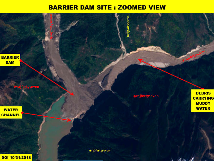
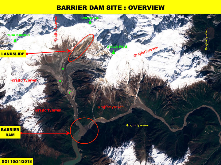
Latest satellite images from Tibet’s Mainling and Metok areas very vividly tell us that a possible landslide between 26 and 31 October triggered a major event, creating a barrier dam on the Brahmaputra.
This barrier dam was formed weeks after another, which took shape at the same place on 18 September 2018, stoked a flood scare in India.
The assessments made in connection with the first barrier dam, whose genesis was explained by ThePrint in an earlier article, were based on information deduced from the very low temporal resolution imagery available at the time.
The satellite coverage of Mainling and Metok areas of Tibet is poor as very few satellites have paths above these locations. They are also hard to come by as the area is generally covered by heavy clouds and their shadows.
ThePrint has made special efforts to get the latest available satellite imagery to study the barrier dam area in its entirety, to offer a more clear understanding of the situation now.
Also read: Brahmaputra flood scare in Arunachal over, but India must watch out as crisis can return
Blocking the Brahmaputra
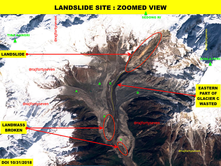
The longest and deepest canyon in the world is Brahmaputra Canyon between Mt Namcha Barwa and Mt Gyala Peri.
Gyala Peri, along with Sedong Ri and Tiba Kangri, form a gorge southwards. The gorge has four glaciers, forming a funnel before their waters join the Brahmaputra.
The mountains in this Himalayan region — being very brittle and seismically active — have faced many landslides, avalanches and combinations of both.
According to satellite images from 31 October, a landslide on the southern face of the Mt Sedong Ri ridge possibly caused the eastern part of one of the four glaciers — marked C, the main one – to break off.
As a result, the width of the Sedong Ri glacier was halved and its length shortened by almost a kilometre and a half.
The eastern part of the glacier, along with landslide debris, forced the landforms X and Y [see images] to partially break away and block the Brahmaputra.
Village under threat
At the available resolution, it’s not possible to calculate the size of the debris, which went on to form a barrier dam against the Brahmaputra.
According to images from 31 October, the barrier dam had been resolved by overflow, but a bigger threat continued to persist for residents of a village of 30 households known as Gyala, which is perhaps the last settlement in Mainling county.
During the crisis stoked by the September landslide, the water levels did not reach the village and remained much below, though the Daling bridge, located about 22 km upstream from the Gyala barrier dam, sustained damage.
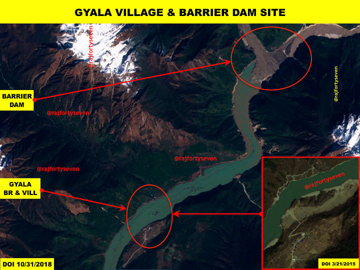
This time, however, the dammed waters have possibly risen 5-10 metres higher. While the bridge is again under water, almost the complete road from the Daling turn onwards is inundated.
Also read: China gives big push to road & rail infrastructure in areas bordering India
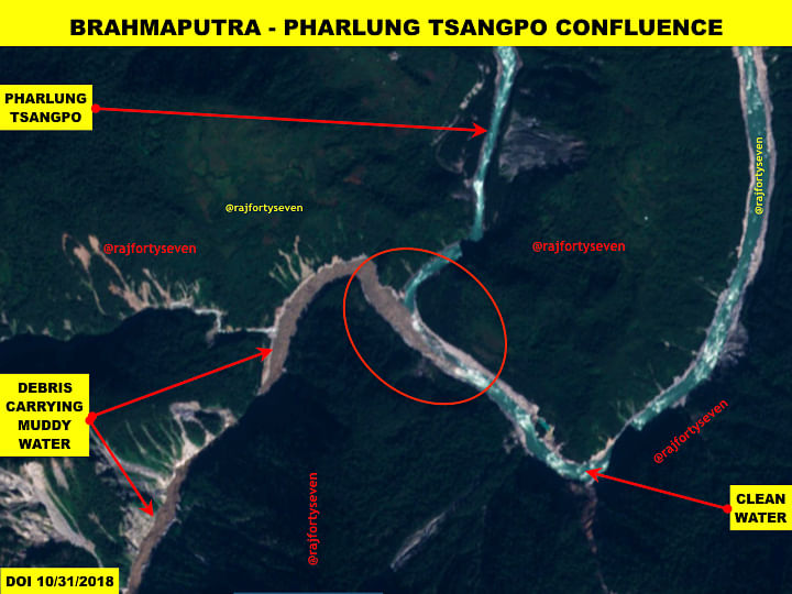
By 31 October, the water of the Brahmaputra, teeming with the debris, had reached approximately 59 km downstream, up to the confluence of the Brahmaputra and its tributary Pharlung Tsangpo. This helps us calculate the speed at which its progressing: Considering the landslide blocked the Brahmaputra on or after 26 October, the debris is moving very slowly at an approximate speed of 10-15 km a day.
The speed may increase as the Brahmaputra is joined by its tributaries along the route in Tibet, especially the Pharlung Tsangpo, the largest tributary on the left.
Thus it can be safely assumed that the debris is likely to reach Tuting, Arunachal, by about 10-15 November and Pasighat by 20-25 November.
Although not much harm is expected to come to India, keeping tabs on daily water data from China and aerial monitoring of the area may help mitigate any possible damage.
Is it mistake of print media to name Siang river in Arunachal as Brahmaputra? Brahmaputra is in Assam not in Arunachal. Why Siang river is not mention as Siang in this news?